
The Layman’s Guide to
The Amazing but Totally True . .
. Scientific
Facts of Creation
By
Wendy S. Scott
Updated 7/27/09
Contents:
Geological Evidence
Chart of
“Cretaceous/Tertiary” Extinctions
Worldwide Sedimentary
Deposits
The Evidence of Geological
Formations
Grand Canyon Depositional
Evidence
Grand Canyon Sedimentary
Chart
Geological
Evidence: Brief List Of Facts
1)
Earth is perfectly configured for life
2)No explanation for abundant water on
the earth
3)
Water is the most common chemical
compound on
the face of the earth
4)
Water molecule bonds are broken at
2,000 degrees Celsius
5)
Cool troposphere needed to permit water
condensation
6)
Oxygen is the most profuse element on the earth
7)
Marine
fossils prove the earth was once entirely covered by water
8)
Fossil sea life covers every continent, and is generally mixed with terrestrial
fossils
9)
No way to measure the age of the earth
10)
Radioisotope tests are ambitiously
inaccurate
11)
Radioactive decay applied based on
unverified assumptions
12)
Reliance on radiometric dating confirms
entropy always existed
14)
Many facts support a young earth: Celestial, biological, chemical, coal and even T Rex bones
15) Population growth rates prove
that the human population can only be about 4,300 years old
16)
Iridium spike at K-T boundary points to
massive worldwide volcanism at massive exterminations
19)
Mass extinction evidence only
reveals that all these plants and animals died and were quickly buried
21)
“Geologic column” corresponds to mixed remains of ecological
zones
22)
Terrestrial and Marine “index
fossils” are frequently and inexplicably mixed in the same location
23)
Fossils are formed by water and sediments
24)
Delicate fossil preservations (jellyfish, crinoids, insects, leaves, feathers, hair ) point to rapid burial
25) Terrestrial (land) animals are also
buried in water borne sediments, requiring a “flood” type event
26)
Massive
fossil graveyards establish the effects of water cataclysm, showing
great collection by cataclysm
27)
Inconceivable circumstances are used to
explain catastrophic mixed ages, mixed systems such as leaves or clams, bazaar burials, fish graves and mixed animal burials
28)
Upright fossils such as trees and Polystratic fossils such as large
animals, disprove uniformitarianism
29)
Misplaced
animals, plants, pollen and mixed age fossils disprove evolution
30)
Vast
sediment deposits confirm a world flood
31)
The
different types of worldwide sediments indicate their deposition environment: limestone (carbonate), sandstone, mud/shale, and conglomerate.
32)
No evidence of surface exposure between
era gaps
33) Rosh Hanikra formation absolutely
proves a worldwide rapid deposit of limestone
34) Dead
Sea basin proves that the ocean was once at least hundreds of feet higher
35) Mt.
Sdom is a salt deposit from a massive water evaporation
36)
Massive formations are eroded from
sediments indicating vast water events
37) Grand Canyon was carved before uplift
38) Grand
Canyon sediments are over a mile deep
38) Grand Canyon plateau exhibits numerous evidences of
classic catastrophic flood traits
40)
Rapid deposition indicated by contact
points of layers, lack of
erosion, and type of
sedimentation
41)
Breccia, conglomerate and mud confirm
flood
42)
Fossils of crinoids, Nautiloids, and amphibian tracks confirm rapid
burial
43)
Vulcan’s Throne lava flow into the
canyon proves recent activity
44)
Mt. St. Helens’ eruption demonstrates
catastrophic effects: rapid
deposition and erosion, petrification
45)
Worldwide incomprehensibly vast fossil
fuel deposits confirm an immense world-simultaneous flood
47)
It takes 3-7 feet of organic plant
matter to yield one foot of coal
48)
It does not take millions of years to
create fossil fuels—we can do it in a lab
49) All
coal deposits yield measurable Carbon 14 making them “younger” than the things
that died in them
50)
Requirements to create fossil fuels are
the exact
circumstances created by a worldwide Flood
51)
Banded Iron Formations require a
worldwide simultaneous cataclysmic waterborne sedimentation event
52)
Innumerable volcanic rock and sediment
formations indicate rapid underwater
deposition
53)
Mountains arose after worldwide fossil
deposition, as
seen in numerous fossils
54)
70%
of the earth’s surface is covered by water; would cover it by 1.7 miles without
the mountains
55)
Ice Age requires sudden cataclysm
56)
No fact disputes a worldwide flood, but all indicate it is indisputable fact
INTRO PHYSICS BIOLOGY FOSSILS back to top CHALLENGE INFO
Disclaimer: The author of this guide is not a research
scientist. This information has been
compiled from an abundance of easily accessible and confirmed scientific
authorities. The majority of the
information is common knowledge in the scientific realm, while lesser known
facts are cited. Do not quote the author as a scientific authority. This guide is intended to systematically
build the case for Biblical Creation through the logical alignment and
application of the abundance of established scientific facts.
True Blue
All undisputed facts in this guide are in bright
blue.
Geological Evidence
“Where were you when I laid the foundations of
the earth? Explain it if you have
understanding.” Job 38:4
According to all our observations, there is a
stability within species and their biological processes today. In spite of this evidence, the theory of
evolution insists that in the unobservable past, biological
processes operated much differently.
According to the same evolutionary model, though, geological
processes are supposed to be dictated by the opposite assumptions about
the past. These scientists claim that
the geological processes witnessed today are the same processes
that operated in the past, despite evidence to the contrary.
The difficulty with geological processes under
the evolutionary model is that extremely long ages are necessary to allow for
evolution to happen. Because of this,
scientists must view geological formations from the perspective that it took
millions of years to create them. The
only way to do this is to impose the gradual, nearly imperceptible erosion
processes we see today on all the world’s mountains, valleys, canyons,
sedimentary deposits, and erosion zones, regardless of their catastrophic
appearance. Geologists call this
uniformitarianism. Unlike the other evolutionary
fields, the motto for uniformitarian scientists is that “The present is the key
to the past.”
Evolutionists disregard the implied
contradiction between the predictability of uniformitarianism and the unpredictability
of rest of the processes proposed for theory of evolution. The fact is that these two concepts are
mutually exclusive. Scientists must
contend that first the formation of the universe broke the laws
of physics that we observe today, and they apply chaos as the mechanism for
creativity. They must also accept that
biological operations in the past broke the reliable genetic
patterns we observe today, utilizing chaos again as the creative force.
All along, though, in these same conditions, the
geological world created by this chaos is supposed to have immediately fallen
into reliable physical operations, and the gradually erosive processes that
have been completely maintained until today without globally catastrophic
events. If the evidence supports these
assertions, then certainly such an interpretation would be acceptable. The evidence does not. Not only have we already seen that chaos
could not have created the complexities of the universe and life, but this
geological section will reveal that the destructive forces of erosion have not
always been slow and consistent. In
fact, catastrophe is the best interpretation of the face of the world.
In light of the obvious contradiction, the only
compelling reason for evolutionists to hang onto these gradual processes over
millions of years is that if one has complete faith in evolution, it would by
necessity have taken millions of years to occur. Otherwise, the geological record factually
favors the Creation/Flood model. In
science, one ought to be able to observe the evidence and make logical
conclusions without regard to whether those conclusions are contrary to one’s
expectations. In the instance of
geological formations, however, the average person is capable of drawing such
logical conclusions with little scientific background through casual
observations.
This section proposes an appeal to logical
thinking based on the natural processes we can observe in catastrophic events,
the atmosphere, geological formations, and principles of hydraulics,
sedimentation, erosion, mountain forming, and other information gleaned from
the geological record. In concert, these
observations help us to interpret this record of our geological past, and to
draw sound conclusions based on our first hand knowledge of geological
processes.
When we take the effects of known catastrophic
episodes and compare them to the evidence of geological formations, there is a
compelling resemblance. The record
clearly indicates, through the impressive topographical features of the world,
a story of quick bursts of catastrophe, followed by uniformity of an
indistinguishable period of time. This
evidence of catastrophe demonstrates how well the Creation/Flood model is
supported by the actual geological features of the world.
The “Early” Earth
Creation scientists have a great deal
of factual support for the model they trust in.
The evidence shows most logically that the world was formed, with all
its unique features, intentionally. The
uniqueness of our planet attests to this in every way, and the uniformitarian
faith in coincidence is shattered by the beauty and perfection of balance that
the earth maintains.
The earth is called the “living
planet” not only because it has life, but because it has all the right
physical and dynamic conditions to accommodate life. The first section already discussed the
earth’s cosmological perfection. It is
precisely the right distance from the sun, and the moon for temperature and
tides, it has the perfect speed of rotation and tilt of its axis to engender
tolerable temperatures and vital season changes.
Additionally, the earth’s geological and chemical
package is uniquely suitable for supporting life. The earth possesses an enormous range of
chemical and physical elements, and precisely meets the necessary conditions to
keep these elements viable. If the
earth’s gravity were too strong, our chemical atmosphere would be harsh. If the gravity was too weak, the necessary
atmospheric chemicals would float away.
If the earth did not have a hot interior, our planet would grow cold
from the inside, like Mercury, and lose the vital dynamic of a molten inner
core. If our planet were too hot,
though, life would be impossible. All
the other bodies and planets within our observation usually fail to meet any
of these requirements, and always fail to meet all of them.
The earth exhibits so many factors of perfection
that they all testify as facts of Creation.
Even evolutionary science books cannot help marveling at the hundreds of
perfect factors that we enjoy on our remarkable planet. This absolute edge of perfection is what is required
to support life, which is unarguably more powerful evidence for design than it
is for the instruments of chaos and chance.
It would be necessary to write an entirely separate book on earth sciences
in order to discuss simply the incredible facts of perfection that perform the
concerto of our living planet. These
facts confirm the careful planning of Special Creation. Evolutionists do not argue that the planet is
not incredibly and perfectly balanced for life; they simply feel
that this perfection is an inexplicable accident.
Even though these actual facts are indisputable,
evolutionists offer subtle, but unsupportable explanations in order to fit them
into their evolutionary perspective.
These rationalizations are only fulfilled in conjecture, and not in the
facts. For example, in the first section
we discussed how evolutionists propose that the formation of the universe was
the result of the Big Bang, and overstep the source of the materials. Rather than simply accepting these forced
scenarios, we need to stop and break down the total implications of each.
Because evolutionists frequently misrepresent
the true facts, or misrepresent concepts as facts themselves, the section that
follows will have to address each of the evolutionary fallacies put forth about
the formation of the earth, and its “early” state. By raising logical scientific objections, it
is possible to think through and factually disprove each off-shoot assertion,
which leaves only the rational and factually supported Creation Model as the
best explanation. To do this, it is
necessary to go back to the formation of the earth according to the
cosmologist’s basic evolutionary model.
The main problem concerning these
proposals about the “early” earth is that evolutionists cannot agree on what
they believe these “early” conditions actually were. After the Big Bang, cosmologists propose
numerous possibilities for how the earth itself was formed. Some say, unwaveringly, that the earth could
have formed from a vapor of atoms that began to condense and heat up, leading
to all the elements now melded together to form our planet. Others say that the earth was created by
already formed debris discarded from the sun, or even that it was formed by
hunks of rock left over from another further removed occasion.
No one knows which of these is the best option
because these ideas are not based on the evidence, but on the faith that the
universe was formed by itself, and therefore one of these ideas must be
true. There is no evidence to clear up
this important matter about the past because we only have the evidence of the
scientific principles we observe today to guide us. These observations conflict with all these
naturalistic assumptions, forcing evolutionists to create confusing scenarios
in an attempt to account for everything.
INTRO PHYSICS BIOLOGY FOSSILS back to top CHALLENGE INFO
Water
The earlier section on Physics discussed in
detail the difficulties with the formation of our planet after the Big
Bang. If one brushes aside these
problems, the next set of problems is just as crucial. One of these issues, which is unexplainable
within Big Bang parameters, is the incredible abundance of water on the
earth. Frankly, there is really a lot of
water.
The problem with the presence of so much water
on the early earth is how it got here. There is no agreed upon, or
even feasible, explanation of how so much water came to the earth. Water is the most common chemical compound on
the face of the earth, and covers 70% of our planet’s surface, totaling about
326 million cubic miles (one cubic mile has about a million, million gallons in
it). This is not counting the water
continually in vapor form above the planet.
There are more molecules in one drop of water than the number of visible
stars in the sky, and each molecule (just like every star) had to have a cause
for its existence. If one believes that our
planet was the result of the Big Bang, then a truly remarkable explanation is
required for this incredible presence of water.
Because water poses such a difficulty for
evolutionists, the explanation for this abundance of water must be geared to
each scientist’s perception of the most realistic scenario for the formation of
the earth. Depending on who you talk to,
therefore, the water formed as a natural product of the Big Bang and either it was
released as gas from a very hot earth, or it seeped out as water and
vapor from beneath the planet’s cool crust.
The most humorous proposal has been that after
the earth was formed, our profusion of water was delivered from outer space, by
hitching a ride on a comet or some such extra terrestrial vehicle. Of course, this would be quite a lot of water
to be hitching a ride, making this third concept absurdly unrealistic, and so
common sense will simply be the argument against it. What a coincidence it would be for all that
water to form in outer space somewhere, and then come to our nice planet for
us. Imagine how huge that hunk of ice
would be at 326 million, million, million gallons. Not only would it have left an incredible
dent, but if there was any kind of
atmosphere on the earth when it came, it would likely vaporize much of the
water before it could reach the planet.
Altogether this proposition is scientifically unreasonable, and only
demonstrates the difficulty evolutionists have in explaining this abundance of
water on earth.
There is good reason for the difficulty because
the facts don’t allow a naturalistic explanation. Here are some factors to
consider if we approach this from the evolutionists’ perspective: 1) the earth
should have been very hot when it formed, or at some point, evidenced by the
still hot mantle and core 2) the early earth would have had an unstable early
atmosphere, from which evolutionists must exclude oxygen 3) we know that no new
water is being significantly formed. These
are some of the factors that make it difficult for evolutionists to come to a
scientifically coherent explanation for the water on our planet. This little chemical wonder is quite a
mystery.
Water is not an atom, but a molecule. Cosmologists might feel safe in saying that
all the chemical elements of the universe formed naturally, and without further
explanation, we are supposed to accept this.
But water is a bonded
molecule, not a single atomic chemical element (such as lead, or helium.)
Though oxygen is a chemical element, and hydrogen is a chemical element, water
is not an element. The water molecule is
held together by a weak hydrogen, and chemical bond susceptible to breakdown.
Scientists must argue that the molecular bonds
that form all the water that now resides on the earth came as a direct result
of the explosive forces of the Big Bang, and survived the chaos of forming a
new planet. The miracle of such a
molecule is unfathomable. Though there are many chemical elements that
scientists could argue resulted from the Big Bang, atoms could not possibly
find each other and bond into molecules until after matter formed
and began to cool. The formation of
water molecules would depend on the right conditions—the Big Bang and the
extreme heat are decidedly not suitable, and would only serve to drive the
atoms apart.
Most evolutionists believe that the “early”
earth began at some point as a ball of condensed molten elements, either as
discarded from the sun, or when it miraculously heated up to bind and form the
molten core. Despite the impossibility
of water molecules forming and surviving such heat, they contend that they
already existed within the molten planet.
This theory proposes that out of this molten planet, pre-existing water
molecules (and it would have to be a lot of them) were released as gas, and
became part of the atmosphere, where the water vapor later returned to a cool
earth as rain.
It is remarkable that these scientists propose
that it was possible for the molten earth to contain water molecules, but that the simpler, more common
component of water, oxygen, was not present. But these conditions are so stringent for a
reason. Evolutionists must adhere
to such unreasonable standards, because if
oxygen was available to facilitate the formation of water, then oxygen would
have been freely present in the atmosphere. Remember from the section on biology, though,
that scientists know that if oxygen was in the
atmosphere, then it would have completely prevented the right chemicals from
bonding and evolving into life. Evolutionists, therefore, cannot allow for
oxygen in the atmosphere, and must believe that the water molecules must have
somehow already existed chemically within the heat of a molten planet, and
without the benefit of oxygen to form it.
If one chooses to unwaveringly accept this
irrational hypothesis, then it is necessary to explain how any water vapor
within this ball of molten elements did not break down immediately. If the planet was indeed molten hot when it
first congealed, then the water somehow would have had to survive as gas. This is impossible. Again, the water molecule
bonds are broken at 2,000 Celsius, and the core of our planet even today
has only cooled down to 4,000 Celsius.
It is actually only necessary to go 10% into the earth’s crust to reach
2,000 Celsius. The water molecule could
never survive in a molten planet, and therefore (if one must have a naturalistic
cause) it could have only formed on a cooled planet by combining oxygen and
hydrogen in the atmosphere—which is death to evolution. Therefore, it would be impossible to somehow
form this abundant water on the planet, but to have no free oxygen in the
atmosphere.
Yet, we will take this vein of thought to its
final conclusion. Even if we disregard
the indisputable fact that the water molecule would have broken down, and allow
water vapor to exist, the delicate molecules would still somehow need to remain
present in the atmosphere while the planet cooled, so it could eventually turn
into liquid water. But because the atmosphere would have
been unstable, and because there would be no ozone layer yet for diverting
solar radiation, the planet’s gases would remain too hot, and the water vapor
would have boiled off (Venus demonstrates this principle). However, the solar radiation alone under the proposed
conditions would have certainly been sufficient to break the molecular bonds,
decomposing the molecules into hydrogen and that very oxygen that evolutionists
are trying to avoid in the first place.
INTRO PHYSICS BIOLOGY FOSSILS back to top CHALLENGE INFO
This concept was discussed in the section on
biology. Many evolutionists disregard
the incomprehensible notion that the water molecule could form and survive
under the proposed traumatic conditions, but also recognize that mere solar
radiation could split up the same water molecule and form the ozone molecule
with the freed oxygen. Clearly, evolutionists recognize that the water molecule
is susceptible to destruction, while at the same time it is expected to perform
chemical miracles in surviving all of that heat and radiation without ever
breaking down and freeing the oxygen until it is convenient to form the
ozone.
The scientists who believe that the water
molecules could have survived the solar radiation attribute even more miracles
to the molecule. They suggest that the
water vapor released from the molten earth actually returned to the earth as
rain and helped cool the planet’s surface.
The simple principles of convection, however, refute this concept. A cool troposphere is
required for water vapor to condense and fall back to earth as
precipitation. Warm air pushes water
vapor up, so the heat from the planet would keep the vapor far from the earth,
preventing it from condensing into rain and returning to cool down a hot earth.
A cool troposphere is essential for cloud
formation and precipitation, and the hotter the planet, the further away the
vapor would have to rise to cool down.
It is not possible for water vapor to condense into rain high above the
earth and then return to the hot surface under these conditions before it
evaporated. The best that one could hope for is a
reduction in the heat of the solar radiation from the canopy of water vapor,
which would actually serve to trap in the heat of the planet. Hmmm . . .
Because of the destructive forces of such
extreme heat and radiation on water’s delicate molecular structure, there is no
way for water vapor to have mysteriously come as part of the “early” earth’s
chemical package, or be retained by the molten planet until it cooled. Any scenarios that assume that the earth was
hot at any time must explain the formation and survival of a
delicate molecule under such caustic conditions—and do it without the benefit
of free oxygen.
Many other scientists believe the complete
opposite of these ideas, asserting that the earth started out essentially as a
cold planet. The image that the planet
started with a cool crust seems like a more favorable environment for
maintaining abundant water. The
reality, though, is that at some point all matter in the universe would have
had to be hot if it came from the Big Bang, and there is no
feasible alternative for the creation of heavy elements without some form of
baking process, as in the sun. We must disregard this reality in order to
play out the cold planet scenario.
For the earth to begin cold, then, the planet
could not have been cast off in a chunk from a sun process, because then it
would begin hot. It had to have
congealed from already cooled debris.
Oxygen and hydrogen would have already combined into water and were
present in the debris before the planet formed—a lot of it. Then, somehow the remaining oxygen would have
been blown away (assumedly along with all the other gasses not trapped in the
debris). Of course, oxygen would have to
be trapped in the debris as well if the other gases are, which will be a
problem later when all the gasses are freed.
A first problem arises at this point in that the
original debris would lack
the gravity to hold onto the gases necessary for forming water to begin with. How would bits of debris keep oxygen and
hydrogen hanging around until water formed when small planets can’t manage to
do it? There is no way to put the moment
of water formation on the uncongealed debris, before the planet congealed, and
then somehow also get rid of the remaining free oxygen. That would mean that the water formation
would have to be removed even further to a situation previous to that. There is not much hope for finding a way to
form water without oxygen tagging along.
Even if water had formed on some much larger
body, and then that body broke up and carried the water, like comets, into this
debris field that will be the earth, then there is still a process that will
disrupt that. Somehow, at some point,
the planet must heat up again in order to congeal and eventually have a molten
core. This process would be all
consuming, in that the surface is clearly solid and compact, and a molten state
would have been necessary for separating the elements so that the heavier ones,
like nickel and iron, sank to the center.
This is how we have an active mantle and circulation of material just
below the crust. However, this process
would necessarily have raised the temperature in all the debris above 2,000
Celsius, destroying the water molecules, and bringing the planet back to square
one. Free oxygen.
Realistically, this mass of rock we call earth,
at some point, would have had to be molten to allow for a purely naturalistic
formation. Proposing that the earth was
initially cold doesn’t make it any easier for water to form—it just fast
forwards over some difficulties.
Evolutionists do not fully follow the natural consequences of their
hypothesis, which are only superficially reasonable, but always result in a
scientific dead end.
Although evolutionists need the earth’s
atmosphere to be void of free oxygen, they dismiss the fact (discussed in the
section on biology) that oxygen is the most profuse element on
the earth, and has been combined with many other elements. It is clear that oxygen has always been
available in order to form these bonds.
Substances that contain oxygen in their molecules are found in
everything, including the earth’s crust, and could not be infused later from
the air. The very granite and basalt
rocks that our continents are founded on are silicates, which require abundant
oxygen as a chemical component.
Again, even the very biological forms that would
be prevented from evolving in an oxygenated atmosphere all contain oxygen as a
main component in their amino acids.
Moreover, attempts to explain the current abundance of atmospheric
oxygen as discussed in the section on biology, presents further problems in the
formation of water. Evolutionists must
assign the duty of producing this remarkable abundance of atmospheric oxygen to
very industrious cyanobacteria and other imagined culprits.
Cyanobacteria, like plants, produce oxygen by
releasing it from water when they split the molecules in photosynthesis. Therefore, evolutionists must believe that
all the oxygen that was not at first in the atmosphere, became so abundant (and
it really is a whole lot) when it was obtained from water through the splitting
of each molecule. This means that before
plants started to photosynthesize, and release all that oxygen, there must have
been even more water than there is now. A lot more.
The Troposphere contains most of the atmospheric
oxygen, but not all. It is about nine
miles high all around the earth, but the ocean is only about seven miles deep
at its very deepest point. Since oxygen
makes up about 21% of the atmosphere, imagine how much water would have been
necessary originally before the cyanobacteria started converting it? When we also take into account how much
oxygen has permeated the entire planet, down into the very rocks, it would have
taken even a lot more water for this amount of oxygen to be released.
Whatever evolutionists would like to imagine the
initial state of the earth was, there are too many known scientific factors
that cannot be worked out in their hot planet/cold planet configurations. If the planet was ever molten, then water
molecules could not have formed until after it cooled below 2000 degrees
Celsius, which would require a highly oxygenated atmosphere. If the planet began cold, then there is still
no explanation for how water molecules formed without oxygen being present at
some point. Even so, the planet would
still have to become hot to the core, breaking down the bonds of the water molecule,
which still releases the oxygen.
Evolutionists consider several options for how
so much water was created on the earth not because the options are so good, but
because there are so many problems with them.
Oxygen is disallowed from the early earth theories not because of
evidence, but because the natural laws dictate it in order for scientists to
give evolution a chance. The abundance
of water on our planet further discredits these scenarios when we try to
imagine how much would have necessarily been lost in any of these transformations. Water is the most common substance, or chemical compound on the face of the earth, and oxygen
is the most common element on earth—facts that are impossible to explain through
these naturalistic theories.
INTRO PHYSICS BIOLOGY FOSSILS back to top CHALLENGE INFO
The Core Issue
These concepts of a hot planet and a cold planet
are so opposing, and yet there is no evidence to support either, or to allow
for them within testable scientific principles.
Under the hot planet scenario, evolutionists propose that the molten
earth sweated the miraculous water vapor, and when the planet cooled, the vapor
returned as rain. Under the cold planet
scenario, evolutionists propose that the earth’s crust was cool, but somehow
there was a hot core. This inner heat
expelled all the gases, water, and water vapor, into the atmosphere where it
condensed and began to collect in the ocean.
Ignoring the obstacles just discussed, these proposals sound quite
reasonable on the surface until one begins to ask logical questions.
Whether or not these theories are feasible,
evolutionists must follow certain assumptions from this point depending on
their view of the formation of water. In
fact, this issue is so significant, it influences everything that could
possibly follow. After one assumes the
earth had initially formed, one of two things should have happened. Either there was little water on the surface
of the earth, or the surface was completely covered in water. There is no agreement as to which is
true. It depends on whether one believes
that the earth started hot, or cold, and therefore whether the water was
released from the molten planet to the air, or contained under the surface of
the crust. This leads to two completely
different perspectives on the initial configuration of the earth, and
ultimately should impact how the earth behaved geologically. Unfortunately, because evolutionists do not
always play out the logical implications of their theories, most pick and chose
which phenomenon occurred regardless of their causational relationship.
Instead of dealing with the details of
a cold planet, most evolutionists have invented a “goldilocks” temperature for
the initial state of the earth that could not exist. They would like it to have been cold on the
crust, and hot in the core, but as already discussed, it would have necessarily
all been hot at one point. If we go
ahead and simply allow the assumption that this state was possible initially,
they theorize that with an essentially cool crust, and a hot core, the water
vapor could have been ejected from beneath the surface into the atmosphere
through volcanism, and natural seepage.
Here, it collected on the surface, or condensed
as rain and returned to the surface of the earth. Since this is intended to be an explanation
for how water appeared on the earth, it could not have materialized until this
point. This means that, by necessity,
the outer crust had already formed and cooled, and the water had surfaced and
pooled when the circumstances and temperatures were optimum. The image of water ejected onto a cool crust
is the most popular among scientists, despite the fact that it doesn’t fit with
the problems mentioned earlier, or the projections that follow.
The problem with believing that the water was
ejected from volcanoes, and other vents in a cool crust, is that this means
that the crust was already formed, so the major continents and continental
plates would already have to be established.
Theoretically, in this case, the water would have slowly filled in around
the rocks. With the majority of the
continental plates already formed, tectonic activity would have already been
building mountains along with the necessarily active volcanoes.
The number and size of the volcanoes required to
expel the amount of water that now exists on the planet, indicates a great deal
of mountain building would have been part of the scenario. The water filling in around the mountains and
continental protrusions would have caused ocean basins to form with the growing
weight. Additionally, the space left beneath the crust as the water was
vacated, would facilitate the depressions that could hold and contain the
water. Once the water was essentially
expelled from the earth’s crust, any future rise in the water levels is
extremely difficult to explain through this theory since the mountains would
have already been built up.
Geologists frequently must defer to the invasion
of vast, “ancient” seas on continents in order to explain geological and fossil
evidence, but under this scenario, there is no justification for these drastic
changes in the sea level. Evolutionists
believe, based on fossil evidence, that this early time was when the sea level
was at its highest. However, once the
original sea level was established under this scenario, there would be no cause
for the ocean to again rise and then fall numerous times, and invade continents
numerous times over hundreds of millions of years.
Because of these limitations, water expelled
from the already formed crust of the planet is not the preferred conception of
the early earth. Evolutionists need the
continental crust to move all around the world, and up and down, and to be
flooded, and drained numerous times in order to have an opportunity to explain
the fossil and geological evidence without conceding to a worldwide flood. For this reason, it is necessary for continents
to come and go, and to crush together and separate under evolutionary
schemes. This is not the sort of thing,
though, that happens so erratically if the crust is already cool before the
water is expelled from beneath the surface.
However, evolutionists cannot have the water
come from volcanoes unless there are volcanoes protruding from the crust, and
water cannot pool on the surface of the earth unless it is cool enough so that
the water doesn’t evaporate. If the
crust is already cool when the water is expelled, and the water collects on the
surface of essentially established topography, then the subsequent erratic
desirable geological movements necessary are unjustifiable. Because of all this, the other model is more
fitting for the movements evolutionists would like to impose on the continental
crust.
Now we must go back to the optional explanation
for the presence of so much water on the earth.
Here we will assume that the earth was initially a molten ball, and that
all the water molecules somehow already existed intact within the molten
ball. In this case, the belief is that
the water vapor was emitted from the molten ball and it was mysteriously
retained in the hot atmosphere until the earth began cooling. Eventually, the crust would have to cool
enough so that whatever water had miraculously remained could condense into
clouds and fall back to the earth, and so the water could stabilize on the
surface.
However, because the water vapor would have been
ejected prior to cooling, and the surface would be cooling before and during
precipitation, volcanic and mountainous formations would not have necessarily
formed on the earth. Under these circumstances, the surface of the earth would
likely be a relatively smooth sphere with very little geological formations yet
at all. Without mountains, valleys, and
oceanic basins on the earth, based on the tremendous amount of water, the
surface of the earth could be completely covered by water once it returned to
the earth. More on this will be discussed
later.
Under this scenario, the resulting geographical
features would deepen and rise gradually through tectonic and volcanic activity
as the hot mantle continued to be fluid beneath the surface and adjust to
further cooling. The continental build up
would be slow, and mountains, valleys, and oceanic basins would take time to
form through this process. This would
allow for the evolutionists’ preferred vision of the early earth, and its
plastic continental crust. On such an
earth, the continental plates could be undefined and in constant metamorphosis,
supposedly allowing for the complex movements of continents that are proposed
by many evolutionists.
There is certainly some scientific rationality
to this idea that the earth’s crust could undergo changes as the molten mantle
beneath continued to move in a convection style effect. But this bit of rationality ventures beyond
our scientific experience, and subtly crosses into unsubstantiated mayhem. As the continents built up, and depressions
in the crust began to form ocean basins, uniformitarians believe that these
continents would be free to converge and divide, split and fuse continuously in
bizarre and unimaginable movements by mere geological whim.
Additionally, this initial geologically
featureless configuration also allows for the continents to gradually rise out
of the water through continued volcanic and tectonic activity. By beginning featureless, the earth’s crust
is able to rise and form continents haphazardly, and evolutionists use this
gradual buildup of continents to power their ever transforming world
landscape. This image of a pliant crust
for our budding planet is precisely the one that most uniformitarians acquiesce
to in order to explain so much of the fossil and geological evidence throughout
the earth.
Evolutionists believe that this flexible model
will allow for the necessary presence, recession, and influx of continental
ancient seas in order to explain the abundance of marine fossils all over the
world. Although most evolutionists
prefer to imagine the early earth spewing the water vapor out from a cool
crust, as in the last scenario, they necessarily need to believe that the
geographical features arose in this fashion with the water covering the earth
entirely. Without this scenario, there is no way to justify the emerging (and
submerging?) pre-formed continents and their erratic movements through long,
non-catastrophic geological activity.
And without these erratic movements, there is no rationalization for the
geological and fossil evidence that will be discussed later.
INTRO PHYSICS BIOLOGY FOSSILS back to top CHALLENGE INFO
The Spread of Life
The major issue, however, that evolutionists
must consider is specifically, again, the phenomenon of abundant fossilized sea
life. The only reasonable
explanation for how these marine fossils cover the face of the whole earth is to agree that the
whole earth was once entirely covered by water. But
again, when scientists suggest this, one may wonder why this does not confirm
the Flood. In order to avoid this fact,
scientists must insist that these fossils are the remains of life from the
“early” earth, when they believe the continents were first emerging from under
water. If these creatures had evolved
and were deposited while the earth’s continents had not yet fully emerged from
the water, then they believe this explains how they were fossilized throughout
the world on what now forms the continents of dry land.
One important problem with believing that the
earth was completely covered by water before the first leap into life is that
life could not possibly invent itself in the hostile environment of the deep,
open seas. It is statistically
impossible for even two delicate amino acids to form from all the necessary
chemicals and then run into each other in the open sea before they were
destroyed under such conditions, so a complex protein would certainly never
form, and so on. One cannot have the
earth completely covered by water, and contend that life formed in these
adverse conditions when we still cannot do it in the safety of a petri
dish.
Even if evolutionists contend that life formed
after a very long time, after land first began to arise somewhere, there would
need to be a pocket shelter from a turbulent sea in order for all those amino
acids to get together before they were destroyed. This would be tricky, though, because, as
discussed earlier, any bourgeoning life, would certainly be destroyed by the
bombardment of the sun’s radioactivity, being so close to the surface, without
the benefit of an ozone yet.
Currently, evolutionists are considering how
rocks and clay minerals could have been the birthing-place of life rather than
water. This concept, however, would pose
these obvious difficulties: 1) extreme
exposure to solar radiation 2) limited mobility for amino acid assembly. 3) no innate connection to the ocean where
the rest of life supposedly evolved. One would do well to keep in mind that the
emergence of a new theory best serves to expose the mystery of evolution rather
than the certainty of it. The reason for
a new theory is because of the problems inherent with life evolving from
chemicals. There are just as many
obstacles whether life tries to evolve on land or in the sea.
Another
challenge to evolving in the vast ocean is that most of the life forms from the
remarkably diverse (yet stable) worldwide Cambrian explosion are relatively
shallow water creatures, and could not tolerate deep-sea conditions. The Cambrian system is believed to be the
first stage of evolutionary development, and evidence of this incredible
abundance is left in the rocks of all the continents.
Most of these species required relatively
shallow conditions to survive, from cyanobacteria to snails, and all the
species that depend on them. These
fossils cover every continent, and are found anywhere from the center to the
edge. Therefore, evolutionists are forced to
imagine impossible scenarios about precisely how much land was exposed to offer
protection, on every part of every future continent, despite the fact that the
whole of each continent is covered by these early marine fossils.
The typical depiction of this early time
proposes that islands of the crust began protruding above sea level at numerous
places throughout the earth as volcanoes built up over hotspots, or tectonic
activity uplifted the bedrock. These
baby continents then gradually began to move and submerge at will all over the
earth. Supposedly, as these land-masses
became more exposed, the Precambrian microbes, and then the worldwide Cambrian
explosion of species theoretically occurred simultaneously as demonstrated
in the abundant fossils, throughout the entire world.
Since Cambrian life lives almost entirely in
shallow water, we must ask, therefore, if the ultimate impossibility
occurred. Scientists must suppose
essentially one of two unlikely scenarios for the spread of life throughout the
planet under these harsh conditions. One
is that the delicate microbes of new life managed to cross the turbulent seas
and spread everywhere (deep seas, no ozone), and fill the planet with
oxygen. Then whatever of these lucky
contestants was first to move up would rapidly evolve into the whole spectrum
of the Cambrian system in one part of the world. From there it had to spread again over the
turbulent seas throughout the world, and so on for each stage, yet giving the
impression that life occurred simultaneously worldwide.
The alternative is, incomprehensibly, that
evolution miraculously gave birth to life several times, and followed the same
developmental pattern at different locations all over the world, producing the
exact same abundant species in the shadow of every emerging continent. Again, evolutionists are not able to feasibly
work out the details of implausible conditions that they are dictating. These assumptions are not based on fact, or
even the best interpretation of evidence, but on necessity in order to allow
for evolution. The only fact we know is
that the world was completely
covered by water and life, and that marine fossils prove it.
Evolutionists would like to limit these deposits
to the Cambrian system, when the water would have been its highest, and it
would be most reasonable for such deposits to be worldwide, but they
cannot. In fact, fossilized marine life
throughout all the subsequent “geologic systems” (Silurian, Devonian, Permian, Cretaceous.
. .) is prevalent on every continent,
telling us that science cannot possibly limit these deposits to the “early”
stages of the earth. Evolutionists’
basic knowledge of many marine systems is based on these fossils found on what
is now dry land, in the middle of continents worldwide. This preservation of sea life throughout all
supposed evolutionary stages is why uniformitarians must invoke the frequent,
and inexplicable invasion of “ancient seas.”
More on this will be discussed under the uniformitarians section.
Evolutionists use this very abundance of marine
life to aid in assigning geological periods and establish evolutionary
progress, but no one questions how paradoxical it is that even the sediments that are
assigned to the evolution of land animals is still marked by abundant marine
life—no matter where the site is—dinosaurs and clamshells buried together. The worldwide preservation of marine fossils
throughout all supposed geological eras still only confirms one fact—that the
world was once under water. The need for a pliant early earth, and the
need for continents and ancient seas to come and go is so that evolutionists
may explain the inexplicable. Upon close
examination, though, we can see that even their own concepts conflict with
other pieces of the puzzle.
Altogether, there are too many difficulties with
these conditions to believe that they were likely inducements to life. Even so, to believe that the earth began as a
molten ball, scientists must still overlook the impossibility of water
molecules pre-existing in this fiery planet.
They must also disregard the impossibility of the molecules surviving
under these conditions in order for the water to return to the earth in such
enormous quantities. Beyond these
obstructions, this model must have precedence over the cold crust model if
evolutionists hope to explain subsequent geological, and fossil evidence. However, simply having a flexible model does
not necessarily lead to self-explanatory geological activity.
INTRO PHYSICS BIOLOGY FOSSILS back to top CHALLENGE INFO
The Earth on the Move
Uniformitarian geologists impose such incredible
acrobatics on the earth’s crust, that they amount to a geological free-for
all—chaos and unexplainable movements being the rule. At any given point in this scheme, part of
In order to explain various geological
phenomena, uniformitarians have mapped the different stages of continental
“progression” based on their interpretations of the evidence. Though these theories may vary among
geologists, they outline the essential movements believed necessary to explain
the geological evidence. Evolutionists
who rely on these movements must hold to the concept already discussed, that
the molten bedrock of the earth’s crust began nearly completely underwater, and
that geological activity was responsible for the emerging continents and their
paths.
These theories rely on continuous continental
alterations using concepts such as, “uplift,” “rift,” “convergence,”
“divergence,” which they impose liberally on the earth’s crust in a confusing
ballet of geological motion, unlike the simple and unilateral activity zones
proposed for plate tectonic movements today.
The forces of this arbitrary activity bring the same continents
together, that they would later turn and rend apart. This theory raises them, then lowers them,
and has them gallivanting all over the globe to the most astonishing choreography
without any accountability as to the cause.
Although plate tectonics is used as the vehicle
force behind all these movements, under this scheme the presumed direction of
movements fluctuates and even reverses constantly, negating any possible
legitimate geological tendencies.
Uniformitarians believe that these movements and the build up of
continents eventually converged to form the super continent of Pangaea. The formation and then separation of this
continent is timed to coincide with the evolutionary perception of when certain
worldwide explosions of terrestrial species occurred. This scheme facilitates explanations of a
worldwide simultaneous explosion of plants and animals without having them travel
across oceans and throughout all the continents to accomplish it.
After about 100 million years, this incredible
continent supposedly broke up again into the opposite direction
by the very forces that had initially brought it together. Then the fragments would have fractured along
new boundaries, and zipped apart in all directions at about than an inch a year
before the new continents finally came to the positions they are in now. There is no authoritative evidence to
substantiate this nomadic model in a way that excludes other scientific
interpretations, including Flood evidence.
The assumptions about the erratic restlessness of the continents lack
credibility because they are based on an attempt to explain difficult fossil
evidence, not because they are the natural conclusions drawn from undeniable
evidence or comparable observations of today’s geological movements. It is simply the only way to maintain the
evolutionary theory in the face of the pervading facts.
In addition to explaining sedimentation and
other fossil evidence, uniformitarians believe the rise and shift of continents
can allow for magnificent swings in climate that seem to have occurred in
different parts of the world. These
climatic fluctuations are evoked with little causational relationship to known
phenomenon, and are clearly based on conjecture and preconceived ideas of
evolutionary timelines rather than on geological evidence. A great deal of speculation is used in
assessing not only the position of the continents at various times, but how
these positions (though hypothetical) and geological activities would result in
certain climatic effects.
This flexible system is manipulated at will to
explain remarkable phenomenon such as extinctions, a perceived Ice Age in
Africa, tropical forests in the Arctic, deserts in North America, and other
evidence of atypical vegetation, animal life, and geological phenomena
throughout the world. The reader can
decide the feasibility of such pliant interpretations, and whether or not the evidence
justifies it, by researching these theoretical movements. Many textbooks and encyclopedias on science
and nature (including the Atlas of Life on Earth by Barnes and Noble,
2001) offer maps that plot these proposed continental changes from the
“earliest” stages. Any further
discussion that would address this topic in minutia would be both productive
and enlightening, but again, another book.
Altogether, necessity is indeed the mother of
invention, and the conditions of the early earth as envisioned by evolutionists
lead further down the path of rationalization and away from the reality of
scientific fact. Each concept runs into
another scientific contradiction, and all these theories are proposed without
substantiating proof that excludes other interpretations. The objective of this investigation was to
point out the fallacies and assumptions that are embraced by evolutionists in
order to justify their theories. They
separate discussions about the geography of the earth, from the chemistry of the
earth, from the physics of the earth, from the biology of the earth, and
frequently ignore their interdependence.
But we cannot—they are too interwoven.
Evolutionists impose an initial state on the
earth without regard for the necessary details in chemically accounting for the
abundance of water. They ignore the
irrationality of the existence of water molecules without the presence of
oxygen, and then evoke enough oxygen from the cyanobacteria to fill every part
of the planet and form the ozone. The
sudden explosion of marine life worldwide, as recorded in the rocks and
sediments on every continent, obligates evolutionists to construct their
implausible crustal movement theories around the evidence instead of in line
with the true facts and observation.
Additionally, the result of evolutionary
scenarios concerning the “early” earth are a faith-based scheme fantastically
orchestrated on whim in order to keep evolution from being nullified by
geological difficulties. The following
topics will not discuss the intolerably numerous and complex continental
movements as proposed by uniformitarians.
One would have to address each and every movement and attempt to align
them with the actual geological evidence in order to properly demonstrate the
unnecessary and capricious nature proposed through an initially molten earth
and its mobile crust.
The concept of Pangaea will be discussed later,
but the main difficulty concerning this theory is not in Pangaea itself, but in
the randomness of continental movements proposed from the onset of the “early earth.” The uniformitarian concept of this
unpredictable activity still cannot reasonably account for all the geological
evidence. Instead of clarifying the
relationship between theory and evidence, this subjective geological activity
has become a generic defense for difficult issues, even when the explanations
themselves cannot be justified.
Under this scheme, “ancient” seas are free to
come and go, land rises, and lowers, converges and divides, the climate is
drastically altered, continents are renovated, and anything is possible as long
as it is not a worldwide flood. From the
formation of water to the formation of the continents, the “truth” about the
“early” earth depends on one’s perspective and aim. Overall, there are too many conflicts to call
any of these scenarios a fact—if the facts could be determined by the evidence,
there would not be such differing views.
In fact, the evidence itself is the problem. These theories about the creation of water,
and the configuration of the earth all conflict with actual evidence and
testable science.
This very same geological evidence, though, is
easily understood under the Creation/ Flood model. God created the earth, water included, just
as it is. Though some water indeed was
evidently stored underground, it is this breakup of the ground and release of
water (undeniably much in the same manner as proposed feasible by “cool crust”
uniformitarians) which brought the Flood and the death we now observe in so
much sediment and fossil evidence.
Nothing scientific disputes the Creation model
for the formation of the planet. On the
contrary, all the elements of the Flood are elements acknowledged in the
evolutionary geologists’ theories, just in a different order. While the specific theory of the continent of
Pangaea is not eliminated by the Bible, all the cosmological and geological
proposals that lead to Pangaea through uniformitarian schemes are
scientifically arbitrary. If Pangaea
existed, it was created that way, and then was torn apart in the processes
related to the Flood, which will be discussed later.
INTRO PHYSICS BIOLOGY FOSSILS back to top CHALLENGE INFO
The Age of the Earth
Here is the geologist’s dilemma. There is no incontrovertible proof of the
ages of rocks or of ash and lava flows, or of any geological episode not
recorded by humans. The fossils are used
to date the rocks in the geologic column, but the rocks and strata in the
geologic column are rarely if ever used to date the fossils--only
confirm. No geologist is able to
irrefutably date rock strata with radiometric dating methods without relying on presumed dates from
fossils based on assumptions about the evolutionary timeline.
This means that if a biologist thinks it would
take 100 million years for a fish to turn into an amphibian, and a
paleontologist finds an amphibian fossil, then that fossil is dated the
corresponding age. Then the paleontologist
tells the geologist where that sediment layer is in the geologic column
according to the assumed evolutionary order of life, and the geologist ensures
that the dates derived from the corresponding rock coincide with the
paleontologist’s assumption of age. Vary
rarely will the geologist’s final assessment contradict the assumptions of the
paleontologist because when an undeniable disparity arises, the paleontologist
has the final say in the assignment of the date. In this way, geologists generally rely on the
paleontologist for an idea of the rock’s age to begin with if (and there
usually are) there are fossils associated with the layer.
This is best summarized by Derek Ager
(interesting name), professor of Geology at
. . .
fossils have been and still are the best and most accurate method of dating and
correlating the rocks in which they occur. . . . As for having all the credit passed to the
physicists and the measurement of isotopic decay, the blood boils! Certainly such studies give dates in terms of
millions of years, with huge margins of error. . . . I can think of no cases of radioactive decay being
used to date fossils.
Most people assume that geologists can pinpoint the
age of rocks with relative accuracy.
They don’t realize that people have not been around long enough to
really know what rocks and various topography would look like after millions of
years. People have this idea that rocks
have some intrinsic discernable date on them, and are further convinced of the
fallacy of evolution. Geologists depend
heavily on the use of the highly limited radiometric dating, which as stated,
is not self evident, but relies on the preconceptions about age in local
fossils for verification.
Radiometric dating is so inconsistent that
evolutionists themselves must regularly reject the dates they yield. Most detrimentally, as we will see, when
these tests have been run on artifacts from known geological episodes, radiometric
tests have failed in excess of hundreds
of thousands to more than a billion years too old. The equation for radiometric dating requires
an unquestionable presumption of hundreds of millions of years in order
to interpret the reading to begin with.
However, there is no verifiable technique for validating the accuracy of
these assessments other than by the fossils, which in turn receive their ages
from a presumption about an evolutionary timescale.
The method of radiometric dating in itself is
flawed. Geologists use the principle of
radioactive decay in rocks and ash exposed to the earth’s surface to date how
long ago they came out of the earth (generally through volcanism). The problem is that although it is possible to
measure present isotope ratios in mineral bearing rocks, there is no way
of knowing what the initial ratios were in order to calculate the age of
a rock. Dates based on this method must begin
with a preconceived age in order to calculate the initial ratios, then use
those ratios to calculate the age. This method essentially
calculates the remaining percentage of radioactive nuclide when the initial
amount at the time of surfacing is unknown. The only way to arrive at an answer is
to make an assumption about what it started with, without any way of verifying
it.
More alarmingly is that this method is applied
despite the fact that radioactive decay in rocks is assumed to take hundreds of
millions to billions of years to reach half-life. Uranium-lead is estimated to
reach half life in about 700 million years, potassium-argon in
about 1.25 billion years, and rubidium-strontium in about 49
billion years. This means, as scientists
openly acknowledge, that the potassium-argon dating method is “useful” for dating qualified
rocks beginning at one million years ago and older. The Uranium-lead dating method is “useful”
for dating rocks at 100 million years and older, and the
Rubidium-strontium test is useful for dates beginning at 1 billion years
and older.
Based on their own data, it would not be possible to
date the age of the earth by any radioisotope method if indeed it
is only about 10,000 years old. In fact, it would have to
be at least 100 million years old to obtain any type of interpretable
reading. This is like counting the
lifespan of a flea in millennia. If one
insists upon answering a question within an unanswerable context, the answer
will not be correct. Scientists have
already decided how old the earth is.
Radioisotope dating is a façade without a framework to anchor it.
In reality, this dating method cannot be
corroborated since no one has actually ever lived a million years to verify it.
Unlike carbon 14 dating,
which decays at a much faster, more measurable rate, radiometric dating relies
on decay that is so slow, the method is not genuinely verifiable within our lifespan, even
if it is properly applied. We are unable
to factor in every possible variable that could affect these levels. Moreover, the three most common methods used
are uranium-lead, potassium-argon, and rubidium-strontium, which assume that
one actually decays into the other.
However, it is not possible to accurately factor what degree these
“decayed” element exists independently as contaminants. Like many other evolutionary assumptions, radiometric dating is not
verifiable,
yet evolutionists propose that it is infallible evidence.
What a lay person like myself wonders is, if
each element (argon, potassium, uranium, lead . . .) presents a different level
or rate of decay, and as it would happen, rocks sometimes get all mixed up, how
can anyone really believe that their radiation isn’t effecting each other? Aren’t they assuming that there was none of
the supposed “decayed” versions or elements (lead, argon) at the initial
formation of the earth? Additionally,
one would assume, just like anything else, the circumstances of the extrusion
would also affect the rates of decay. As
my Mom put it “Hey, if I take a teaspoon of ice cream and a scoop of ice cream,
they are not going to melt at the same rate because one has more cold stored
up.” I think you have a valid point
Mom.
It is fair to say that no one knows exactly how
various circumstances would affect such rates.
No one can say for sure what
factors even compel elements to decay, so we cannot presume to know what factors can
influence their rates and ratios. The
amount of the sample, catastrophic circumstances, extrusion under water,
massive extrusion quickly, slowly, a hot environment, cold environment. . . obviously
any of these factors could affect the decay rate. Regardless of whether or not these factors
would have an effect, we are still left with the conflict that the method
presumes long ages in its equation.
What is so interesting about this method is that
it relies entirely on the recognition that decay in rocks is inevitable and
assumes it has been happening for hundreds of millions of years after the
formation of the earth. As an aside, this very
reliance on rock decay as a dating method exploits and corroborates the
undeniable fact that the 2nd Law of thermodynamics, the law of
increasing entropy, is an active force. This confirms that evolutionists really
do recognize entropy would have always been in operation even before evolution
would have started.
In the minds of evolutionists, it must be possible for entropy to be
fundamental while the reverse of entropy would also have been acting,
even dominating, in order for evolution to prevail. These are contradictory forces, needing
separate universes in order to operate simultaneously. Regardless, the method is still dramatically
inaccurate.
INTRO PHYSICS BIOLOGY FOSSILS back to top CHALLENGE INFO
Known Errors and Problems
Perhaps the most condemning indictment against
radiometric dating is its reliable unreliability. Geologists generally usually use more than
one method wherever dating any site, and these three methods almost always offer
vastly differing dates for the same site. One
must wonder how a scientist decides which of these dates to accept when the three can vary by
hundreds of millions to even a billion years difference among them? This makes radiometric dating
completely unverifiable because not only do the testing methods not even confirm each
other, but they cannot even accurately date known
events.
Geologists have performed numerous radioisotope
dating tests on geological features whose dates are known, such as Mt.
Any scientist, evolutionist or Creationist,
should agree that this is a dubious method, which is believed only to
accurately date unknown episodes, but exceeds the dates of known
episodes by millions of years. Errant
calculations have even been excused as referring not to the extruded rock that
was tested, but to what was already calculated for the mantle itself. This would not be helpful at all for dating
the age of an exposed rock ever.
By all common sense, this cannot be considered a
reliable dating method. It is an
oxymoron to continue to use a scientific dating method as verification of
evolution when it itself cannot even verify the known facts, and it is a
non-falsifiable measurement. If you ask
a geologist about this inaccuracy, they will tell you it is complicated, and
you don't understand. There are many
more dramatic instances of inaccurate dating, and reassignment of dates because
of conflicts. Despite the truth,
society’s ill-founded faith in radiometric dating is so established, that most
people concede to the mystique of this geological illusion, and assume that it
is a demigod of fact.
Alternative dating methods are no better. As mentioned in the fossil section, carbon 14 dating
(radiocarbon dating), which is used on organic matter, can only be measured
reasonably accurately within about 5,700 years of the death of the organic
matter. The sample becomes too degraded after that
for a trustworthy assessment. Evolutionists know that
anything over “50,000” years should yield no measurable carbon 14. In light of this, an embarrassing fact is
that there is a measurable presence of carbon14 in all
coal deposits—a
complete contradiction to the millions of years attributed to coal
formation.
In fact, a new method, Atomic Mass Spectrometry
(AMS) has found a quarter of one percent of modern levels of Carbon 14 to be
remaining in coal samples dated by evolutionists to be 100 million years old. At 100 million years old, there should not even
be one atom of Carbon 14 remaining. This
percentage of Carbon 14 found in coal is much closer to a deposition about the
time of the Flood, taking into account the effects that such a massive
catastrophe would have on all Carbon levels.
This remaining quarter of a percent of carbon 14
would also make “ancient” coal deposits, which are deep under thick layers of
“millions of years” of sediment, tens of millions of years more recent than the
supposed evolution of mammals and humans attributed to the top layer. Wood has even been found in “Upper Permian” rock
that still contained measurable amounts of carbon 14, when it should have been
250 million years old.
Even the samples less than 5,700 years old are
not always reliably dated. Every test
depends on several assumptions, which cannot be unquestionably verified. Scientists must assume that carbon 14 always
degrades at a consistent rate regardless of external circumstances, and that
the ratio between carbon 14 and carbon 12 also remains perfectly
consistent. These assumptions disregard
any possible fluctuations due to catastrophe, or different atmospheric or
environmental conditions in the unrecorded past.
Moreover, dates older than 5,700 years rely on
further evolutionary assumptions for verification. Evolutionists have tested the living
bristlecone pine which they believe to be about 5,000 years old (not too much
older than what Creationists would accept), and have used it to calibrate their
tests on older samples. However,
scientists admit that since the tree is still alive, they have to apply a
theoretical curve to account for continued life, so this test is not a standard
carbon 14 verification. They have also tested wood
from
However, since this date can be projected to a
degree by some written records, and is within the acceptable range of relative
accuracy of 5,700 years, this is not good evidence that the method is reliable
beyond that time. Other similar attempts
to calibrate this process to much older dates rely exclusively on evolutionary
assumptions of when that civilization existed.
In other words, they would use the assumed date of the civilization to
calibrate the carbon 14 test, and that same carbon 14 test would then be
calibrated to confirm the date of the civilization.
The crux of the Creationist argument is based on
the fact that not only has the use of Carbon 14 testing overstretched its
plausibly reliable application far beyond the 5,700 years, but even on known
artifacts, wrong dates have been assessed.
There are many examples of
unacceptable dates in all directions, demonstrating that there are simply too many
factors that we may never fully comprehend that can influence sample levels,
readings and interpretations. There
are examples of recently dead animals testing at thousands of years old, and
that famous “100 million year old” oil dating at only 50,000 years old
(supposedly about the time of Neanderthals).
These dates are blatantly inaccurate regardless of which side you are
on.
When evolutionists themselves derive these
unacceptable dates, they are quick to deploy a litany of reasons for the
errors. They confess that contamination
was to blame, in both directions. Some
have blamed too old dates of recently dead animals on a contamination of “old
carbon,” which increased the ratio of Carbon 12 to Carbon 14, giving the older
date. Given evolutionists’ quick excuse
of inaccuracies, other factors that could affect Creationist predictions should
be equally considered.
Since fossil evidence indicates that the
pre-Flood world was temperate, and lush, there could easily have been a higher
ratio of Carbon 12 to Carbon 14 before the Flood. Additionally, post-Flood carbon 14 may decay
faster due to less protection from solar radiation after the rain canopy
collapsed. Given so much evidence
supports a global Flood event, the post-Flood world would unquestionably have
disrupted carbon levels of both types of carbon, affecting
every prediction. Moreover, all carbon
levels would be catastrophically affected, from increased levels of decay
(evident in the vast oil and natural gas resources) to vast carbon outflow from
volcanic activity. This would undeniable
be a world of catastrophe in which every prediction would be haphazard, while
uniformitarian presumptions must incorporate steady,
non-catastrophic carbon levels that would not fluctuate because that is their
entire premise for dismissing catastrophe to begin with.
Evolutionists, however randomly apply their
rationalizations to suit the situation, and don’t see this as reason to reduce
the stock they put in carbon dating.
Sometimes they reason that radiation emitted from surrounding rocks or
environment can affect carbon levels.
However, this presumption is not afforded to Creationists concerning
their predictions. Evolutionists even
claimed in one instance that water which flowed through carbonate rock effected
carbon levels of a sample. Does this
mean that if limestone is around, it could affect organisms buried in or living
nearby that Creationists might point out?
No, because contamination, adjustments to expectations, and contributing
factors in general are only allowable for the “real” scientific model, but for
the Creationists, they are just excuses.
Many, many inaccuracies are available as an
indication of how easily this dating process can be disrupted. The obvious problem becomes, which dates will
be accepted? Anthropologist Robert E.
Lee stated in his article in the Anthropological Journal of Canada in
1981:
The
troubles of the radiocarbon dating method are undeniably deep and serious . . .
It should be no surprise then, that fully half of the dates are rejected. The wonder is, surely, that the remaining
half come to be accepted.
From the Creationist point of view, the
tool of Carbon 14 dating is interesting, but not reliable, even though it
frequently confirms Creationist models.
They know that in the pre-Flood world, the atmosphere, the carbon
levels, and the radiation levels that create Carbon 14 out of common nitrogen,
all of these factors absolutely would have been different. These factors would have a profound effect on
the initial Carbon 12 to Carbon 14 levels, as well as the rate of decay. Additionally, the catastrophe itself would
bring innumerable factors that we are not capable of calculating or testing
beyond speculation.
Creationists see that these factors are
reflected in the carbon readings of today, but since the calibration would be
based on assumptions about the Flood, just as evolutionists use the
readings to justify their assumptions,
they prefer to rely on other, testable factors as evidence.
INTRO PHYSICS BIOLOGY FOSSILS back to top CHALLENGE INFO
Interesting Facts
The Creation scientist will find there are
numerous and reliable dating methods that favor a young earth. There are scores of interesting trivia to
confirm the Creation model, all of which can be methodically verified. For instance, the evidence in space tells us
that things are decaying too quickly to be billions of years old. All our observations about rates of heat loss in celestial bodies, the breakdown in matter, like comets and
Saturn’s rings, and the slowing rate of earth’s rotation tell us that the
universe cannot be more than thousands of years old. Those who try to explain why these
observations do not confirm even millions of years old, let alone billions,
will resort to imposing potential factors for which there is no evidence.
Even the dust in space has been measured to
gather on the moon at an approximate rate of 2.7 inches per million years, but
there is only about a half an inch on its surface now. If we assume that the moon was squeaky clean
when it formed, it still couldn’t be more than 200 thousand years old, but not
billions. In fact, scientists were so sure that
there would be several feet of dust, that they designed the Apollo lunar
landing gear with a type of snowshoe for landing in the thick dust, and made
the ladder 18 inches short from the ground, forcing the astronauts to jump.
On the earth, we observe many curiosities even
in the natural sciences. For example, the oldest
living organism is a bristlecone pine in southern
Why is it that all these things, which can be
gauged and tested with reasonable accuracy, don’t date into at least the tens
of thousands of years? Is it because the
flood was only about 4,000 years ago?
Why is it that the oceans contain only about 3.6% salt? If there was absolutely
no salt in them to begin with, the current rate of deposition of salt minerals from the land into
the sea (where it is left after evaporation) is estimated at about 5,000 years
or less of deposition. How does a scientist
account for long ages within this kind of scientific evidence?
Another example is that at current rates of erosion,
the continents would erode flat in about 14 million years from now. Even when we take into account uplift of the
continents, this fact contradicts the existence of fossil layers hundreds of
millions of years old, that are still above sea level. We must assume that the same erosive
processes were acting in the past, yet instead of being eroded away, they
supposedly only built higher and higher.
This poses two problems. The
erosion of mountains do contribute to the sediment layers, but
even the current mountains would erode flat in 14 million years, therefore
fossil layers exposed today that are many times older than that should have
already been stripped away long ago.
Since the very fossils we have been privy to today are supposed to be up
to several hundred million years old, how did all those layers avoid the
erosion that is so prevalent today?
The only way this is possible is if there was no
erosion for the first several hundred million years while all the subsequent
fossil layers were added on top (by water deposition, of course, so this
no-erosion thing will be tricky). This
is not realistic, though, and doesn’t fit with the uniformitarian model of
steady processes. The only real possible
explanation for so many layers to be deposited by water, but for the water to
cause no erosion to the current layers, is if the sediment deposition happened
all at one time, instead of numerous times, or continuously over hundreds of
millions of years. This, of course would be by Flood.
It would actually work out better for geologists
if they conceded to this because of all the mountains, like the
Perhaps more telling statistically is our
ability to verify the age of humanity. Many people are aware that
there is a lack of written language known to date older than 5,000 years. Though scientists may ignore the significance of
this statistic, the estimated population growth rate itself is not disputed
among scientists. Today,
the earth contains about 6 billion people. As
recently as 1985, the world contained 5 billion people—a rapid development in
about 20 years, but the trend continues.
In 1977 there were 4 billion people, in 1962 there were 3 billion, and
in 1930 there were 2 billion. It took
only 70 years to triple the population of the earth. A mere 200 years ago, there were only 1
billion people in 1800, a blink in the evolutionary eye. There were only about ¼ of a billion people
at the time of Christ. It had taken just
2,000 years for the population to grow by nearly 25 times.
If we take these known estimated populations, and
continue to calculate back, we very quickly run out of people. Just 1,000 years before Christ, even if there
had been only a ½ percent growth per year, the world could not have contained
much more than 2 million people. Since
Christ, the average worldwide growth rate has been over one percent per year,
and presently it is at about 1.4 percent with the poorest countries having the
highest growth rate. This rate of increase
would lower the earlier population even more.
Evolutionists tell us that modern humans evolved over a hundred thousand
years ago. The population growth rate,
however, puts the start of humanity at just over 4,000 years ago, about the
time of the Flood.
Population growth rates are so reliable because
they are testable, and there is a long history of growth rates that can be
verified by unquestionable mathematical calculations. Scientists can take known population estimations,
compare them to estimations from another time, and easily calculate the yearly
growth rate. Even if extremely high
mortality rates, and extremely low reproductive rates are generously factored
in, it would be ridiculous to double this estimation to 8,000 years ago—yet
this exaggerated figure utterly rebuts evolutionary timelines.
We have 2,000 years of reliable population
estimations in order to calculate steady rates, and there are certain
reasonable limits to how low this rate can be.
The ratio of human survival rates to death rates, even in extremely
harsh conditions, has never been witnessed in human history to hold steady at
zero growth. There has always been
growth. For evolutionary timelines to be
true, humans would have needed to hold to no detectable growth for over 190,000
years.
Hominid development would have required a large
ancestral base, and therefore would have developed from a large, widespread
population, with numerous simultaneous and consecutive “almost fully human”
generations. Otherwise this
unprecedented revolution in the animal world would have emerged through
evolution at near extinction rates. Then
this weak and endangered (yet astonishingly remarkable) new creature suddenly
got a foothold just a few thousand years ago at a time in civilization that
evolutionists consider as recent as yesterday.
This is exactly what the undeniable evidence presents based on these
undisputable population growth rates.
INTRO PHYSICS BIOLOGY FOSSILS back to top CHALLENGE INFO
In order for scientists to justify something as
dramatic as human evolution in light of this reliable evidence, they need to
assume that there must have been a strong evolving human population that
thrived and dominated for over 200,000 years up until just a few thousand years
ago. Then, to explain the low population
growth data, they would need to invoke a catastrophic event that wiped out all
but a few thousand “fully modern” humans.
Such a concession, of course, removes any possible corroboration for
evolution, since there is no traceable evolutionary link through such a constricted
barrier.
Once a catastrophe is necessary to explain the
current low population, the evolutionary premise loses a scientific advantage
over the model that simply asserts the human population is young. There really is no other way to explain this
insufficient human population except through a catastrophe, and having no
evidence of one other than the Flood, every other assertion is
speculation. Even the found remains of
humans confirm this, as the earth should be filled with graves and bones, but
there is a notable lack of such confirmation that this number of people ever
lived. If evolving humans have been
living and dying for hundreds of thousands of years, one might reasonably ask
where all the bones are.
Most remarkably, scientists working in another
area, genetic “mutation” rates have come to the same conclusion about the
world’s population. People around the
world are so genetically similar, that it is impossible that humans had evolved
all over the world for hundreds of thousands of years. Because their data on mutational differences
indicate such a close common ancestry, and limited “mutational,” or genetic
differences, scientists must assume that modern humans came from a recent stock
of humans, contradicting evolutionary assumptions.
A program on the Discovery Channel introduces
this dilemma while talking about the destructive power of volcanoes. The
These “mutation” rates are then applied to the
genetic differences between populations, and calculations are made about how
long it would have taken for them to diverge.
Again, since there is no evidence that different characteristics are the
result of mutations, then these differences come from built-in genetic
variations. Because of this,
evolutionists project an excessive amount of time on the progress of
civilization to allow for these mysterious mutations to occur. Even allowing the evolutionists’ assumption,
though, their own calculations still arrive at a shockingly recent the
population growth.
Although Creation scientists would call these
differences genetic variation rather than mutation, the remarkable genetic
similarities worldwide confirms a recent population growth since the
Flood. Whether one calls this data
“mutations” or “variations,” it so undeniably indicates a recent descent from
common ancestors, that scientists must invent an explanation. In the program, they suggested that there
must have been a massive population reduction on the scale of near
extinction. Again, one might suggest
that a worldwide Flood could accomplish such a thing. Evidence like this overwhelmingly
demonstrates the credibility of the Creation/Flood model.
In addition to these bits of trivia, there are
also numerous geological dating methods that validate the Creation model. Unfortunately, for both sides of the debate,
there are scores of methods that have attempted to gauge the age of the earth,
but they all rely on assumptions that cannot be verified. This is why all the different chronometers
(aside from radioisotope dating) date the earth the full spectrum between 100
years (influx of iron into oceans via rivers) and 500,000,000 years old (influx
of magma from crust to form mantle) or more.
All of these scores of estimates are based on assumptions about steady
rates of measurement gathered within a few generations of scientists.
Since evolutionists always assume that current
rates have been the same since the past, and Creationists believe the evidence
supports sudden Creation and planet maturity along with a worldwide cataclysm,
some of these methods may never be verified to everyone’s satisfaction. There are simply too many factors that we are
not knowledgeable enough to account for, and too many disagreements on all
sides. But the point is, considering the
assertions evolutionists make, if very few of these methods agree, then how can
geologists arbitrarily decide which ones they will accept? There is no sure way to verify the earth’s
age.
All the uniformitarian assessments assume
millions of years for evolution, but the evidence does not require that
interpretation. When something is a
fact, it means that there is no reliable refuting evidence, or possible
alternative interpretation. The rate
evidence, such as the population growth is, reliable and verifiable, and
indisputable. But while the information
just discussed is compelling, the geological record itself also provides
competent, reliable evidence that not only completely allows for the
Creation/Flood model, it is typically best understood through the
Creation/Flood model. Our actual
observations and collective historical experiences make the most sense under a
young earth Creation/ Flood scenario when we consider what we know about
observed catastrophes, rock formation, hydraulic erosion, and even fossil
anomalies. All of these phenomena
support the Creation model.
A last example is taking what should be an
evolutionists’ weapon of evidence, that actually reveals how indisputably young
the earth’s history is. Let’s call them,
un-fossils. As discussed earlier, there
are a growing number of examples of fossil specimens that should be tens of
thousands to millions of years old that show no signs of the long years of
decay they should have undergone.
Millions of year old bacteria have been cultured to life. Carbon 14 has been found in all samples of coal and fossil fuels despite supposedly being millions of years
older than it could possibly survive.
Similarly, DNA has been extracted and analyzed from “Neanderthal” bones. Since carbon 14 would not even last 50,000
years, certainly uncorrupted DNA from Neanderthals of about the same age should
never survive.
More telling than this is the remarkable discovery
of red blood cells found in T. Rex bone. This is impossible if dinosaurs died millions of years ago. This fact
defies the whole foundation of evolution, and is further proof that the more
scientific research that is done, the more evidence points to the Creation
model. We are grateful for those
intrepid scientific explorers.
Paleontologist Mary Schweitzer has engaged in some unusual
work with fossils.
She is the first paleontologist to examine fossil bone fragments under
the microscope, and has found heme (the protein of hemoglobin) and red blood
cells in several specimens. The latest
was from a femur of a T. Rex found encased in massive amounts of sandstone in
Montana in 2000 by researchers from the Museum of the Rockies. Since the large femur was broken in
the process of transporting the specimen, the museum sent fragments to
Schweitzer for her research.
This specimen appeared so well preserved that
blood vessels and blood cells are evident, intact with several nuclei, as well
as actual soft tissue. Despite
supposedly being 68 million years old, the bone wasn’t even fully fossilized
with mineral, and the tissue actually became elastic after hydration,
indicating the lack of degradation of these proteins.
The May 2006 article in Smithsonian entitled
“Dinosaur Shocker!” quotes fellow paleontologist Thomas Holtz Jr. as stating
the obvious on page 55. “Schweitzer’s
work is showing us we really don’t understand decay.” Well you certainly don’t understand something. Until now, no one even thought blood cells
and tissues could be preserved by fossilization even 10,000 years, let alone 68
million years. Since such an short
window of time would completely discredit evolution, real science must
acquiesce again.
Despite claiming to be a Christian, Schweitzer
is frustrated by Creationists pointing out how impossible this preservation of
blood cells and soft tissue is. She says
“They twist your words and they manipulate your data.” It is not necessary to manipulate data when
the researchers themselves are astonished by their findings. It speaks for itself. Although perhaps there are still some
mysteries about the extent that organic material can be kept viable under these
circumstances, this fossil is certainly a poor example to promote the concept
that T.Rex was killed 68 million years ago.
The fossil simply cannot be that old.
Even after being sealed off from organisms and
oxygen, this does not keep the tissue and the cells from chemically degrading
or turning to stone. Moreover, the
protein collagen has been indicated in the samples, which is particularly
telling since it should completely degrade in less than 30,000 years. The only explanation uniformly offered by
researchers for this amazing preservation is that it must have fallen into some
sort of preserving chemical solution in its burial. Clearly, scientists recognize how
extraordinary these findings are, they simply refuse to consider the implications. Instead, the discovery goes a long way to
substantiate the Creationist timeline of death by The Flood just thousands of
years ago.
The author of the article, Helen Fields, goes on to
illustrate the exact assertion of this book—that scientists who adhere to the
evolutionist perspective will completely ignore blatant contrary evidence. She explains Schweitzer’s thoughts on pg 55:
For her, science and religion represent two
different ways of looking at the world; invoking the hand of God to explain
natural phenomena breaks the rules of science.
After all, she says, what God asks for is faith, not evidence. . . “I
think that God designed it so that we’d never be able to prove his
existence. And I think that’s really
cool.”
God has given us all this really cool evidence
that the Bible is true, and the people who could verify it are committed to a
science that makes it illegal to recognize God.
Wow. Science. The feasibility of evolution is completely
intertwined with their timeline of millions of years. Regardless how scientists would like to guard
the evidence, it continues to substantiate the Creation/Flood timeline.
INTRO PHYSICS BIOLOGY FOSSILS back to top CHALLENGE INFO
Evidence
for the Flood
Dinosaur Extinction:
As discussed in the introductory chapter, the
most crucial aspect of the Creation model, the one that typically receives
derision, is that of the Biblical account of the worldwide catastrophic flood. Despite the perceived fantastical aspects,
the geological evidence for the Flood is so remarkable that it is bewildering
how blatantly geological hypotheses ignore the possibility. In attempting to solve the mysterious and
catastrophic global extinction of the dinosaurs, scientists have entertained
theories of the bizarre, including asteroid or meteor impacts, draught,
disease, earthquakes, radiation, massive volcanic activity, and even dinosaur
blindness, but never a worldwide flood.
Is this because there is no evidence for a
flood? No, there is infinitely more
evidence for a worldwide flood than for any of the other theories. This is especially true when we realize that we only know about the
existence of dinosaurs at all because they were entombed in water borne
sediments as fossils, which will be discussed more.
In trying to solve the mystery of dinosaur
extinction, scientists have only recently entertained the possibility of a
flood in any form, generally as localized floods, or coastal floods caused by a
meteor impacting the ocean. This
reluctant admission is a result of logical conclusions drawn from the
geological evidence of tremendous and sudden depositions of waterborne
sediments. The theory considers the
evidence of regional massive sedimentation and geographical features in the
These scientists propose that the waves could
have reached as far as 700 feet inland for surrounding coastal areas. Some argument is made over the validity of
the so-called impact crater, but there is agreement about the undeniable
evidence of regional flooding. According
to these researchers, massive sedimentary deposits are apparent on the coasts
of all surrounding regions, particularly noted by these scientists in
Scientists, seeing the potential of this
explanation for the demise of dinosaurs, are willing to concede that these
massive sedimentary depositions are indicative of rapid verses gradual
deposition. They site that these
deposits contain no evidence of animal boroughs or root intrusions typical to
lengthy passage of time in between gradual depositions. Scientific supporters of this theory contend
that such a flood disaster could have global effects, and rightly so, but how
could a single tidal wave wipe out dinosaurs in every part of the earth (but
left all other kinds of animals) regardless of their proximity to the
coast?
Most scientists recognize that this theory
cannot adequately account for the extinction of the dinosaur, but acknowledge
the evidence given. Even in this limited
scope, however, they are reluctantly giving credence to a worldwide flood
because one must assume that if the evidence reflects one kind of flood, it
could reflect another. The implication
that dinosaurs could have been catastrophically killed by flood, also confirms
that the evidence shows that they were buried in sediments.
Instead of focusing on the flood evidence,
though, the majority of the evolutionists place their faith in the atmospheric
effects of a possible meteor, or asteroid impact. As children, most of us were taught that the
dinosaurs were eradicated when one or numerous asteroids struck the earth
raising a huge cloud of dust that covered the earth, choking the atmosphere. This dust is supposed to have blocked out the
sun, which theoretically brought a draught, killing all the vegetation. There was a very popular animation that
illustrated this theory, which made the public education circuits, and depicted
this dark and violent world of dinosaurs.
Since then, there have been several revisions to the same event, but the
essence is the same.
The popularity of this theory persists due to
the discovery of a band of rock that has a high iridium content
located between the supposed “Cretaceous” and “Tertiary” systems (or the K-T
boundary, which is considered the dinosaur/ mammal boundary). Iridium is rare, and known to be found
abundantly only in outer space, or under the surface of the earth. Scientists believe that the presence of this
iridium layer supports the asteroid theory for the demise of dinosaurs. Scientists also know that this spike in iridium
could be caused by worldwide cataclysmic volcanic activity. Evolutionists often consider volcanic
activity in their scenarios as an alternative explanation because a great layer
of volcanic ash would produce this worldwide spike even more effectively than
simply clouds of dust scattered by one or more asteroids.
Massive volcanism, however, is part of the
Creation scenario, and corroborates the anticipated factors of the Flood
account. Scientists point to the
worldwide layer of ash-like iridium spike, and also consider the possibility
that massive volcanism may have occurred in the past, which subsequently
blocked the sun, and disrupted the climate with added moisture and ash. When they do this, they are pointing to
evidence of the cataclysm associated with the Biblical Flood.
According to the Flood account, volcanic
activity in the oceans and on land discharged a great deal of the subterranean
water as part of inducing the Flood. The
geological turmoil caused by the Flood perpetuated the upheaval. This volcanism continued as part of the mountain
building process that assuaged the Flood waters off of the land. There are only two possibilities for
explaining this iridium layer: asteroids and volcanoes. One validates the Creation model, and the
other, as we will see, doesn’t fit the evidence.
When examining the demise of the dinosaurs,
there are several difficult issues that scientists must account for in their
theories. These issues are so
problematic that evolutionists are forced to create complicated and unsupported
scenarios in trying to explain them. Yet
these same difficulties for the evolution model are simply resolved when we
view the facts from the context of a worldwide flood. Scientists that will not accept the Flood
evidence must explain what kind of catastrophe would eradicate the dinosaurs of
all sizes and ecological niches, and yet other types of life would have had to
obviously survive even until now. If
this disaster wiped out the dinosaurs, it should have wiped out all terrestrial
animal life, yet clearly it did not.
INTRO PHYSICS BIOLOGY FOSSILS back to top CHALLENGE INFO
Though they had different body types than
mammals, the dinosaurs were vastly diverse, ranging from gigantic to very
small, carnivores, herbivores, scavengers, as well as insectivores. There were even the dinosaur type sea
creatures like the plesiosaur. Supposedly,
none of these survived, though mammals would have depended on the same types of
environments that they did. As discussed
in the section on mammals, most evolutionists profess that the mammal
population at this time was limited to basically the shrew, and perhaps other
small mammals until the dinosaurs were wiped out. In the event of proposed dramatic atmospheric
disturbances (such as meteors or asteroids raising clouds of dust),
evolutionists suggest that these small mammals, waiting in the wings to take
over the world, managed to hide underground until the danger passed.
If this were the case, however, it is certain
that the death of the dinosaurs through this means would take many months. How did only these sensitive mammals survive
no more than a few feet below ground with their environment, air, and normal food and water supplies thoroughly
corrupted, while the most dominant and versatile creatures to ever live, big
and small, perished in this earth shattering disaster? If it were possible to survive at all, why
didn’t scavenger dinosaurs survive off of all that carrion until the conditions
changed, the way animals underground would have to survive until things
changed?
It is as if evolutionists are comparing
short-term disaster events, such as fires or local floods, with what would be a
very long term global disaster. Mice
have been known to survive short-term limited disasters, but even mice drown on
a sinking ship. Being a few feet
underground does not protect one from an epic, atmospheric disaster for
long. Evolutionists seem quite
comfortable with dictating the timing and survival of mammals. According to many records, we know that
dinosaurs and a great diversity of mammals actually did coexist in the
Cretaceous, making the dictates of what and when mammals survived and evolved a
thin line of subjective distinction.
The survival of mammals is only slightly
baffling compared to another survival tale.
This scenario cannot explain how gracious and delicate birds
inexplicably survived in the same environment that killed all the
dinosaurs. The fully formed Archaeopteryx
(as discussed) has been designated by evolutionists as part of the Jurassic
system—supposedly before the grand appearance of “true” mammals, but while
dinosaurs were at their strongest. The
“true” bird must have been close behind.
The fossil site already mentioned in
This early establishment of “true” birds raises
two problems. First, since birds
supposedly began to evolve while dinosaurs were at their peak, then the
disaster itself later could not have provided the environmental or survival
impetus to evolve. The second problem is
that birds are even more vulnerable to atmospheric changes than the whole range
of dinosaurs would be (canary in a coal mine?).
They live in the air and trees, and could never have survived a disaster
that wiped out all the resourceful dinosaurs worldwide. If this were possible, why did not the array
of flying reptiles survive?
Any such worldwide disaster would have far
reaching consequences that would affect the whole spectrum of life. Additionally, there would need to be the
necessary recovery time for the air to clear, the hydraulic cycle to pick up
again, and the plants to begin to grow.
If dinosaurs, the most resourceful animals, could not survive anywhere
in the world because of the disaster, how could anything survive? It would have to wait a long time to breathe
and eat, and drink in safety in order to thrive. Scientists cannot reconcile the fossil and
geological evidence with a feasible theory for the sudden extinction of the
dinosaurs that is consistent with the evolutionary model.
Even many evolutionists acknowledge that there
are difficulties with the traditional extinction scenario. Instead of a cataclysmic cause, the Atlas
of Life on Earth proposes on page 229 a possible gradual extinction of the
dinosaurs through an unexplained temperature drop. Of course, this wouldn’t explain how they got
buried in all that sediment, but that will be discussed later. The Atlas kindly lays out the figures for
extinction rates of different animals during this event by comparing fossils of life that existed at the time of the extinctions
to today’s life. Evolutionists have
long maintained the impression that there was little more than the shrew that
needed to survive the catastrophe, but this book flatly acknowledges the
clear evidence that there was a wide range of all life that the
fossil record captures at this exact time of supposed transition.
This concession makes theories about the
dinosaur extinction even more strained, as a much more diverse group of animals
across the board would have had to weather the disaster that brought all
dinosaurs to an end. According to their
interpretation of the evidence, there have been some surprise survivors of this
extinction based on comparing what fossils are found at this perceived
Cretaceous/Tertiary (K-T) boundary, and what is known to survive today. Therefore, according to the evolutionary
interpretation of the fossil record, all of these categories are represented to
the extent that their post “K-T extinction” survival can be compared. Among the survivors are birds (of course), crocodilians,
all amphibians, 95% of lizards and snakes, 85%
of the placental mammals, and only
25% of the marsupials. Since
evolutionists can take great liberties as to when fossils are assigned in the
timeline, the evidence must unavoidably demonstrate this arbitrary “mass
extinction” managed to zero in on all dinosaurs (regardless of size).
Just as interesting is the assessment that about
70% or more of marine species also
became extinct at this time although
only about 15% of fish specifically
went extinct. This further
complicates a sufficient cause of the mass extinctions if a worldwide
sediment-bearing Flood is excluded as a possibility since burial, not
ecological or environmental, best explains their deaths since these species
tend to be floor dwelling, or low-mobility species, while the majority of fish
survived. Strangely, though these
statistics argue that only 25% of birds
survived, the chart about bird development two pages later explains: “By
the end of the Cretaceous, the birds had evolved into the major groups known
today.” That means that birds were fully developed before the massive dinosaur extinction that closed the
“Cretaceous,” and therefore could not
have been the event that spurred their evolution. In fact, birds would have been very strongly
developed for a supposed 25% extinction rate to have hindered their speciation
so little.
This chart demonstrates the hypocrisy of the
extinction/progression scenario:
Chart of “Cretaceous/Tertiary” Extinctions

Despite the fact that evolutionists use the
dinosaur extinction as the impetus for ushering in a new era of birds and
mammals, all of these animals not only lived contemporaneous with dinosaurs without the help of
extinction, but they apparently survived what only the dinosaurs could
not. There is no opportunistic
relationship implied in the fossils, which simply confirm that there was a great disaster
that killed massive amounts of animals, and destroyed ecosystems as well,
evidenced in the vast entombed remains. Once
again, the fossil
record only demonstrates what had died and was buried,
not all that has lived. It is the same
today. We can dig up a graveyard from
the old west, and get an idea about the types of people that lived in that
town, but there is also a lot of room for misinterpretation depending on what
we dig up. One could easily assume that
mostly old people lived there, or only really sick people lived there. If there had been a measles epidemic, one
might think that it had been a town made up of only small children, or if one
digs up the jailhouse cemetery, one would think people had weak necks back then
because so many of them were broken.
This is how it is to interpret the fossil record. All we know is what died, and what was
buried. We only really know what
survived by what still lives today.
Perhaps if evolutionists did not confine their
conclusions to fit their evolutionary expectations, they would discover that a
great variety of animals lived at the same time prior to the extinction, and
the reason they cannot explain why some survived while others did not is
because the rocks only tell one story—what died. They do not tell when they died, or how long
between, or even a particularly accurate order.
The only real geological evidence for the
extinction of the dinosaur is that something buried all these dead
animals, including the mammals and birds in adjoining layers. We know this happened for a fact because that
is what a fossil is. Nothing more can be
derived from this fact other than that these species were buried, and quickly,
because their preservation in the rocks is the only evidence that they existed
at all. The true scientific query should
be why were they all buried?
INTRO PHYSICS BIOLOGY FOSSILS back to top CHALLENGE INFO
Geologic Column
When evolutionists go looking for evidentiary
support, their entire model is based on the order of species found fossilized
in the rock strata. Scientists contend
that, here the sedimentary rocks have preserved the story of evolution. Fossils beginning at the lowest level are
supposed to represent a sampling of the early, simple micro-biotic life, moving
up to simple sea life, toward more complex sea life, to lowland life, to more
complex terrestrial life, to dinosaurs, to mammals and birds, to the life
represented today and man. They call
this the geologic column, and in the evolutionist’s mind, it is the perfect
picture of life’s progress from the sea to land and up from there. The fossils, they believe, are the key.
The problem is that this geologic column is not
complete anywhere, and is frequently uncooperative. According to the uniformitarian model, if the
column were complete, the span of 600 million years of life would require 130
miles of sedimentary rock to record it in.
The worldwide sedimentary layer does not generally exceed seven miles
depth in any one place. This leaves the
uniformitarian scientist the responsibility of deciding which of the 600
million years are actually represented in the maximum 5% of the
supposed strata available. This subjective dating method, though pliant
in the geologist’s speculative imagination, still frequently does not fall in
line with evolutionary expectations.
Quite often, as mentioned before, species are
actually found out of order. Not
slightly out of order, but dramatically.
As mentioned in the fossil section, frequently, uniform rock formations
will bear two species that are believed to be sequential, at the same level or
in reverse evolutionary order.
In these dramatic instances, there is no visible break in the laying
down of the sediment, and no apparent physical explanation for the fossils to
be laid down in inverse evolutionary order.
Such inexplicable evidence mortally wounds the
concept of evolutionary ascent from lower forms, making scenarios
unimaginable. Again, this phenomenon is
so common that geologists employ a plethora of incredible approaches to explain
them, many of which do not fit the on site evidence, and seem to the mind
mechanically impossible. They impose
sedimentary shifts and intrusions of newer sediments, and even a sort of flip
flop of layers regardless of the uniform appearance of sediments. Rather than take the record for what it
presents, these scientists explain why the evidence does not fit
their expectations.
The geological presentation of the
fossil record does not need to be explained to validate the Creation/Flood
model, and the Bible was written long before anyone knew how to gather such
evidence and manipulate the account to fit it.
When the Bible was written, people probably didn’t bother to study the
sedimentary layers and fossils, yet this new scientific research confirms the
Bible. On the other hand, it is the
inconsistency of these fossils and sedimentary layers that cause today’s
evolutionists to readjust their theories.
The very evidence at the heart of evolution
doesn’t actually prove evolution at all.
The different strata that evolutionists would like to use to demonstrate
the stages of evolution also correspond to the preservation of different ecological zones if they were to be somewhat mixed and frozen in
time in the Flood (factoring in the sorting action of water on different
bodies). This is what evolutionists term
the “geologic column,” but this evolutionary timeline is more harmful than
helpful to the paleontologist, and it is not even the best, supportable,
interpretation.
What we find from the lowest rocks to the
highest rocks in this “geologic column,” are these fossil snapshots preserving
fully formed and ecologically established species. No transitions, and no explanations. Predictably, the sediment sometimes preserves
a wide variety of fossilized life natural to a general ecological zone. The “column” does not sufficiently
demonstrate every stage of evolutionary development, but the evolutionist’s
perception of this ascent from the sea is actually consistent with living
ecological zones.
This obvious parallel interpretation is evident
beginning with the lowest section in the evolutionists’ column, which contains
sedentary mud dwelling micro-biotic life and worms and such. The next section up bursts into more complex
sedentary life (trilobites, sponges and clams), to soft bodied low propulsion
life (like jellyfish and nautiloids).
Then more mobile life is preserved as the strata goes higher from the
base, revealing vertebrate fish, then up to amphibians, and then to reptiles,
then mammals and birds.
Not surprisingly, life today is organized in
generally the same manner: the lowest being simple life in the mud on the sea floor (called
the benthos) or in lake bottoms, to complex vertebrates, from bottom dwelling
fish to more surface fish (called the nekton), up the shoreline to amphibians,
into drier zones, reptiles, smaller mammals, up to larger mammals depending on the local
topography. The fossilized plant and
tree life are often grouped in similar zones as well. This demonstrates that fossils preserved life
according to its regional relationship, and according to the different biomes
like tropical forests, coniferous forests, temperate forests, deciduous
forests, and grasslands. Perhaps one reason the geologic column is incomplete
in any given area is because not all kinds of life live in the same ecological
zone.
Each era on the evolutionists’ geological column
can reasonably be correlated to these ecological biomes. The benthos correlates to the Pre-Camrian/
Cambrian/ Ordovician eras. The nekton
correlates to the more mobile Silurian/ Devonian/ Mississippian eras. The grasslands and swamps correlate to the
Pennsylvanian/ Permian eras. The conifer
and tropical forests correlate to the Triassic/ Jurassic eras. The deciduous and temperate forests correlate
to the Cretaceous/ Tertiary/ Quaternary eras. The
actual fossil record itself does not perfectly reflect this evolutionary
concept of geologic systems, but it is what evolutionists have agreed the
fossils demonstrate in general. In
reality, the conditions appear to be more turbid than paleontologists like to
admit, but the evolutionists’ concept of a geologic column correlates so well
to natural biomes, that it gives a great deal of credence to the Flood
model. The Flood model would expect that
many regional species would be buried together, along with a lot of lingering
marine life that had been swept inland.
If one were to imagine a catastrophic flood
today, one would expect to see essentially this same pattern buried within the
sediment. Some fossils would be created
during the Flood, and some as the Flood stood, and some as the Flood receded
and left new deposits. This would lead
to multiple marine fossil layers.
Additionally, sorting would be natural in these different zones among
creatures with a wide range of mobility.
The larger animals and the more mobile animals,
and air breathing marine animals (turtles, whales) would escape longer from the
steadily rising waters. Birds could
perch in trees, avoiding drowning longer.
More significantly, animals that floated best would end up dropping into
the sediments later. This is exactly
what is reflected in the supposed geologic column, allowing for any amount of
intermingling and sorting by the physical properties of the plants and animals,
as expected in a flood. Many animals,
including humans, could cling to vegetation, or float extensively, exposing
them to ordinary decay, and leave no trace.
INTRO PHYSICS BIOLOGY FOSSILS back to top CHALLENGE INFO
Interestingly, scientists confirm this “picture”
of ecological zones frozen in time. Many
books on how to find and identify fossils will discuss the conflicting mix of
evidence at any site through this encapsulation of ecological zones. Snails and horsetails have no business in the
same strata if snails only represent the Cambrian era, and Horsetails only
represent the Pennsylvanian, supposedly being separated by millions of years. The fossil hunter, though, recognizes their
ecological relationship and will discuss the sites based on the expectations of
certain zones and the fossils they are likely to produce such as marine,
wetland, tropical, forest, and so on.
It is clear to them what kind of environment is
represented by the sediments and the site, and appropriately characterizes
it. They do not seem to consider that
another site, hundreds of miles away, which also lay in the same strata,
reveals a completely different fauna. Although related strata is generally
recognized as the same period, new explanations for the burial of those fossils
may need to be conjured if it is not environmentally reasonable.
In one region of the strata, marine fossils are
found, and in another, large terrestrial fossils are found. The same sediments cover them both, but they
do not acknowledge that both sites capture ecological zones more rationally
than geological periods. Rather than realize that all fossil
sites are subject to ecological zones, regardless of where they lie in the
strata, they still typically characterize the age of a site based on key
fossils that they believe indicate a particular period of evolution.
When we read the descriptions of certain
evolutionary time periods, like the Jurassic, or the Cretaceous, we are told
about their climate and vegetation as if they were distinct to those
times. The Triassic is borderline
wetland and tropical, marked by ferns and horsetails, and conifers along with
other similar moist-climate vegetation.
The Jurassic is considered fully tropical with ferns, tropical conifers,
and similar biota. The Cretaceous is
marked by the dramatic appearance of angiosperms (flowering plants and trees)
deciduous trees, and a slightly drier climate.
Finding each of these fossils is very important
to evolutionists because they believe that they mark major epochs and shifts in
evolution. But because evolutionists
wrap all their ideas up with their sense of when things existed, they are
ignoring the obvious difficulties with this limited perspective. Since fossilized flora and fauna must
obviously reflect an entire ecological zone, it isn’t really possible to
designate it to a specific time period.
The majority of ecological zones today are marked by specific biota,
therefore one would understand that the same applied in the past. But since evolutionists are married to the
timeline, every flower indicates the Cretaceous, but a fern can indicate almost
any time.
Moreover, many species seem to appear in a geologic
system, never to be heard from again.
Evolutionists acknowledge mass extinctions at every geological age. From the Cambrian to the Cretaceous, animals
have been showing up in the sediment of their supposed geologic system, but not
in “later” sediments. While
evolutionists are constantly trying to explain the source of these numerous
extinctions, creationists offer a simple explanation.
Instead of recording geologic ages, the
sediments are essentially recording a peak at the ecological zones that the
animals lived in when they were killed.
Although, again, the sediments do intermix (which paleontologists avoid
acknowledging), any discernable pattern of extinction is more simply understood
by the Flood concept. Everything was
buried at once, and some things never made a comeback. There will be more on this at the end of the
book.
When evolutionists see the kinds of fossils that
fit one of these eras, they place that stratum in that pre-conceived
period. If it had the right tropical
markers, it would be placed in the Jurassic, along with its approximately 60
million year span and all the evolutionary ideas that are wrapped up in this
timeline. Today, when we find the same
types of vegetation ascribed to the Jurassic (which of course we have lots of)
we do not call it an evolutionary era, and limit the vegetation to a particular
time in evolution. This would be
ridiculous because these conditions still exist. Why do evolutionists apply this reasoning to
the past then? Along with the zonal vegetation
also typically come specific animals and insects. You don’t find bears in the swamp, or frogs
in the desert very often.
These same zones are found thriving all over the
world today, with considerable intermingling, but they have nothing to do with
evolution. This is why the evidence for
the geologic column is so uncooperative for the evolutionists. There are many anomalies within the strata
that confound the evolutionary schemes, but make sense in ecological
schemes. This is also why evolutionists
perceive a layer of sediments to represent one geologic system in one part of
the
It should not be possible for the same level of
strata to demonstrate different evolutionary time periods. Systems like the Devonian should not be
exposed while the Triassic is still exposed, and with no detectable difference
in the levels of strata. This only makes
sense if they are different ecological zones.
Additionally, there is a great deal of fossil sea life throughout all
the levels. This is a baffling intrusion
into terrestrial regions under evolution, but the phenomenon is easily
explained by their influx due to high flood waters, and receding water
deposits.
Because the strata are dated based on these
faulty assumptions about the fossils they contain, the whole geologic system is
wide open to errors in judgment and manipulation according to evolutionary
expectations. When annelids (worms) are
found at the same site as ferns, evolutionists do not say that the worms are
from the Cambrian period and the ferns are from the Mississippian. Clearly they existed at the same time.
But what about the times that only
the worms are found, and no ferns? Then
the geologists would be guessing at the time period and, by their own
timescale, have more than a 200 million year time period to play with. If this can happen within one ecological
zone, what evidence is there that all of these fossil discoveries cannot be
from the same time just like today’s ecological zones exist all at once? The paleontologists are deciding what system
is being uncovered based on previous assumptions made by other paleontologists
about when species evolved and lived.
Without any way of verifying if these
assumptions are correct, evolutionists rely on their so-called “index” fossils
to help them assign an age to a site.
Dependence on this system has lead to many inconsistencies. One convincing example is in ammonite
cephalopods. Paleontologists use these
squid creatures (like the Cambrian level Nautiloid, and the living form, the
nautilus) as index fossils. Index
fossils are fossils that evolutionists believe lived during specific geologic
systems, and when they see them, they automatically date the whole site according
to that pre-determined system. This, of
course is again, circular reasoning because this determination causes
evolutionists to be closed to the possibility that the species could have lived
later than expected, or earlier than expected.
In the case of ammonites, this is a fatal
problem because the age specific relationship to each species does not hold up
under what is termed “condensed beds.”
This is the evolutionist term for too many unique species from different
geologic systems, or times, appearing in the same strata. The existence of the term demonstrates the
frequency of the problem. “Condensed
beds” should only happen under the uniformitarian scheme, never. That is, not ever. “Condensed beds” mean that millions of years
that are supposed to happen between species, did not. There are numerous examples of this occurrence in
ammonites, including sites in the
What is more ridiculous is that these marine
index fossils often appear fossilized in strata simultaneously with terrestrial
index fossils, which naturally would have lived on dry land. Permian floras, or plants, which live on
dry land appear in
The close regional occurrence of marine and
terrestrial inhabitants around the world is ridiculous. Evolutionists cannot reasonably impose so
many influxes and retreats of the sea just because of this evidence. But they do.
These two ecological environments could not exist at the same time, or
even in close relationship to each other, yet this is exactly the type of
unreasonable interpretation evolutionists must impose to hang onto their
theory. (Studies in Flood Geology, pgs 144-148, figures20, 21, 29, 30,
31, 33, 34).
Evolutionists limit all future finds of a region
to their preconceived conclusions drawn from index finds, even when subsequent
finds discredit their assumptions. This is why the time periods of strata are
frequently adjusted by paleontologists to fit evolutionary expectations, and
the numerous anomalies of extinct species found out of place are typically
ignored. Once evolutionists decided what
the evolutionary progress was, each species is relegated to its assigned
geologic system without any evidence to confirm that the system has any
meaning.
The geologic column, which is supposed to
represent the progress of life from the bottom of the sea, reflects known
ecological zones so well that one wonders why it is readily accepted as
evidence for evolution rather than the Flood.
If the need for distinct geological time periods were not necessary for
evolution, one would naturally conclude that these numerous and differing sites
are representatives of the same kinds of varying ecological zones we still have
today intruded upon by flood effects, and not sequences in evolution.
INTRO PHYSICS BIOLOGY FOSSILS back to top CHALLENGE INFO
The Evidence of Fossils
Regardless of when evolutionists believe the
fossils were deposited, logically the sediments would record ecological zones
of some form. If one detects these zones
at all, it could both mean the evolutionists’ timeline, or it could mean
natural zones like we find today. The
problem for evolutionists is that the fossils frequently record evidence that
is inappropriate for the evolutionary scheme.
The evidence completely substantiates expectations of the Flood model,
though, making this a better interpretation.
Although the fossil record frequently suggests
ecological zones, there is also this intermingling of zones (or eras), and
(like the previous example) the jumbling of marine life with terrestrial life,
characteristic of catastrophic deposition.
This is impossible within the uniformitarian model. Once a geologic system has been buried,
something from two systems later, or from a different environment should not
appear in that same, unblemished strata because it would already have been
compacted by millions of years of succeeding systems. These anomalies are
frequently found around the world, which refute the evolution model outright,
and affirm that torrential water is the best catalyst for this worldwide
fossilization.
The Flood explains this intermingling of
specimens, which would otherwise be from different evolutionary time periods or
environments. As mentioned in the
earlier section, it is not unusual to find bits of twigs, leaves,
pollen, wood, bark and seeds from “late” system plants and trees buried among
the “earliest” deposits, including the Cambrian, when they could not possibly
have evolved yet. This is exactly the sort
of debris we might expect to find if we dug into the strata of a mudslide that
could preserve fossil specimens.
There are also fossil deposits that are not
explainable without a catastrophic flood.
One notorious example is the 1½ foot wide coal seam in Yallourn in
Most people do not understand what a
powerful testimony the mere existence of fossils is for a
worldwide flood. Scientists know that
the creation of fossils in sediment rocks is unique, and only occurs when an animal
or plant is suddenly covered by water borne sediment before
it can decay or be consumed. Some scientists try to
contrive the circumstances of these conditions, saying that the soft tissues of
the specimens dissolve first, and then some time later the specimen’s hard
parts become buried. However, when
scavengers and decay destroy the soft tissue, the bones typically become
disarticulated, making them easily separated—especially with smaller animals
and animals in the water.
Additionally, the bones must still be buried by sediments at
some point in order to preserve them and allow for mineral intrusion. Attempting to dictate when the waterborne
sediments cover the specimen reveals the threat that these requirements pose to
uniformitarian concepts and the foundation of evolution. The bones should have already been
disarticulated by decay and scavengers after just a few weeks had passed, so
burial would still need to quickly follow in order to explain the abundance of
intact specimens. The uniformitarian
dictates of these situations are unable to convincingly draw attention away from
Flood evidence.
So many fossilized animals are preserved whole as if they
were in the immediate state of death.
Evolutionists recognize this and must contrive strained sudden, local
flood scenarios to explain them.
Otherwise, if the animal had been dead for any length of time when the
water came, the sudden rush of water and sediments necessary for fossilization
would disarticulate the body even more.
When the fossil bones are found disarticulated, they are
frequently associated with mass graves, and jumbled up with fossils
inappropriate to the environment, like marine fossils, as we will discuss with
Dinosaur National Monument.
The uniformitarian scenarios for fossilization
don’t adequately account for two typical characteristics. The first phenomenon is seen in the
preservation of hundreds of thousands of delicate plants and soft tissues, including
fine details that alter soon after death.
These specimens absolutely have to be buried suddenly and either
immediately after death, or actually causing
the death of the organism.
The other phenomenon is that frequently no
vegetation is preserved with a massive burial where there should have been a
great deal. For instance, sites where
abundant dinosaur fossils are found often yield little or no vegetation to
demonstrate the environment or circumstances of their demise. Both scenarios make sense when assessed under
the turbulent conditions of the global Flood, where the sudden rush of water
could either instantly bury specimens, (as in the case of the entombed dinosaur nests,
eggs and all)
or lift them up into the torrent to be deposited in the sediments later
according to the hydraulic affects.
One article in the December, 1998 National
Geographic credits a massive collection of entombed dinosaur eggs and nests directly
to flooding,
which was evident. The indications are
undeniable, as there is no other explanation for nearly a square mile of these treasures to be
jam-packed in 16 feet of silt. Rather than giving a nod to The Flood, the article assumes that the thousands of shells that
they found in the Rio Colorado formation of Argentina, were set in a
floodplain. According to the author on
page 38, the flood “. . . made it possible for the soft tissues to fossilize
before decaying, an extremely rare occurrence.”
Not that rare in the fossil world.
Fossils do not testify to a slow build up of
sediments over millions of years since fossils are only found in these rapid
sedimentary deposits. The burial is so rapid, that escape trails have been found
for bivalves and other such animals, proving that they were still alive
(briefly) as the sediments piled upon them. Fossil
conditions are so unique, that very little of today’s life forms will be
preserved, and those that are, will in all likelihood be under catastrophic
circumstances. Common sense tells us
that any specimen left uncovered for more than a day or two will start to lose
its form, and soon fall victim to scavengers, insects, and decay from the sun
or water. Only vast, rapid deposits of
sediments can explain the enormous amounts of fossilized life, from large
mammals and gigantic dinosaurs down to small insects and delicate plants.
Paleontologists get very creative in trying to
explain these impossible preservations.
On page 242 The Nature Company Guides Rocks and Fossils
demonstrates their prognosticating abilities concerning the remarkable
preservation of hundreds of soft bodied organisms in the Burgess Shale:
The reason so many different types of
delicate organisms were preserved seems to be that the area was originally in
very deep water just beyond the continental shelf. Animals living on the shelf would
occasionally be swept over the edge and settle into the soft, fine grained mud
at the bottom where the water was too deep for scavenging animals to destroy
their delicate bodies.
This explanation requires many factors that
cannot be deduced from the evidence. The
proposition that this location was once a vast chasm that stretched even beyond
the reach of light, is not reflected in the inland environment of this present day 7,000 foot
In addition to this mountainous, inland area
once being in the depths of an ocean rift, this drop-off was supposed to be so
deep that no life existed there to consume the hundreds of creatures that fell
there. Even in the ocean today, life is so abundant for
this purpose of consuming dead material that many deep sea animals, like sea
urchins, shrimp, and isopods, living over 2 miles deep, feast on the manna of
such fallen prey. Many other animals like
spider crabs, eels, angler fish and other fish live off of this deep sea
ecosystem as well. This chasm,
therefore, would have to reach more than two miles below sea level before such
delicacies would go untouched—this place which is now a mountain range of course.
Though there is no geological evidence (aside
from the fossil sea life) indicating how such a formation could exist at this
location, complicated and unmerited scenarios like this are commonplace from
evolutionists in order to account for these mysterious fossils that could never
be preserved under present day conditions.
Because decomposition destroys bodies so quickly, long periods of slow
uniformitarian geological time cannot explain all this miraculous
preservation. Instead of recognizing the
evidence of a rapid, sediment bearing flood, these scientists frequently
propose such impossible scenarios, that even the now high mountainous region
near the middle of the continent was once under a deep sea, and somehow this is
not recognized as further evidence for a flood.
Moreover, such contrived situations propose that
these delicate fossils formed under a small, incidental covering of
sediment—while still underwater, which is unfeasible. As long as the encasing mud or sand is still wet,
destruction is eminent. Only a
tremendous amount of sediments can provide enough pressure to squeeze out the
water and oxygen, and infuse the specimen with minerals. Because of this, if anything is buried
through proposed uniformitarian “normal” processes under water, and it is
covered by only a light load of sediments, and if that specimen also remains
underwater for any length of time, it will not be preserved. This is especially true for the noted
delicate tissues of specimens such as in the Burgess Shale. The water must be drained or squeezed out in
order to keep the specimen from disintegrating and disarticulating, and to
preserve its form so precisely. Ordinary circumstances do
not accomplish this.
When we look at fossils, we see them packed in
all this sediment. We might be fooled
into believing how natural it is for sea life to be embedded in mud, (though,
again, they are not actually preserved this way today) but fossils are
certainly not limited to just sea life. All fossilized terrestrial life is encased in sediments as well. Within the uniformitarian scheme, this leaves
some issues. On one hand, uniformitarian
scientists will say that the vast layers of sediment were laid by ancient seas,
like that found in the
Instead, these scientists are forced to say,
“Here was an ancient sea, and after it retreated, all these terrestrial animals
came here and died, and drown in a river, or got buried in local floods, or
covered in a landslide (no hills in sight), and sometimes the ancient seas
returned, and this happened numerous times over thousands of square miles.” The evidence, in reality, indicates one
massive episode. Only an immense,
sediment-bearing flood could quickly cover all these specimens so thoroughly in
order to encase them and preserve them, and these thick, uniform sedimentary
layers demonstrates this.
Additionally, these very same sediments not only
cover, but are a part of the uplifted mountains,
including the great Rockies and Himalayas, and the mountains of every continent
in the world. The whole world follows
this same pattern of deep sedimentation, abundant marine and terrestrial fossil
deposits, and fossil covered mountains. Despite
this worldwide phenomenon, fossils are rarely produced through today’s geological processes,
and these are always catastrophic. Logically something cataclysmic happened to
create them.
INTRO PHYSICS BIOLOGY FOSSILS back to top CHALLENGE INFO
Evolution’s
Nemesis: Fossils
There are many sites around the world that
demonstrate the fallibility of evolutionary timelines and scenarios. One does not have to be a paleontologist to
have access to “secret” finds and mysteries.
The fossil books that have been mentioned here are generous to give
these details that conflict with reason.
One might not realize that Archaeopteryx and many other terrestrial animals
have been fossilized in limestone, of all things, in the Solnhofen site in
So lizards, terrestrial plants, dinosaurs and all
kinds of things that don’t belong in the water, mysteriously dropped into the middle of this
very large “lagoon.” And although there
were all these fossilized fish that clearly once lived there, supposedly the floor
of the lagoon specifically could not support life. This condition is imposed on the site to
explain how all these creatures fell in the water and were fossilized instead
of eaten and destroyed. Such a contrived
scenario doesn’t hold up because the fish would have gladly eaten these clumsy
creatures. The evidence otherwise
indicates that only a catastrophe could kill so much life in one place, and
then bury it quite effectively.
It actually takes very little research on the
web, as well, to find such incredible fossil sites. A quick look under the topic of fossil whales
yielded three interesting finds. Yahoo!
News published a story on
The having both a fossil of a modern whale and
terrestrial species from the same era
preserved at this location forces one of these three elements to give
way. This time evolutionists had to
admit that this whale “Suggests that almost modern-looking whales lived
considerably further back in time than scientists realized.” This puts even a tighter squeeze on the
already fast-track whale evolution.
However, it was better to allow that “true” whales existed earlier than
thought possible than to concede that whales did not evolve, but were buried in
the Flood along with all the other life preserved in the sediments.
There was also a “very large whale” found in
1999 according to the Australian Associated Press. It was discovered in the middle of a park in
southern
Another search online (touregypt.net) actually
found an adventure company in
Although paleontologists would not agree, this
evidence is actually better evidence for the Flood. There is a great mix of eras, flora and fauna
and marine with terrestrial fossils in the same general region, and in related
strata. These specimens supposedly could
not live in the same system or locality, and they crowd the
evolutionary timeline with complications.
These circumstances require complex scenarios to be devised and
timed.
The website for the region lists a wide range of fossil mammals
from all different geologic eras including numerous ungulates of all kinds, an
“early” hyena, extinct elephants, insectivores, marsupials, primates, and
bats. Many of these mammals would occur
very late in evolution, such as bats and primates, but some were quite early,
like the creodonts (“primitive” hyena).
However, this same region has also yielded sea cows and, of all things,
the 80 foot long Basilosaurus, which as you recall are thought to be primitive whales. Now depending on what you believe,
Basilosaurus either evolved from the Mesonyx (a wolf) or artiodactyls like a
sheep or hippo.
The controversy here is that Basilosaurus would
have evolved from the very types of mammals that are already been buried in the
region. Then the sea that brought
Basilosaurus inland (called the
Strangely, though, the fossil mammals of this
area could just as easily have lived after the Basilosuarus was buried there
because they are all considered part of the Eocene epoch. Evolutionary wise, they existed at the same
time. Their own timeline doesn’t even
dictate this interpretation of the sequence.
Not only this, but the designation of “early” forms given to these
mammals is arbitrary since bats still exist, primates still exist, insectivores still exist,
rodents still exist, and many of these forms of ungulates still exist. The designation of primitive is only
necessary for removing time conflicts with whale evolution and the invasion of
the sea.
Another mystery is presented by the perfect
preservation of these enormous marine animals.
Paleontologists are perplexed over how the serpentine Basilosaurus, up
to 80 feet long, came to be fossilized in such necessarily shallow water. If the water was deep so far inland, then it
would have had to be deep across the continent, which conflicts with the
scheme. If the “whales” were beached,
then they would have been torn apart by predators and the tides and elements,
and never would have been preserved wholly the way they are. Since leaves have been found also
fossilized with Basilosaurus (not indicative of a salt-marine environment), either Basilosaurus
hauled itself up a river, or it was buried in a cataclysm. The interpretation that best fits the
evidence is that these fossils of every kind were buried in a flood high enough
to completely encase the enormous animals, and the terrestrial animals, at the
same time in tons of sediments.
INTRO PHYSICS BIOLOGY FOSSILS back to top CHALLENGE INFO
In addition to this mix of oceanic creatures in
the same region as land animals, the rocks that these fossils are found in tell another story as
well. Geologists are careful to date and
characterize these sedimentary deposits, but, as we will discuss in the section
on sediments, the
type of deposits that are laid indicate what type of depositional environment
produced them. The land surrounding the
These sediments shift so unpredictably, that
geologists often find themselves having to explain why one type is on top of
another with a confusing schedule of influxing and receding seas. The circumstances that cause of these deposits
range from fast water deposition to deep sea deposition in the same proximity,
which overlap in alternating layers. One
could more logically conclude that all this strata had instead been left by the
different stages of a single catastrophic Flood, rather than by capricious
geological forces.
The frequency of large fossil deposits found all
around the world are a powerful indictment of uniformitarianism. These virtual graveyards
of diversity are powerful evidence against evolution and uniformitarianism, and
are indicative of what would necessarily be enormous water borne burial
incidents. In addition to the testimony
of missing transitional evidence, these large collections of fossils in one
area evoke impossible scenarios about their mass preservation in fossil
form.
In fact, these and other similar finds reveal hundreds of different
animals so close together in their deaths that it appears as if they were swept
into a pile. Paleontologists readily concede to the fact of
these frequent mass burials, but are unable to explain them through the
evolutionary model without imposing speculative conditions not provided by the
evidence. This type of fossil evidence does,
however, perfectly fit the kind of evidence Creation scientists (any scientist)
would expect to find as the result of a great flood.
There is a tremendous mammalian fossil site
called
Moreover, they are remarkably well
preserved. Hair, skin, stomach contents, and the whole outline of
bodies are all easily perceived. The
incredible amount of perfectly preserved fossils belies current uniformitarian
scenarios. But never fear. Under the pressure of evolutionary
expectations, a means will be devised.
According to paleontologists, these fossils were created when they fell
into this deep lake so full of mud that it could not support the life that
would normally destroy them.
This is a familiar theme. Though this German site is reminiscent of the
Solnhofen site, these incomparable circumstances are assigned to all similar
finds. Never mind (again) how terrestrial mammals got into the middle of the
lake before drowning and floating, and got buried with all the others that
suffered the same fate. This lake must
have been a death trap. Or, the more
natural interpretation could be that they were all suddenly buried under a
massive load of mud from a flood.
There are many such remarkable sites that defy
rational explanation. Some are simply
too large to dismiss. There are numerous, large Jurassic fossils found in the great Morrison formation
located from the
Some of the greatest and largest examples of
dinosaurs have been uncovered here, of more than 70 different species. Additionally, a great deal of “Mesozoic” life (much more
“recent”) was also preserved, seemingly out of step with the rest of the dinosaur dominated
period that is represented, including “small mammals.” This
incredible display of specimens is such a diverse mix of life, evolutionists
are stretched to formulate the exact type of environment that would preserve the variety of
fossils from marine life to giant dinosaurs and small mammals, both from the
dinosaur and the mammalian age, in the same relative strata.
Uniformitarians must assume that this plain had already been
uplifted to some degree, to allow for the land to be high enough to support
terrestrial evolution. This conflicts,
however, with the overwhelming indications of abundant water. Therefore, in order to account for the
profusion of marine life, the area is given the full spectrum of marshes,
rivers, floodplain, and left over ancient seas.
In this, they are hoping that, as the water rose, receded, bogged,
evaporated, flooded, and dried, there would be an opportunity to bury all those
gigantic dinosaurs.
This complex scenario does not provide the type of water
intrusion that could bury these large creatures. The location and uplift of the region do not
allow for a sudden intrusion of another vast ancient sea. This is a great deal of criteria for
uniformitarians to account for. The
simple answer is that a single flood buried all of the life that lived in that
plain, mingled with marine life that was swept up in the waters, and that the
subsequent uplift of the mountains drained the land.
Fossils are often found in clusters, sometimes
piles. These fossil collections are
common, and typically when one fossil is found, that area reveals abundant
fossils encased in large beds of uniform sedimentary deposits.
This is so well known that paleontologists rely on these remarkable
collections of fossils when they go fossil hunting, but ignore how unnatural
such abundant preservations are—a sure testament to a watery cataclysm.
There are numerous examples of fossil graveyards such as in Agate springs Nebraska, the
1907 site in Tanzania, Africa, the Karroo Beds (also in Africa) containing
perhaps 800 billion vertebrates, and there are incredible sites of collected
fossilized fish, such as those of Fossil Butte National Monument in
Wyoming. Ordinary circumstances can’t
explain how hundreds of fish could be buried in immediate association with
death, but are clear signs of a catastrophe.
A mass grave of fossilized Centrosaurus has been
found in
INTRO PHYSICS BIOLOGY FOSSILS back to top CHALLENGE INFO
There is also a large site in
This site, as well as sites in the Gobi desert,
Mongolia, frequently capture not only nests of un-hatched
dinosaur eggs, but in one case, even the 10 foot long mother was reportedly
still crouched over them at the moment of entombment. What a grand and sudden flood that must have been. The Flaming Cliffs
region offers dozens of astonishing fossil finds. According to page
237 of A Guide to Dinosaurs, one
Protoceratops was found buried in an upright position, and a Veloceraptor and a
Protoceratops were found interlocked.
The explanation for such unusual finds is that
“The site seems to have preserved the animals like snapshots in time as huge
sand and dust storms buried them rapidly, without warning.” The evidence does
not actually support this kind of fossilization by dust storm, but that is the
easiest explanation for evolutionists.
One wonders what would attract these two dinosaurs so far away from
water and vegetation into a dessert of such enormous amounts of loose sand that
they could not simply crawl out of the pile.
This doesn’t seem to nag at evolutionists though. Moreover, water still was necessary to create
rock out of the deposit. This and scores
of other examples, that apparently occurred simultaneously around the world,
actually tell the story of a worldwide sudden water catastrophe.
Another famous example of massive burial is
A large portion of the deposits is exposed in
hundreds of feet of sandstone as seen in “the wall” in the Quarry Visitors’
That would be quite a powerful (noted flood conditions)
river to drown and actually move and pile up hundreds of tons of
dinosaurs. One may wonder how so many
dinosaurs were unaware that they could not swim and were overtaken by the
meandering, yet powerful (flood condition) river. Instead of accepting this restricted
combination of conflicting phenomena, we can recognize that the great
collection of giant carcasses strongly emulate the large train cars and trucks
piled up as debris after powerful catastrophic flood events we have actually
witnessed with our own eyes.
Catastrophe, when considering these massive graveyards, is hard to
escape.
Other places in the Morrison Formation offer a
different sedimentary medium, requiring further evolutionary gymnastics. Incredibly, the bones in these locations are
entombed in huge volumes of volcanic ash and mud, (like the deposits that will be described in
the
Another example of massive burial, briefly
mentioned previously, is
The park has uncovered at least 36 different
dinosaur species, 250 of which were completely articulated skeletons. This again establishes the rapid burial of
all these giants since they would have decayed and disarticulated from
scavengers if exposed for more than a few weeks. All together 300 different fossil species of
plants and animals have been recorded from this “late Cretaceous” site. The list includes 84 species of fish, frogs salamanders,
turtles, lizards, crocodiles, pterosaurs, and—yes, incredibly—mammals and
birds. (a Guide to Dinosaurs, pages 220-221).
These types of burials are not uncommon among
fossils, but highly uncommon in the natural world. Even the language of evolutionists cannot
omit the obvious evidence for the Flood, so it is redesigned into a more
acceptable package. The book Rocks and Fossils makes this concession on
page 145:
The
dinosaur graveyard at Dinosaur National Monument, in Utah, is in sandstone that
accumulated during several flood events.
Here, scientists concede to the need for floods as the
catalyst, and they recognize that the site is a giant graveyard. While evolutionists are constantly shifting
explanations and water deposition environments to account for the thousands of
square miles of sediments and their fossils, Creation/ Flood scientists see the
evidence plainly. All these elements are evidence of a catastrophe. Even within the evolutionists’ own
interpretation, there is no tangible objection against the Flood.
These examples (among the hundreds of other
types of mass burials around the world) are logically explained by the
cataclysm of the Flood, but are irrationally viewed by evolutionists as
hundreds of non-extraordinary large local flood and burial events. Uniformitarians refuse to acknowledge the
unlikelihood of the coincidental formation of hundreds of mass gravesites of
animals great and small of all kinds, buried about the same time throughout the
world. Instead, they gloss over
the tremendous events that could have allowed such remarkable burials of the
largest land animals to ever exist, as if they were ordinary occurrences
today.
Again, the nature of fossil preservation is that each
specimen must have been completely buried in life, or immediately upon death,
or else the exposed portions would have deteriorated and would not have been
preserved. It is imperative to acknowledge this in order
to understand what all these incredible fossils mean. When was the last time you heard of an
elephant involved in a fossilization accident, and yet elephants are much smaller
than many of the dinosaurs and whales that have been discovered. Large-scale burials of animals and plants are
commonly found around the world, like the tree found in
Even the layers of deposition betray the long
ages assumed by evolutionists when large specimens are found embedded across the
strata of more than one supposed time period (called polystratic
fossils by evolutionists). This
means that a specimen (whether an animal, tree or giant coal seam) crosses
either a visible line in the sediment, that scientists had used to establish
the different geologic eras, or into the range of fossils assigned to a
different era. This is impossible if the sedimentary lines
and their fossils represent the passage of millions of years during a shift in
the environment.
Creationist Ken Ham has frequently pointed to
the example of the fossil trees discovered in
One famous example is that of the upright
whale. This fossilized baleen whale was discovered in
Whether or not it was buried upright, the
enormity of this fossil directly discredits assumptions about gradual burial, and
forces uniformitarians to acknowledge that only a catastrophe could lay down all that pure
diatomic sediment around a gigantic whale before the body decayed and was
disbursed. Every scientist knows that it would take hundreds to
thousands of years to lay down that type of sediment millimeter by millimeter, but it would certainly not
be possible to perfectly preserve the whole whale uncorrupted, and in proper
form that period of time. One evolutionist was
willing to argue the absurd when he learned that some scientists were
suggesting that a catastrophe “on the scale of the Genesis Flood” was the best
explanation for the evidence. Scientist
Harvey Oleny hung doggedly onto his assumptions rather than accept the obvious
as he wrote in his letter to the editor of Chemical and Engineering News
in 1977, vol 55:
Everybody knows that diatomaceous earth beds are
built up slowly over millions of years as diatom skeletons slowly settle out on
the ocean floor. The baleen whale simply
stood on its tail for 100,000 years, its skeleton decomposing, while the
diatomaceaous snow covered its frame millimeter by millimeter. Certainly you wouldn’t expect intelligent and
informed establishment scientists of this modern age to revert to the outmoded
views of our forefathers just to explain such finds!
Even if the whale was in a horizontal position
when it was buried, a catastrophe would be necessary in order to deposit such
an enormous amount of diatoms. It would
take at least a 15 foot deposit
all over the ocean floor in order to cover the whale and preserve it. Despite the abundant conflicting evidence,
evolutionists ignore the fact that under these conditions, a specimen could never be
preserved after being exposed for thousands to millions of years while all the
sediment from the next era accumulates around the exposed portion. Numerous adjustments to theories and
geological events are required to fit the evidence into the evolutionary
scheme, making it a tiring and fickle process lacking the integrity required for
scientific study.
INTRO PHYSICS BIOLOGY FOSSILS back to top CHALLENGE INFO
Worldwide Sedimentary
Deposits
Another fact for the Creation model is simply
the profusion of tremendously
deep sedimentary layers that cover over ¾ of the earth’s
land area (volcanic rock extrusions into these layers account for a good
portion of the rest). As touched on earlier, sediments are generally little
grains of sand, mud, limestone or similar water borne deposits. These can be collected and deposited by
water, and then dried into hard rock formations. Scientists know that only water could have
deposited these sediments that have formed rocks and fossils. Though some scientists
contend that desert sediments can form rocks, even in circumstances of
continued, undisturbed deposition, water would still be needed to cement the
particles. Geologists agree that almost all sediments were
originally deposited and eroded by water, even if subsequent wind erosion takes place.
Because water is necessary for eroding, bearing
and depositing sediments that would form rocks and fossils, this means,
logically, that every place where sedimentary rock has
been deposited, there also had to be at least that much water present in order
to transport it there. The majority of
the world is covered by these solid, often continuous plateaus of sedimentary
rock up to seven miles thick, spreading for hundreds of miles in all directions.
In the
The fact that similar layers occur globally speaks to their
relationship in a worldwide event. In
most cases, the sediments of these deposits could not have even been supplied
by the erosion of local mountains. The
vastness of the sediments would require archaic mountain ranges of unrealistic
height as their original source. This
will be discussed more in depth later.
Geologists are aware of the difficulty that all these formations present
to a model that avoids catastrophism.
Because the evidence indisputably indicates the presence
of abundant water worldwide, scientists must invent hundreds of “ancient seas” and “swamps”
to explain it all. The improbability of
all these formations occurring separately is further enhanced by the
scientists’ disregard that these bodies of water would have obviously to be
immense. Yet they do not consider the
feasibility of a worldwide flood. The
erratic processes that they envision in explaining all these formations are not
happening now, and there is nothing to substantiate that these schemes are the
legitimate application of the evidence rather than a worldwide flood.
Evolution scientists agree that these
sediments were deposited by water, and that these sediments cover the entire
earth up to seven miles thick, yet they still contend that there is no evidence
for the Flood. Although they do not
argue that water was not the cause of these formations, the
question really seems to be how one desires to characterize the water that
brought all this sediment. Considering
the worldwide profusion and thickness of these sediments, it is difficult to
argue against the Flood from the point of “lack of substantial evidence.” Although this is what uniformitarian
geologists contend, the sedimentary evidence clearly points to a massive, dramatic
influx of water erosion and transportation.
Uniformitarian scenarios also seem to leave out
the necessary cause and source of these sediments as well. Part of what forces these scenarios into
difficult corners is the immensity of each of these deposits all over the
world. One example is the large chalk formations that
have been made famous in
Many other sediment rock layers, like shale, were
formed from small grained mud deposits, which typically filter down and settle
in still water. They are the lighter
grains that float longer, and frequently are the last of the transported grains
to settle when the water slows down.
These deposits, sometimes mudstone, or slate, or in metamorphic forms,
are found abundantly around the world exposed in locations such as deserts, or
at the base of folded mountains.
However, a great deal of the rock is comprised of
much courser grains, like sandstone and
conglomerate. As mentioned before,
sandstone is a clear indication of rapid moving water because the larger grain
size requires swift moving water for their original erosion, transportation,
and deposition (and then post-deposition erosion). Sand sized grains are common in deltas, or
anywhere that the water suddenly slows, or spreads out and becomes shallow to
allow deposition. The world is covered
with enormous deposits of sandstone, one of the most common sedimentary rocks
on every continent.
We can verify the type of water environment that
transports these sediments even within the stretch of one river. Many rivers that have their source in the
mountains display most of these environments.
Here, the runoff from rain or melted snow typically has a fierce and
powerful start because of gravity from the mountainous height. A river that begins in the mountains will
cause a lot of erosion. First, the soil
is carried away, and then smaller grains of sand, and then the rocks themselves
begin to erode and break into smaller rocks and grains.
Typically, where the fastest current in the river
is, the bed of the river will be covered with very large rocks and boulders,
sharp, and jagged, and very little smaller grained sediments. At this stage, the water is moving so
powerfully, it will transport smaller rocks much further, while the larger
rocks only travel short distances with the current’s bursts of power. As the river spreads out, the water depth
cannot support the rocks, and they begin to get caught and deposit on the river
bed. Some of these rocks, which have
tumbled further, may be more rounded. A
good indication of the power of a moving body of water is the size of the
rounded rocks it transported because they were brought further.
As the water begins to slow its descent, and as a
shoreline develops and the river course meanders, larger grained sand particles
will be deposited. Typically, the main
course of the river will still be rapid enough to maintain an erosive channel,
but a mixed sandy beach may develop through the fluctuations of the height of
the river. As the river’s descent slows
further, and becomes less powerful, larger grained mud will deposit, and erosion
will decrease. Slow moving rivers are
often murky because their course is eroding the bed of soil, but mud deposition
is still occurring on the shores. Of
course, rapid water, or flash floods are murky because they are stripping the
soil afresh.
A lack of current, or receding water levels are
necessary for mud deposition, as currents would keep these
light grains aloft. Rivers that
terminate in lakes will typically deposit a great deal of mud. Lakes that have an outlet may maintain enough
of a current to affect the amount of mud deposition, while lakes that have only
a small, or no outlet will likely build up more mud as the water is standing
long enough to allow the lightest grains to filter down and settle. So mud is indicative of standing water,
receding water, and the shoreline where the water can deposit the light grains.
Calcite deposits, such as chalk or limestone,
typically occur in warm, calm water environments, and generally require salt
water. Geologists, for a time, have argued that the
immense limestone deposits in the
Limestone has been noted to catalyze chemically
in circumstances that combine warm water temperatures with the appropriate
levels of carbonate.
While some limestone deposits are clearly accumulated by the shells from
living organisms, many of these large deposits are composed of mud-like grains
that are notably lacking in organic shell remains. The uniform deposits of organic calcites could easily
accumulate rapidly through the catastrophic deaths of millions of
organisms. However, this lack of shells
in massive layers of such pure strata is a better indication of a rapid
deposition as the result of chemical processes rather than gradual deposition,
over eons, which would be contaminated with other environmental deposits.
The Flood is the only feasible mechanism to explain how all
these different environments occurred and left their deposits in such massive
quantities. All
of the sediments just discussed are found covering the earth in unfathomable
quantities. Every exposed surface of the
earth that has not been eroded away has hundreds to thousands of feet of one or
more of these sedimentary rock layers overlaying the basement rock. Most of the time, two or more of them blend
from one to the other, as seen in the
Again, the Flood is the most fitting source of
these enormous layers of uniform depositions around the world. It is not simply that mud and limestone and
sandstone layers cover the earth, but unmistakable evidence of flooding is
contained in these deposits. These layers are not only
comprised of small particles, but frequently bands of deposits contain both the
unweathered and tumbled conglomerate, which indicates deposition by torrential
and rapidly moving water. The term conglomerate refers to sedimentary formations that
contain larger sized rocks and boulders that were carried with the sediment
during deposition.
Geologists concede that massive amounts of fast
moving water are required to transport large, heavy rocks along with the
smaller, lighter grains. This means that
every level of moving water was present, beginning with rapid powerful torrents
to break down and transport these large rocks.
But the cracks between these rocks were not just filled in later with the
smaller grains, they were actually transported and mixed in with the smaller
grains, like a slurry, which can only occur in powerful flood conditions.
These conglomerate layers cover hundreds of
square miles, proving the extent of the flood waters. Such formations are widespread and easily spotted
in exposed environments like rocky desserts such as the Olgas of Australia, and
deserts in
As touched on earlier, there is an additional
problem for uniformitarians with the abundance of sediments. The worldwide sandstone deposits are so
immense that it would require unrealistically high mountains on every continent
in order to provide these sediments for regional deposition. The sandstone sediments for these vast
formations had to erode from some original rock source, and uniformatarians
would like to point to large, ancient mountains, as in this comment in Atlas
of Life on Earth, pg 132:
To account for the volume of sediment, there was
even a suggestion that a vast continent, now submerged, existed in the region
of the Atlantic Ocean. Geologists have
often tried to calculate the height of the Acadian-Caledonian range by measuring
the volume of Old Red Sandstone derived from them, and have reached unrealistic
conclusions.
Geologists have invented these mountains, and a continent referred to as
the Old Red Sandstone continent just because of the need for them, which one might
propose is circular reasoning. The name
of the continent alone should be a tip off to the difficulty uniformitarians
have in explaining such tremendous sandstone deposits, so they simply made a
continent out of it to get rid of the problem.
This is not the only place where explanation is needed.
Such enormous source mountains would have to
exist at several locations in the “old world” to account for all the sediment that would
have eroded and become deposited across the continents and ocean floor. These incredible mountains would be unlike
any we have today. More importantly,
this concept does not fit the uniformitarian need for low continents
continually flooded by ancient seas.
Neither is there any evidence of these continents and mountains except
for the need for them. Geologists
wouldn’t need a local source of sandstone for each continent if they simply
acknowledged that a worldwide flood would cover all the continents and land at
once with an eroding power sufficient to redistribute the existing rock and new
volcanic rock to account for all the sedimentary deposits.
Additionally, sandstone is made up of mostly quartz, which is a
crystal that only forms when melted rock slowly cools underground.
This specific condition means that these
supposedly oldest of mountains, and their sandstone product, could not have
emerged directly from the watery world that uniformitarians envision of the
early earth. Mountains that rise out of
the sea come from underwater extrusions, which produce basaltic flows, and
contain no quartz, such as with the
Uniformitarians generally propose that the
continents gradually rose out of the sea, but these new continents would have
to be basaltic, and would not produce quarts.
Therefore, based on the evidence, it is not possible for so much
sandstone to be produced in accordance with the early stages of uniformitarian
geology. There is no evidence that lava
extruded underwater could produce such an abundance of the quartz that we find
in all these massive sandstone deposits.
Instead, a more complex series of stages would
be necessary for building the mountains in order to form quartz. The newly formed continents would have to
undergo additional transformations, or be subject to additional processes in order
to satisfy the scientific requirements of how quartz is formed. Since these deposits are admittedly ancient,
and the source mountains would undeniably have been much more ancient,
uniformitarian timelines (and certainly discussions) don’t account for this
additional phase. Creationists,
naturally, are able to trust that the earth was created in a mature state with
a wide variety of geological facets. The
Flood only eroded this original state, and whatever volcanic extrusions
preceded the Flood. The Flood best
explains the erosion, and unique deposition of sediments around the world.
INTRO PHYSICS BIOLOGY FOSSILS back to top CHALLENGE INFO
A Snowball’s Chance
The widespread existence of conglomerate is
apparently quite a mystery for geologists.
This phenomenon is so common around the world, and yet so difficult to
explain outside of Flood geology, that it has spawned a bizarre theory by a
group of intrepid geologists, lead by Paul Hoffman. This theory demands discussion, if only to
show how desperate evolutionists are to explain the geological evidence. The 2003 book Snow Ball Earth, written
by Gabrielle Walker, illuminates this concept with story telling detail, and is
available through the Discovery Channel and other bookstores.
Although this theory is intended to address a
geological puzzle, it also tries to incorporate an explanation of the
mysterious Cambrian Explosion, as discussed in the section on fossils. These geologists recognize what a quandary it
is to explain this sudden evolution of the incredible scope of complex life
after single celled life supposedly languished for thousands of millions of
years. This problem was in the back of
Hoffman’s mind as he began his worldwide geological exploration.
Hoffman discovered in his geological
expeditions, cathartically, that many sediment deposits defy uniformitarian
explanation (hello). The phenomenon he
observed on several trips had been noted by other geologists as well throughout
the world in regions like
southern
It is even more difficult to explain the
additional phenomenon that a great many of these rocks are of a different character than those
of the immediate locale. How could these rocks be
deposited so far removed from the original source? It would seem logical that recognizing this
dilemma would be the first step in acknowledging the clear evidence for the
power of a massive worldwide flood.
Instead, like all evolutionists, Hoffman and his fellow believers
devised an alternate theory that could salvage the basic uniformitarian scheme. Their theory, however offbeat from the rest
of geology, is that the world at one time was utterly encased in a ball of snow, top to
bottom, without any mechanism for such a catastrophe. What an amazing conclusion.
This snowball supposedly began at some point
millions of years before the Cambrian explosion, as the poles incomprehensibly
began to freeze toward the middle until even the equator was frozen. Theoretically during the time of this deep
freeze, glaciers covered the earth, ripping up rocks, and carrying them to new
locations, where they were dropped as the glaciers melted. Such large deposits are called “dropstones” because they
were not dragged across the landscape, but dropped from floating glaciers.
To these geologists, the evidence
indicates dropstone deposition because the stones are out of place from the
local topography. They also appear to
have dropped into the soft sediments and became enveloped as if the sediments
were wet at the time of the deposition of the larger rocks. All the locations that this team observed had
these characteristics. They believe that
after the glaciers ripped up the stones, they floated
on the “ancient sea” (there it is again), until the stones dropped into the
soft sediments, creating the characteristic dent beneath them.
Remarkably, they believe that it was this
Snowball Earth that triggered was supposedly the Cambrian explosion 600 million
years ago. The little single celled
organisms that survived the deep freeze were apparently inspired to do greater
things, and this relief from the oppression of ice, capriciously instigated the
greatest leap in evolution (to that point).
One wonders how such unfounded speculation can come from reasonable
scientists, when the obvious solution fits this same evidence.
A massive flood would also rip out giant
boulders and other stones, sweeping them through the raging water with a mix of
sediments, and leave them in these soft deposits. Then the receding water would
erode the sediments and expose the anomalous boulders. In fact, the current would even help form this characteristic
“dropstone” dent in the sediments, the way a receding wave digs out the sand
from under our feet at the beach. All of these characteristics, from giant boulders, to smaller
rocks, to whole sedimentary layers of conglomerate, are signs of water
deposition. Not only is the anomaly of
the Cambrian explosion a problem for evolutionists, but so is this sedimentary
evidence. Both can be reasonably explained
by the Flood, which has a scientific, and a historical basis. The Snowball Earth does not.
The author admits that this is a controversial
view. In fact, it seems that the
closed-minded uniformitarian community has struck again. While creationists find the theory amusing,
it at least carries the acknowledgement that these noteworthy sediments
commonly occur worldwide. They clearly
are not explainable through the uniformitarian scheme, and the characteristics
of these locations are so similar, that they apparently have a worldwide correlation. In fact, uniformitarians simply have no
genuine explanation for these abundant occurrences.
One may wonder if this snowball team had
considered Noah’s Flood as a possible explanation for these distinctly water
formed features. According to the book,
however, it was not, and without any scientific justification. The author tells us on page 146, that the
“father of geology,” James Hutton, recognized this same evidence, and used it
to help formulate his own hypothesis about the history of the world. He thought the evidence clearly demonstrated
that the earth was at one time covered entirely by water, leaving this mix of
sedimentary deposits. The author of the
book goes on to say, “This biblical interpretation has been swept aside for a
more rational approach.” Apparently the
Snowball Earth is just such an approach.
Of course, the foolishness of this assertion is evident in that the
Snowball earth would still require a worldwide “ancient sea” for the glaciers
to float on.
There are also many conflicts between the
Snowball Earth and the uniformitarian scheme, which cause problems for
evolutionists. Timescales and
assumptions for the two theories do not fit together. Because the Snowball earth theory floods the
world before the Cambrian, it requires the African and the European
continents to become connected hundreds of millions of years too early to
account for the evidence. This disrupts
everything uniformitarian from the breakup of Pangea, to when the continents
were flooded by ancient seas, as well as the explanation of fossil formation
and species disbursal in light of the adjusted timescale. The presence of fossils from “later”
geological ages in the same area as these “pre-Cambrian” glacial deposits,
forces one of these evolutionary interpretations to be incorrect.
INTRO PHYSICS BIOLOGY FOSSILS back to top CHALLENGE INFO
Uniformitarians would not like this obscure
theory because it lifts up the skirt of geology, and publicly exposes
non-uniformitarian evidence. Despite the
Snowball Earth’s careful avoidance of the Flood, the evidence that has forced
these geologists to formulate such a drastic explanation is actually evidence
that validates the Flood. Pages 52-53
begin to describe Nambia, which is one of the typical sites these researchers
have noted for being full of uniformitarian contradictions. The evidence here
of these large boulders embedded in small grained gray siltstone, is what first
convinces Hoffman that they had been deposited by icebergs—in the middle of
desert
Everywhere Paul went in Nambia, he spotted signs
of ancient ice. He would be hiking up a
gully and suddenly he would see a huge white bolder embedded in gray silt
stone . . . The bolder, a “dropstone”
must have fallen from a melting berg up on the sea surface. . .
As Paul looked more closely, he would see a
medley of rocks appearing in the siltstones, all shapes and sizes, and colors;
fractured and rounded, pink, brown, tan, white and gray, granite basement,
quartzite, and carbonate. This mad
jumble had somehow become bound up in the fine gray silt. Like the boulder, these rocks were
interlopers. Something had gathered them
up from the mountains and gullies throughout Nambia.
Would it be too fantastic to propose
that water had been the catalyst of this tremendous gathering?
Moreover, the theory proposes conflicts with
other geological factors that can absolutely be determined about these
sites. Another geologist, Brian Harland,
had initially begun to toy with the theory when faced with certain evidence in
the Svalband archipelago north of
Because these sediments had to be
deposited in warm seas, Harland is confused by the interrupting layer of mud
and conglomerate. This is the same type
of layering that would be noted at the other sites, containing the same
conglomerate mix. Despite the fact that
a pre-Cambrian warm sea carbonate formation would have to immediately precede
and follow the contrasting glacial environment of a Snowball Earth, this is the
conclusion Harland draws from the evidence.
Even in light of such clear contradiction, the snowball theory is the
most palatable explanation within the limited options of a uniformitarian
earth.
It was Harland’s conclusions that first spawned
Hoffman to put it to use in his similarly inexplicable observations. Together, they do not accept the more logical
deduction that all of the deposits (limestone, mud and
conglomerate) were made in a worldwide sea that was characterized by
alternating episodes of both calm and turbulence. This of course would be fitting since these
researchers already recognize that there was once an ancient sea over each of
these sites.
The geological evidence used to propose the
Snowball Earth not only conflicts with logic and experience, but with the only
theory that offers a reference point for evolution. When faced with evidence that shatters the
uniformitarian timeline, these scientists refuse to step back and re-examine
their stand. Instead, they concede to
the more radical proposition that at some point these tropical seas were suddenly
disrupted by catastrophic glaciers. One
must assume it is because the alternative is unthinkable.
Overall,
this peculiar hypothesis is another example of the typical evolutionary
avoidance behavior. It goes out into the
mix of theories, and whether or not it makes sense geologically, or disrupts
the rest of the evolution timeline, it is another option that props up
evolution. In reality, it helps very
little in explaining all the features of the earth in uniformitarian terms
because of its proposed early occurrence.
It must fit into this early period because nothing could have survived a
worldwide deep freeze had it happened later.
Additionally, the types of “later” fossils demonstrate that the world
had been temperate for the duration of life that existed up until the very
recent Ice Age.
No corroborative evidence has been offered to
substantiate the required stages of this theory. This strange hypothesis proposes that the
earth was initially warm enough to spawn the abundant single-celled organisms,
but then it inexplicably froze, only to defrost again and warm up so thoroughly
that it stimulated the broad ranged Cambrian explosion. Most significantly for this section, it could
not possibly explain the sedimentary features we observe today. Uniformitarians need many more things to happen
to the world after the pre-Cambrian, over hundreds of millions of years, which
would have certainly altered, and likely erased, the ancient Snowball Earth
topography in the process. The world’s
features are too tortured under the uniformitarian scheme for this presently
exposed surface layer to be the result of the basement, pre-Cambrian
deposition. This topography is on top of
many layers of geology, and one wonders how an evolution geologist would not
have recognized this.
The Uniformitarian Premise
According to evolutionists, the layered sediment
formations found covering the earth are gradually laid down over eons through
“various” deposition processes. As
discussed earlier, the principle uniformitarian vehicle for these sediments is
the gentle influx and retreat of calm, ancient seas. Each layer represents a different era of
time, and a shift in strata is believed to indicate when the sea retreated, and
up to millions of years later,
returned. As discussed earlier,
geologists find it handy to assume that in the “early” stages of the earth, the
majority of the “new planet” was initially underwater. The slow build up of continents would seem to
provide the best opportunity for these ancient seas to linger and periodically
re-flood the landscape. There are many
difficulties with these assumptions, though, as an explanation for much of the
worldwide sedimentary deposits.
This book has already discussed how vital it is
to uniformitarians for these seas to be on standby, ready to invade the continents. The clear evidence of the marine fossils
preserved worldwide in miles of sediments requires an explanation. Since this evidence proves that the world was
under water, and that marine animals were buried in sediments that now cover
the continents, scientists are saddled with unmistakable confirmation of the
Flood. Rather than recognizing this,
however, they have rewritten the obvious interpretation, and created the
Cambrian system to suit evolution.
The Cambrian system is handy because it uses the
abundant marine fossils to propose how life initially began on a watery planet,
and soon evolved to fill the vast seas. From here, the ocean levels must have
risen and fallen numerous times in order to strand the bodies of these animals
on land, encased in sediments. The
misrepresentation in the evolutionist scheme is that the existence of these
fossils on land is seen as confirmation of evolution, when they have nothing to
do with evolution. Evolution does not
benefit from the complex scenarios necessary to explain the location of this
evidence. The rising and falling seas
only serve to explain the strangely abundant marine fossils that cover every
continent. The presumably erratic
geological activity would have no effect or influence on any evolutionary
process.
The Cambrian is not the only system represented
in the fossils. Once again, we must
recognize that all of the fossils from every geological “system” that are now
deposited on dry land were once formed underwater. This means that although fossils seem to be
the only evidence to indicate there is indeed a mysterious history of life and
death on the planet, they themselves require a complex explanation within the
uniformitarians scheme—one that has no material effect on whether evolution occurred
at all or not. Aside from the injection
of random fossilization “accidents” from swollen rivers and “local” flooding,
the majority of the fossils from every “system” are explained by
uniformitarians through the fluctuation of these “ancient seas.” But can these
erratic seas be justified geologically?
When we assume that all the marine
fossil-bearing land (essentially all land) was under water initially, the
steady processes that we observe today cannot enlighten us about how all the
continents repeatedly emerged and then submerged to the whims of “ancient
seas.” The amount of water on this
planet has remained the same.
Uniformitarians propose that one factor is a cycle of numerous Ice Ages
in the past that repeatedly froze and released the water, which affected the
sea levels. They also propose that as
glaciers melted, the land became more buoyant and raised up, which caused the
water to drain.
There
is certainly clear evidence of at least one giant submersion, and one great Ice
Age. But uniformitarians use this
evidence to invoke whatever number of Ice Ages are necessary to explain
sedimentary deposits in any given area.
These Ice Age schemes, however, are bogged down
with the complexity of their explanations, and the actual evidence breaks these
theories down under scrutiny.
Nevertheless, even Uniformitarians must recognize that Ice Ages cannot
explain every rise and drop in sea level because the concept does not
correspond with the types of life fossilized at those times. In fact, all fossilized life prior to the
recent Ice Age indicates a temperate climate, which eliminates legitimate
claims about Ice Epochs contributing to any fossil evidence prior to the
supposed appearance of mammals. And
without a justifiable cause to explain every supposed continental flooding,
then the uniformitarian basis of fossilization around the world is
illegitimate.
INTRO PHYSICS BIOLOGY FOSSILS back to top CHALLENGE INFO
The Evidence of Geological
Formations
Explaining continental flooding is a
particularly evident problem when considering the massive build up of these
layers. There are many obvious examples
of sediment deposits that are layered much higher than sea level, such as in
the
It is clear that while the sediment layers would
have been getting higher, the level of the land would have to be dropping lower
in order to allow for the next level to be added. It would have to be like those spring-loaded
plate racks that restaurants use. In
order for the next plate to fit on top, the other plates must go down. The layers on the continents have the same
problem. The uniformitarian explanation
could not be justified by the rise and fall of the seas alone, but must require
the continents themselves to rise and fall, and in increasingly more dramatic
increments in order to account for the depth of thousands of feet, of
fossiliferous deposits to accumulate, and then eventually be fully uplifted
above sea level.
After considering the issues with the repeated
influx and retreat of ancient seas, there are further difficulties with
explaining the massive, worldwide sedimentary deposits through eons of
geological capriciousness. There should
be evidentiary indications that these different deposition layers were laid
over the course of millions of years.
However, there is remarkably no evidence to substantiate that any two of
these adjoining sedimentary layers are so different in age. Millions of years are supposedly represented
at these lines or shifts in strata where the lower layer of sediment was no
longer under water before the next layer was brought in by another ancient
sea. Despite the eons of time, these layers,
worldwide, lack the expected signs that they were exposed
to the surface for any apparent period of time.
Indications that a layer was ever exposed to the
surface should be preserved at this boundary in the strata where the two
ages. Examples of such signs of exposure should be
evident in water erosion (little grooves for drainage), accumulation of soil
formation, animal burrows, plant material, and root invasion. All these things would leave their scars in
the layers, but instead these eras meet almost meticulously, without the
characteristic water eroded grooves and signs in between them that so
prominently mar the surface of today’s exposed sediments.
It is difficult to explain how geologically
long, steady periods could produce such uniform water born sediment formations, without
any recognizable breaks in continuity supposedly through eons of inescapably constant
erosion. Instead, we see massive deposits of uniform
sediments that have been eroded and shaped post deposition.
When we go to the sandstone cliffs at the beach,
there is typically a large plateau of sediment overlooking the ocean, with huge
erosion zones and gullies, where drainage and rivers have carved into it. Clearly, water has been working on these
deposits, leaving its scar. But when we
look at the different
lines of strata below the top layer, we see that there is no wearing away where
these layers meet, although they supposedly accumulated over millions of years. How is it that today erosion can carve through all
the sedimentary layers, but there is no erosion between
sedimentary layers if each layer was actually exposed to the surface for hundreds of
thousands to millions of years?
Sedimentary formations around the world
typically have huge era gaps in their strata.
Geologists don’t know what time period they are working in until they
find fossils to tell them. Hundreds of
millions of years are defined not by the apparent age of the layers, but purely
by the fossils they contain. A road
cutout may reveal fossils on the lower level from the Ordovician system, and
three feet above that the fossils may supposedly be from the Tertiary, and yet
you would never be able to discern with your eyes that the lower rock was about
400 million years older.
You would probably barely detect a subtle line
of color change, and that would be where the geologist claims that the
sediments were supposedly exposed to the surface for 400 million years, but it
took an expert to explain that to you because you would never know it. Though there is sometimes a shift in the strata
from limestone to shale or sandstone, often there is nothing more than this
little line at best to indicate the shift. In some
cases uniformitarians rely on erosion by the intruding sea to explain the
levelness of strata contact, but this evidence that the layers were ever
exposed is never found. It is as if the
new invasion could fastidiously remove all erosive and depositional signs of
millions of years of exposure, but leave the uniform sediments only. Frequently, (as discussed before) one can
even locate something embedded across the line,
making the millions of years of exposure
fantastic.
A global
flood, however, is perfectly consistent with the evidence of these
formations—so perfect, one wonders at the scientists who would deny the
possibility outright. We can easily
grasp through our own common sense and experience, how a great flood could have
caused such spectacular sedimentary formations.
One can visualize a present day sea cliff, with the sandstone rising
uniformly for hundreds of feet, with very little variation in the lines of the
strata.
Imagine a flood, higher than that, stretching
all the way back across the continent.
Deposits showering down through the water would lay down the strata in
the direction of the current. Each layer
would be laid across the land according to the stages of the Flood leaving
abundant alternating sediments like sandstone, mudstone, and limestone, which
sometimes blend together at the boundary. Then imagine the effects of the water
draining into the sea, depositing more sediment (as seen in river deltas), and
then carving away the sediment into valleys and cliffs through sheet, and
river, and shoreline erosion.
The
The
seaside cliffs around the world are also strong confirmation of the Flood
model. Many beaches have these cliffs of
sandstone (or limestone in
Since late Cretaceous/early Tertiary fossils are
laid into these very same sediments in the
If any uplift had already occurred, then how
were these sediments laid from the west coast, over the
The complex schedule of events required to
account for all the sedimentary and fossil evidence is only promoted in order
to maintain the evolutionary timescale.
When we examine each factor in detail, from the cliffs of
The obvious conclusion, again, is that the continents were entirely covered by
water. The water killed every
terrestrial creature and covered the continents with fossils and various
sediments. The majority of the mountains
arose after the sediments were deposited, which drained the land. Various sediments record the various stages
of deposition. The deposits demonstrate
the various stages of the Flood through the depositions left from the initial deluge,
the erosion, the standing water, the rising mountains, the drainage and
deposition of eroded materials toward the sea, and continued incidents of
uplift, deposition and drainage as the planet settled geologically. Sediment deposits at the sea were some of the
latest as the last of the land was drained.
The Ice Age that was triggered by the
catastrophe (to be discussed later), caused the highly active hydraulic cycle
to bind up much of the water in polar ice caps, keeping the ocean at a level
lower than today. As the temperatures
evened out, the Ice Age ended, and the ice caps began to melt. The water that was released began to
gradually raise the ocean level, chipping away at the coastal deposits, which
formed cliffs in many sediments around the world.
In vast, coastal carbonate deposits, such as in
Uniformitarians claim that these chalk cliffs
were deposited when the ocean was higher, but this tiny island has recorded a
lot of fossils and geological features in its small space. An unfathomable history of geological turmoil
would be required in order to deposit all of the fossil eras that are found in
Wouldn’t all that flooding have cut
Because of the overwhelming presence
of sediments and fossil sea life in every part of the world, paleontologists
are forced to summon their “ancient seas” or “swamps” at will regardless of the
logistics. It is astonishing to hear the
frequency with which these large bodies of water are invoked. It is widely known that even the tallest mountains of the
There is no geological evidence against
the hypothesis of a worldwide flood, yet scientists refuse to consider it
because of its implications. Although the planet Mars
does not presently have any measurable amounts of water on its surface, scientists have been
quite certain until recently that certain formations indicate it once had been
covered by vast amounts of water.
Interestingly, though, the earth, which has a surface water ratio of 70%, supposedly could not have
once been covered by a flood, despite all of the geological and fossil
evidence. In the face of renowned scientific skepticism, the following topic
discusses common geological formations found throughout the earth, which are
best explained by a catastrophic flood.
INTRO PHYSICS BIOLOGY FOSSILS back to top CHALLENGE INFO
Rosh Hanikra Evidence
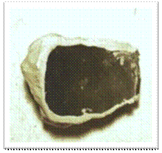
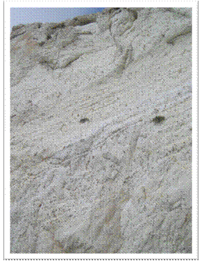
Figure
1 Close up of the embedded rock Figure 2. 200 ft. Rosh
Hanikra cliff face of chalk with
the embedded volcanic rock deposited
throughout
Israel: Rosh
Hanikra
One simple example that shatters the
uniformitarian scenario is that of the chalk cliff formation of Rosh
Hanikra
on the northern coast of
Throughout the deposit is an abundance of
globular shaped obsidian-like rocks of various sizes. The grain size of these brownish-red rocks is
extremely small, and glass-like indicating rapid cooling. The shape and grain size of these rocks
strongly indicates a volcanic eruption that deposited the lava into a water
environment while still hot.
Moreover, since the rocks are abundant throughout the chalk deposit, no other
circumstance is possible.
However, since this same rock is abundant and uniform from the bottom to
the top, the formation had to have been a rapid deposit,
of both the chalk and the volcanic rocks, otherwise the same
volcano would have needed to erupt continuously, in the same productive manner,
with the same mineral composition for millions of years. The evidence, logically and without bias,
clearly indicates a rapid deposition.
The Dead
Sea
The
Although at 400 square miles it certainly is not one of the largest lakes in
the world, unlike most lakes, it receives virtually no rainfall due to the high Israeli mountains
to the west. The only notable influx of water comes from
the
The
The yearly influx of water from rain, run off,
and the rivers does not compensate for the profound evaporation rate of the
At one time the
Currently, the lake is dropping about 39 inches a
year, and has lost 20% of its volume in the 25 years before the year 2000. This extreme rate is partially due to the
reduced influx from the
Moreover, this evaporation rate has clearly
prevailed over all subsequent influxes of water because although the lake is
captured in a mountain basin, its surface has evaporated down to 1,300 feet below sea
level. This prevalence of the evaporation rate over
all influxes of water limits what possible source of water could have originally
formed the
First, the surrounding geological evidence
demonstrates that the water was once much higher than it is now. There are steep, sheer cliffs that line the west
coast of the
Secondly, the only way for the water to be trapped in this
basin at all, obviously, is if the mountains were already raised. These mountains, however, are the very
obstacles that prevent the rain clouds from passing over and dropping rain into
the basin. Fortunately, uniformitarians do not believe
that rain or rivers created the
Geologists propose that volcanic pressure and
plate tectonics are responsible for the mountains and the
The
Not only are the Red Sea and Dead Sea not still
joined, as one would logically assume in a an ever rifting valley, but there is as additional problem for uniformitarians. According to the book Smithsonian, Earth,
on page 251. “The Dead Sea achieved its
greatest extent about 10,000 years ago, and has been shrinking slowly ever
since.”
Okay. So
if uniformitarians believe that the
This timeline is a sort of trap for
uniformitarians. Because of the region’s
geological features, fossils, topographical features, and the
Tying up nearly 400 feet of the ocean’s water in
the polar ice caps unquestionably prevents the inundation of the valley at the
prescribed time. According to their own
interpretation, there has actually never been a better opportunity for the
The only realistic scenario that fits all these
factors is that the mountains were raised while the water levels
were higher, trapping the water. This
event was both the birth of a lake, and the death of a lake since it began to
evaporate as soon as it was cut off from a sufficient replenishing source. Regardless of how the mountains formed, and
how the valley widened, the mountains had to be raised before the
water could be trapped, while the water covered the land. In order for the water to cover the land in
this location, at this time, the water had to be higher all over the world.
Just as
discussed before, the Flood water covered the land, and then the mountains were
raised on every continent, draining the land.
Although the valley that rifted created the
Clearly, the evidence shows that the water originally
reached even higher than the apparent 700 foot shoreline. It not only once covered the surrounding
mountains, on both the west and the east, but it actually made
these mountains. The hills and mountains all
around the
Additionally, both the sandstone and the limestone layers are
interrupted by frequent layers of conglomerate interspersed throughout the
deposits, establishing periods of turbulent conditions. No geologist will deny this, but it is the
timing of the water deposition, and the raising of the mountains that is of
most interest. The only feasible way for
the water to be trapped in this basin is if these sediments were deposited while
the land was covered by water, and then raised into mountains while still
under water, in the same incident, rather than two separate complex
incidents. The features of these
mountains and hills show that the powerful erosive forces occurred post-deposition
and post-uplift.
The entire region was indisputably once
underwater, and the surrounding valleys and hills exhibit the unquestionable
evidence of massive water erosion, even though it receives insufficient rainfall
and runoff to cause these features. All the topography of the
area demonstrates the classical sedimentary layering deposited by abundant
water, and the dramatic erosion establishes a massive evacuation of water, not
just the scars of yearly runoff. A deluge of water
evidently formed these features from the high, flat top mesas like
Evidence for this is clearly seen in the hills
and mountains surrounding the lake. Not
only were the mountains formed by water deposition, but the water was evidently
still present as the hills were raised. The abundant caves and other
erosion factors prove that the mountains were still briefly under water even
after they had risen. The surrounding mountains
and hills above the
This evidence indicates that the whole region
had been covered in water, and that very little rain has been falling since, or
these shells would have washed away.
These mountains could not have been formed under some ancient sea, and
exposed for millions of years. The
delicate snail shells would not still be there, the salt mountain could not
have been created, the caves would not be there, and most importantly, the
In fact, there was originally enough water
trapped in the basin that the evaporation deposits formed an entire 760 ft mountain of pure silt-covered salt, Mt.
The Flood is the best explanation for the
INTRO PHYSICS BIOLOGY FOSSILS back to top CHALLENGE INFO
Other Formations
Formations all over the world demonstrate the
effects of this worldwide flood. Every
valley and canyon in the world, large or small, is immense compared to the
streams and rivers present in them, testifying to a time of a great volume of
water. Most regions of the world have
this type of topography, with some kind of valleys, canyons, plateaus, caves,
or other large features eroded from sedimentary deposits. The tremendous forces required for depositing
and carving out these enormous formations cannot be generated by today’s
inadequate processes, or by the water sources available. Clearly there was a time when these vast beds
of sediment were laid by large volumes of water, and afterwards the valleys,
canyons, plateaus, and caves were eroded as the receding waters stripped the
layers away. We have verifiable evidence
that such erosive forces are the best explanation for modern day topography.
These features are so common, we don’t even
think about them anymore. Everywhere we
go we live among these vast sedimentary deposit and erosion features. We notice the deposits most at the coast, in
valleys, road cuts, and in canyons.
These formations are composed of large piles of sand and mud that have
been carved away by enormous water forces.
Look at them, and ask yourself how all those sediments got there. Check out the broad valley that the little
river runs through. How much water would
it have taken to erode the land all the way down to the bottom of that
valley? It is strange how small that
little river looks, all settled into its niche, compared to the work it is
purported to have accomplished. What
could possibly create the unusual hills and ripples and grooves in the land
just as if massive water had run across it, eroding it away?
A casual survey of most regions will turn up
these features, so we can all conduct common sense research on our own. Uniformitarians try to convince us that these
features were formed from gradual processes, slowly laying down the sediments
over millions of years with each calm, ancient sea. But, as mentioned, the sediments are too
high, and they are consistent with a one-time, verses periodic, deposition. Many features undeniably are too spectacular
to have formed through this long-term, imperceptible process of
uniformitarianism. The only time that
these schemes fit the evidence is when evolutionists concede that a large-scale
evacuation of an “ancient sea” had laid and carved the deposits—and that,
naturally, is confirmation of the Flood.
We know enough about catastrophes to recognize the evidence of one.
Aside from the well studied effects of the
The abundance of these features worldwide
discredits elaborate uniformitarian explanations for each. The absence of sufficient, present day water
sources (often none is available in arid regions) in comparison to the grandeur
of these common features, begs to be logically considered. Some examples of dramatic sedimentary formations
that are clearly carved by water are the
The immensity of these features, like the 1,142 foot Ayers
Rock, require that the water that deposited it would have been that high. Water that high in one place means that it was
that high everywhere. Since the same
water that deposited these features was also clearly responsible for their
erosion, the complex scheme of gradual deposition and uplift once again is an
arbitrary tale. Every similar feature
around the world would experience its own schedule of “ancient seas,” swamps
and gradual localized uplift to explain what is evidently a worldwide pattern
of deposition and erosion.
These incredible canyon, pillar, and giant arch
formations, carved from massive uniform sedimentary deposits, are certainly not
evidence testifying to uniformitarianism.
The majority of these features are formed in sandstone, which again is
transported through rapid moving water.
How can uniformitarianism actually hope to explain hundreds to thousands
of square miles of massive sandstone deposition, and then large canyon,
pillars, and arches carved out of them without a catastrophic flood event? After all, what is the difference between an
“ancient sea” that inundates the land with massive amounts of rapid moving
water, and a worldwide Flood that inundates the land with massive amounts of
rapid moving water? Since most of these
features now stand in regions that are presently deserts and wastelands, very
little water is available to carve the dramatic erosion features after the
“ancient sea” has evacuated. This leaves
all the work, again, to the sea itself—confirmation of the Flood.
The clear evidence is that some enormous amount
of water laid all the sediments, and then carved them into these tremendous
erosion formations—some of the most spectacular geological features in the
world. Attempts to construct histories
for these vast, impressive formations, without a flood, boggle the imagination. If this kind of blatant evidence were
available for evolutionists, everyone would happily accept it, but because it
supports Creation, it is reinvented.
Explanations should not replace facts, and doctrine should not
compromise observation.
INTRO PHYSICS BIOLOGY FOSSILS back to top CHALLENGE INFO
Grand Canyon Depositional Evidence
When geologists look at the vast carved valley
in
There are large boulders deposited in the valley
that could not have been transported by the little river. There are great moraines and piles of debris,
giant drag scars, jagged rocks and the U shaped valley, none of which are
characteristic formations eroded by a small river. But despite this, if scientists did not have
enough experience to imagine the concept of glaciers, the evidence would likely
be compromised to suit the assumed hypothesis.
This is why the “scientists” of days past thought the earth was flat,
and motionless, and that everything else moved around it. At that time it seemed ridiculous to think
that the earth was moving, certainly we would feel it, or we would fly off of
it—this despite all the evidence to the contrary.
The same problems apply to scientists
today. Because of the spiritual
implications, the evidence of a worldwide flood is ignored or rationalized
away, even if the replacement theory is scientifically misapplied. Scientists cannot accept the worldwide Flood
interpretation of the evidence because it would be confirming the entire
Bible. The worldwide flood is such a phenomenal
event, that to acknowledge it would take the legs out from under the
naturalistic paradigm, and leave no viable refutation for the claims of the
Bible. Just recognizing this position
evolutionists are in, sheds light on the motivation behind disregarding the
obvious interpretation, and denying geological Flood evidence. Confirming the Flood does not only eliminate
the evolutionary interpretation of fossil evidence, but validates all the
claims of the Bible, historically and spiritually.
Just like the
Due to the vast deposits of sediment,
evolutionary geologists concede that this expansive area was once covered by
“ancient seas.” They must actually
resort to believing that numerous placid ancient seas came and went over
millions of years, building these vast deposits. Then, only after these seas
finally receded for the last time, and the region uplifted the layers, could
the little stream begin its magnificent work—remarkably, for millions of years
more.
Moreover, the river would have had to work contrary to the force of gravity since the uplift clearly
occurred before the carving began. The plateau is so high, though, that the
river today enters the canyon from its long journey through the northwest at
its present level of 3,000 feet above sea level, while the top of the
north canyon looms high above it at 8,000 feet above sea level. This river does not begin to cut the canyon
by starting from a higher elevation, and then gradually descending through the
canyon. Instead, it grandly enters the
gates of the steep-walled canyon as one who travels through it, not as one that created
the passage.
The river would have needed to start higher than
the 5,000 foot cliffs above it in order to have carved down through the
sediments to create the canyon. How did the river ever
climb to the top of the canyon in order to start carving it down? Even uplift of the region would have certainly displaced
the river, and caused it to go around.
Water seeks to go down hill in any fashion, and this river would have
either remained at its natural level 5,000 feet below, or it would have been
cut off from its source.
Evolutionists are also puzzled about how this
could be. There is still a great debate
about how the river could carved through the wall, where it really originally
entered, and all sorts of possible theories that do their best to exclude a
catastrophic inundation. If one weren’t
tied to certain expectations, one might conclude that the river is a residual
of a vastly greater flood of water, which had both laid and carved the grand
feature in the aftermath of a catastrophe.
As we will see in the
No uniformitarian explanations are given within
the scientific evidence for how or why these proposed numerous and immense seas
arose and retreated so far inland with gaps up to millions of years between,
before they finally withdrew. These
numerous seas are necessary to account for deposition of all the impressive
strata in the
Again, one might wonder how a geologist can
admit that vast ancient seas once covered so much of the continent, but
outright reject the Flood, despite the clear evidence. Careful to characterize the ancient sea as
calm and not calamity related, they are undaunted by the fact that an ancient sea that could
leave sediments as high as the Grand Canyon, would necessarily cover the entire
continental US, including the Appalachian Mountains (which are also, by the
way, sedimentary). Not including the
additional uplift, the remarkable depth of the sedimentary layers alone is
evidence of the Flood. From the top of the canyon
to the little river below, there lies an astonishing sedimentary deposition of one mile deep, indicating that the
“ancient seas” had to rise at least this high—over 5,000 feet.
Though uniformitarians recognize that the entire
continent was once entirely under water, they must believe the area of the
Since a 5,000-foot trench absolutely does not
fit the evidence, they must assume that the region, and only that region, is
spring loaded. This means that every
time an ancient sea wanted to come in, the land would have to be below sea
level to allow it. But then the land
would need to rise above sea level to drain it and expose the sediments. But when the next sea wanted to come, then
the land would need to ratchet down below sea level again to permit it, and
then rise again to drain it, exposing the region. But wait, here comes the sea again, and we
don’t know why, but the land must courtesy again, and before we know it, this
magnificent process has managed to shove the first layer of exposed sediments
all the way down one whole mile so that the top and last layer can be inundated
again. And all of this activity would
occur with the same amount of water in the world as when it began, and with the
continents continually building up.
The scheme is further complicated by the fossils of shoreline,
fresh water, and terrestrial life captured in these sediments, which keeps evolutionists
from allowing for an entirely deep-sea deposition. Between that, and the pattern of sedimentary
deposition, they must cling to this concept of shallow seas, and perhaps the
spring-loaded land. And still, these
theories do not escape conflicts with the evidence. Even the alternating types of sediments require varied
environments of deposition, rather that a strict repetition of episodes, forcing the seas to
be alternated with swamps, and sea-swamps.
Here is the uniformitarian interpretation of the
layers of the Grand Canyon:
INTRO PHYSICS BIOLOGY FOSSILS back to top CHALLENGE INFO
Grand Canyon Sedimentary Chart
|
Chart of Grand
Canyon Sedimentary Layers |
|
|
|
|
|
|
|
|
|
|


Uniformitarians impose amazing expectations on
this region, which is presently hundreds of miles from the sea. The radical progression strains the
imagination alternating from full inundation, to exposure, to partial
inundation, to exposure, to terrestrial shoreline (not indicative of life that
lives near the ocean), to extensive desert, to coastal submersion to total
submersion. It is arguably unreasonable
to accept these characterizations as the best model in the face of no
supporting evidence other than the fossils and sediments themselves. Too many factors rationally negate these
scenarios.
There simply is no coherent geological evidence
to explain how these divergent environments were actually evoked in order to
pile up these 5,000 feet of deposits other than by catastrophe. One thing is certain—the sediments are this high
because the water was once that high. The
uniformitarian explanation for how these enormous and varied sediment deposits
were laid so far inland is not logistically plausible. No matter how this concept is propped up, the
evidence defies every rationale for rising and sinking land and seas.
Every aspect of the uniformitarian reasoning is
discredited by some infallible fact of the evidence. If the western half of the
Today the average land height worldwide is 2,757
feet above sea level, and this is after the majority of mountain
building has occurred. Scientists know
that the uplift that formed the present day mountains occurred after
the water covered them because fossil sea life is found on the tops of the
highest mountains of the world. The evidence is
undeniable, and any other interpretation ventures outside this evidence. The
Water then once entirely covered the Grand Canyon Plateau and beyond. At 5,000 feet of sediments, the water had to
be a minimum of 5,000 feet high to deposit the final layer. And the sediments do not end there. That is simply the line of where a particular
formation is perceived to end. One
again, sediments cover the entire
Furthermore,
For instance, where there should be a clear separation of the
two layers because of the length of time between deposits, there is frequently
instead an inter-fingering of materials.
This is when the overlaying layers are blended at
the boundary with the lower layers. If
they were actually separated by millions of years of exposure, this would be
impossible. The next layer should sit right on top instead of the materials
blending together. Instead, this
indicates that these different sediments were deposited at about the same time
period, as the particle composition shifted content and grain size.
Additionally, as each “ancient sea” receded, it
would have left the new deposit exposed to the elements for a time period of
between hundreds of thousands of years up to over a hundred million years. During that exposure, one would expect
certain things to happen that evidently did not. One, as mentioned before, is that there is no
evidence of erosion over this period of exposure. This concept is confirmed by the
uniformitarian term “paraconformity,” which is an unexplainable lack of erosion evidence at
strata boundaries. This is when two
sedimentary deposits that represent two different geological eras, meet without
demonstrating the typical signs of erosion or evidence of the passage of time
in between.
The underlying strata throughout the canyon lack
the characteristic “V” shaped drainage erosion features. As discussed earlier, there should naturally
be grooves and channels cut into each layer after the water drains and exposes
the sediments to the surface. Erosion of
this nature would be evident after just a few years, let alone a hundred
million. This erosion is completely
missing at all the sediment contact points throughout the canyon, which is undeniable evidence for a
one-time continuous depositional event.
These features are called “unconformities”
because they fail to demonstrate evidence of the deposition or erosion expected
over millions of years of exposure that supposedly elapsed between depositional
layers. Two powerful examples of
unconformities are where
the Coconino Sandstone overlays the Hermit shale in
precise contact. Since shale is soft,
one would expect a great deal of erosion to occur before the next layer is laid
millions of years later, but there is not.
Again, the assertion is that this sandstone was deposited in a desert
environment, which would bring in the sediments without water. Since the shale should have easily turned
into soil and clay from exposure, this evidence should also have been preserved
as the dry sand covered it, but there is none.
The other example is where the
first layer of sediment contacts the bedrock at the “Great Unconformity.”
This feature is so named by evolutionists because of the dramatic
levelness of the underlying rock which had evidently been scoured flat prior to
the deposition of the first layer of sediments.
Ordinarily rock layers are not naturally as level as a table, and
clearly the invasion of the new sediments was a powerful event that eroded into
the rock. Otherwise, this contact point
is supposed to represent more than one billion years of exposure to the
elements.
There is also a complete lack of chemical erosion in the underlying strata of the
Plants and trees should grow in the interim as
well, sending roots down into the sediments, and animals would burrow into the
ground. Each exposed layer should display this evidence before the next layer
was added. There should be soil building
up on the surface as the exposed sediments would break down, and organic
material was laid and decayed. Most of us have this kind
of soil build up in our yards because we live on this soil layer that sits
directly on top of these sediments.
Instead of evidence for these natural processes having taken place
during exposure, a rapid succession of deposits is evident, as the shift in
strata that should signal a passage of time is completely undetectable.
This deficiency is made more evident by the gaps
between the time periods that the layers represent. When geologists evaluate the steep walls of
the
To a geologist, though, this fact is not
discouraging because the
Not only is there a gap between geologic eras,
but there appear to be compressed eras as well.
The most baffling of these deposits represent the Permian era. Evolutionists must designate these deposits
as Permian because of the type of terrestrial fossils they contain, but
remarkably, the
sediments of this one era are all different. As a reminder, the book Rocks and Fossils
clarifies the cause of these different types of deposits. Limestone, as described on page 147, is deposited
in warm, calm waters due to the calcium carbonate discussed earlier. Page 51 tells us that mudstone is very small
grained and is deposited in still lakes and deep-sea ocean environments. Sandstone is larger grained and requires fast
moving water, like a river.
This means that in the span of one geological era,
shale was deposited in still waters, sandstone was then deposited in rapid
waters, and then limestone in a calm sea.
If we were speaking in evolutionary terms, first the standing sea water
that formed the Hermit shale would have somehow become a deep, rushing current
from north to south (based on the severe cross bedding) to lay down the
Coconino sandstone over that, and then turn suddenly into a calm sea to deposit
the Toreweap and Kaibab limestone. How
can all of this dramatic activity be explained by gradual uniformitarian
standards, when clearly it would require rapid shifts in topography to
instigate it all?
The current cross-bedding in the sandstone
indicates drainage toward to sea, not an inundation from
the sea, so the water level should be draining to leave this type of
deposition. Even if the theory of sand
dune deposition is rejected, and a water invasion is accepted, this evidence
still conflicts. How would a sea be
invading the region if the water is draining toward the sea? However, the moving water was evidently deep
enough that at some point the current settled into standing water and deposited
a thick layer of limestone above it.
Despite this assertion that the sandstone layer
was deposited in a desert, not by water, the depositional and fossil evidence
clearly points to water. Additionally,
the Permian is considered later era deposits, so it is difficult to justify the
appropriate topography that would accommodate the non-ocean, shoreline deposition
of mud, to sudden desert conditions, and then an inundation of calm water
limestone above that. Since all three
types of sediments were necessarily laid during one geologic era,
uniformitarians must construct another complex schedule of events in order to
account for these deposits.
An interpretation more fitting of the
INTRO PHYSICS BIOLOGY FOSSILS back to top CHALLENGE INFO
In the pattern of the
This is when the sandstone layer is laid again,
indicating more fast moving currents and possible tectonic activity that may
have shifted the drainage. Then layers of limestone are near the top indicating
a possible blockage that caused standing water for a time. The uppermost layers reveal that materials
have been eroded away into a flat mesa, where a recession may have begun during
the further uplift of the region. This
rapid evacuation may represent the breakthrough of a large water damn that
suddenly cut through the sediments into the canyon.
Scientists must recognize that many of these
layers require fast moving water. This
also explains the level evenness of the vast plain that the
In addition to the impressive visual evidence,
there are other features in the rock strata to verify the presence of an
enormous quantity of rapidly moving water.
In fact,
the deposition of large breccia (jagged rock fragments)
intermingled with the sedimentary muds, indicates that a fast moving current
tore them from their original sites, and transported them quickly with the
muds. That the breccia are embedded within soft, small
grained sediments, and transported uniformly across certain strata, is not
indicative of slow deposition in a calm sea.
Clearly violence is required to dislodge all these jagged rocks, which
were deposited in the slurry of a rapid current, without sufficient time to
tumble off the sharp edges.
Additionally, conglomerate
and boulders of various sizes
were transported as well, and are also inexplicably and abundantly present
among the smaller sediments. This clear evidence cannot be explained within the placid sea
model, but is characteristic of a dramatic event of torrential waters reaching
far back into the land. There is no other way to
interpret this phenomenon.
Even the hundreds of Nautiloid
fossils that are present in the Grand Canyon Redwall formation demonstrate
through directional orientation that there had been a swift current. Nautiloids are those squid-like creatures
with the long, straight shells, which tend to point in the direction of
currents. In calm seas, these creatures
would die and fall to the floor in random directions, but the hundreds of
fossils found in the
An abundance of delicate soft-bodied animals
(such as Crinoids and Bryozoans) were also exquisitely
fossilized. These creatures collapse and
decay quickly in the water after death, but the pristine preservation of their
fragile parts in the
When we examine the terrestrial evidence from
the Grand Canyon Permian strata, we see delicately fossilized fern leaves, dragon
fly parts, tree stumps and remarkably amphibian animal tracks, along with other terrestrial plants and animals that indicate
that system. Evolutionists would point
to these fossils to bolster claims of the progress of life. Common sense, however, tells us that these
things have no business in the middle of vast open waters that clearly covered
the region for hundreds of square miles.
Moreover, these delicate preservations, again, testify to circumstances
of rapid burial. Fossils in the Grand Canyon
tell the story of cataclysm despite uniformitarian efforts to use them as
evidence for evolution.
One final point involves the use of radiometric
dating of lava flows present in the
Clearly, this flow is at the oldest, only a few thousand
years old, or the canyon would not have been formed yet in order for it to flow
into the deepest carved portion of the
How could rock that came in from the top of the
sediments be as old as the rock underneath all that sediment when it took
billions of years to lay them over it, and then carve out the canyon? This absolute impossibility demonstrates how
utterly this method has failed, and it should never be considered
reliable. How legitimate can it be when the most common radiometric
dating methods consistently present a wide range of dates on the same samples,
and do not agree? Why would any such dates
be accepted?
The
INTRO PHYSICS BIOLOGY FOSSILS back to top CHALLENGE INFO
Mount St. Helens
While no one has seen a little stream actually,
patiently carve an enormous canyon out of solid sedimentary rock, we have
witnessed the results of catastrophic events.
Creation scientists were pleased, but not surprised, by the marvelous
effects of the cataclysmic eruption of
Creation Scientists are interested in
studying all the effects of events like the
Additionally, Creation scientists were
interested in the environmental impact of massive volcanic activity because of
the evidence in the Bible of global volcanism pertaining to the Flood. One such scientist is geologist Steve Austin,
whose extensive research and documentation of the
When
None of the lava flowed out, but as the day
passed, a massive, hot pyroclastic cloud blasted several miles into the air,
darkening the landscape and spewing steam and ash for nine hours, with an
energy output equal to one
Clearly, just this one eruption transformed the region for
miles, altering the landscape, soil content, effecting all plant and animal
life, and the atmosphere, adding layers of ash, and other evidence of its passionate
display. Such unmistakable indications
of eruptions and ash deposits in the past are noted in the layers of the
geological record around the world. Ash
layers are particularly evident in remarkable erosion zones like the
But the spectacular
One of the most spectacular events was in the June 1982 eruption that
disbursed more ash in a pyroclastic flow.
The ash landed on glacial ice on the mountain, which melted the ice and
released a massive mudflow. This torrent
hit the blockage of the Toutle river basin, and broke through producing a flow
of ash, and mud and debris which deposited more strata. As the torrent continued to drain, it cut
through all the strata and formed a miniature
When we see how uplifted the
Just as fascinating was the steam implosion pits that
formed when the hot ash trapped the glacial ice, which melted and escaped as
steam. When gravity gave way at the edge
of these fine deposits, they sank down dramatically, leaving relief -type edged
canyons and gullies exactly like those seen in the
All of the spectacular deposition and erosion
features of the world are consistent with the scale model demonstrated by the
catastrophe of just this single, small, cataclysmic event. Knowing these grand and powerful effects
catastrophes have on the topography, one wonders why uniformitarians insist
that catastrophes did not form such awe inspiring formations in
the past. What is this insistence based
on when real geological models prove
that catastrophe absolutely is an agent for such formations?
All the theoretical effects of a worldwide flood
were perfectly demonstrated in this one example, and showed scientists the
incredible reality of its impact. The layering revealed in the
mini “
One would expect that if there were any
organisms that had not been destroyed in the previous steam blast two years
before, it might easily have been fossilized in the ash and mudflow. No one has seen the types of layering that
uniformitarians ascribe to millions of years of sedimentation, but we have an
excellent example in the
In addition to the dramatic
sedimentary formations,
When uniformitarian geologists explain the
process of petrifaction, they recognize that the trees were saturated by waterborne sand, mud
or volcanic ash, and the concentration of minerals in the water invaded the
cells of the wood, turning them to stone. The elements required for
wood petrifaction, however, would also be present in the Flood. Uniformitarians have
claimed for years that the
However, even if a standing forest had been
petrified in an upright position, this would still be clear evidence of flooding
because dozens of feet of water, ash, and mud would need to invade the previously dry region
in order to inundate the entire forest with the mineral solution. Additionally, many of the trees, both in
Creationists find many problems with the
uniformitarian theories about standing petrified forests. Several phenomena
demonstrate that these forests could not have been petrified where they stood,
in successive eons on different levels.
There is no bark on these
trees, indicating that the bark might have been scoured off during rapid water
deposition, like the trees in
The concept of multiple forests on successive
levels is disputed by logic alone.
Uniformitarians suppose that these successive levels are separated by
millions of years, and yet there is typically just a few feet difference
between them. This is impossible because
of the height of these logs. For a new
forest to grow only a few feet higher than the ground level of the previous
forest, a large portion of the first level of trees would remain exposed to the
elements for millions of years. Clearly,
a tree is not capable of
withstanding such exposure without decay. The
whole standing forest would need to be fossilized at once to satisfy the unique
process of petrifaction. A separate
preservation of each incremental level of forest is unfathomable. There must be a better explanation.
In fact, a group of Japanese scientists
conducted a series of experiments concerning petrified wood, and the rate of
silification in the Tateyams Hot Springs.
They reported their conclusions in the July 2004 issue of Sedimentary
Geology. According to their studies,
the silification of wood can and does occur very rapidly, not requiring the
long ages, but merely tens to hundreds of years under the right natural
conditions (Acts and Facts January 2005). They included among these likely conditions
volcanic ash beds and sedimentary strata in volcanic regions inundated by hot
flowing ground water with a high silica content.
Now, the real life science laboratory of
The
INTRO PHYSICS BIOLOGY FOSSILS back to top CHALLENGE INFO
Fossil Fuels
Another remarkable phenomenon following the
Considering coal seams can run for hundreds of miles, the uniformitarian model
cannot possibly explain these extensive fossil fuels. Uniformitarians, by definition, must
construct slow, gradual processes to explain them, but there are no conditions
in the world today to validate these models, or demonstrate that they are more
plausible than catastrophe. Miles of
fossil fuels could not be the result of normal, natural processes through eons
of time. A catastrophe would offer the
best opportunity to form these massive deposits. It is a significant geological fact that fossil fuels are abundantly
present in every part of the world. Oil,
coal and natural gas are present on every continent, including the arctic and
Antarctic, and they are even found in the ocean. This is
bewildering under the strained scenarios of the uniformitarian model.
Under the uniformitarian model, coal, oil and
natural gas were formed when plants and organisms gradually accumulated over
eons in oceans, ancient seas and swamps, without dissipating in the water. Then, in hundreds of these locations
worldwide, through various local scenarios, this organic matter was completely
covered by hundreds of feet of sediments, and compressed into the fossil
fuels—each, miraculously, at different sites in unrelated incidents. This is not a process we see operating today. We do not find slow, gradual conditions today that will eventually lead to fossil
fuels unless catastrophic conditions intervene. It is
well known that catastrophe is actually the best catalyst for fossil fuels
simply because the geological record can demonstrate a correlation between
catastrophic events and large vegetation deposits.
There is historical evidence of this in the
fossil record. Evolutionists have noted
a significant increase in
Carbon 12, most commonly attributed to rotting vegetation, in the strata where
the Permian extinction is assigned. The
Discovery Channel presented a program “The Day the Earth Nearly Died,”
which discussed this increase in Carbon 12, and the obvious worldwide sudden
loss of life during one of many supposed evolutionary extinctions. The increase of Carbon 12 at this level,
though, indicates that there were specific circumstances involved in this
record of massive death. A worldwide record of
rotting vegetation could only happen during very moist conditions, and the
immense collection of vegetation at this level indicates that it was not
disbursed.
All the evidence indicates that a great deal of
vegetation, simultaneously all over the world, was either ripped up or
otherwise killed under very moist conditions. Then it was covered by sediments
before it could be broken down and consumed by the usual forces of sun,
rainfall, and insects. It would only
take a few years for it to breakdown or dry out if it was not covered. We do know that it was covered, though,
because the sediments lay over this layer now. How did
so much vegetation all over the world suddenly die, and begin to rot, and then
get covered so completely that it was preserved in the geological record? Evolutionists also believe that many, many
animal species also became extinct at this Permian level, demonstrating how
significant the catastrophe had to have been to cause it.
Evidence that these catastrophes could have
formed fossil fuels must be ignored under the uniformitarian theory in order to
keep up the pretense of long ages.
Swamps and shallow seas, however, still do not provide the circumstances
necessary to create fossil fuels. Today we see that the great
amount of organic material needed to form coal does not accumulate in areas
where influxes of great loads of sediments are possible.
Swamps and bogs can accumulate abundant organic
matter because their shallow water is sedentary, and receives little movement
to dissipate the organic material.
However, if there is not enough influx and motion of water to dissipate
the material, there is also not enough influx of sediments to cover
the organic material. There must be a
great accumulation of sediments over an incredible amount of organic material
to create a fossil fuel. In fact, it takes from 3-7 feet of
organic plant matter to make one foot of coal. We occasionally see the organic transformation of
plants in peat bogs into the first stages of coal formation, but it will not
become coal under present conditions because it is necessary for this great
load of sediments to accumulate over the material, before it dissipates, in
order to compress it into coal.
It is possible for peat to accumulate in a bog, but a
uniformitarian would need to propose that after this great accumulation, the
bog was uncharacteristically inundated by sediments. There are situations where a pond or body of water that does not receive fresh influxes
of water may fill in with vegetation.
Moss and sedges can encroach in on the pond from the edges, and these
floating mats will deposit organic material beneath it into the water. This material can evade complete decay in the
poorly oxygenated water, and it will begin to fill in, eventually forming peat
as the water is absorbed. This sort of accumulation mimics the floating
vegetation mat proposed by
Under the uniformitarian theory of gradual
growth and gradual deposition, the body of water must remain calm for eons in
order to amass the necessary plant material.
In a calm sea or swamp, the
only way to accumulate the hundreds of feet of sediments that are always
found covering fossil fuels, is for a unique event to bring them in, which would be a
catastrophe. Not enough sediments
accumulate by a gradual rise in water because moving the heavier sediments
necessary would dissipate the organic material. So we
see that even if the materials did accumulate in a swamp or calm sea, they
would still have to be buried by hundreds of feet of sediments in a unique
event, giving credence to the Flood model. This gradual process is further
discredited when we consider how abundant fossil fuels are worldwide,
necessitating all these ancient seas, mini floods, catastrophes and impossible
requirements for each site. Such
deposits clearly indicate the more logical catastrophic Flood model.
One example is the Ekibastuz coal field in the
former
Additionally, the uniformitarian interpretation
that dictates millions of years to create these formations is not because it
actually takes millions of years to make fossil fuels. No one could possibly know that. In fact, scientists are able to duplicate the necessary
factors in the lab and actually create fossil fuels. Evolutionists simply require this process to
take millions of years to allow for the long ages of evolution. If a single
worldwide flood could explain all fossil fuels, then none of the sediments were
laid over millions of years, and so none of the fossils were made
over millions of years, and therefore there is not enough time in the history
of the world to allow for evolution.
Evolution would take a very, very long
time. This is why uniformitarian
scientists insist upon the slow accumulation of small plants and algae and
other organic material over millions of years under calm, steady conditions,
and the equally slow deposition of sediments, as their devise. They confidently explain all their scenarios,
but offer no evidence that they are possible, or even likely, let alone
factual. Since their own, beloved Carbon
14 tests, again, reveal a measurable amount of carbon in all coal
deposits, the most they could be is thousands, not millions
of years old, making them theoretically “millions of years” younger
than the things that died to make them!
Scientists don’t discuss the discord between
their scenarios and the evidence concerning fossil fuels. If all the organic material accumulated
first, and then the tons of sediments were gradually deposited, what evidence
is there to explain that these thousands of sites suddenly shifted from lush,
calm environments to regions rapidly flooded with sediments? But if on the other hand, as is sometimes
proposed, gradual accumulations of organic matter are alternated with gradual
accumulations of sediment, why are there so many large dykes of coal dozens to hundreds of
feet thick, and sometimes hundreds of miles long? The enormity of the
formations themselves testifies to the enormity of the disaster.
Moreover, the formation of fossil fuels in the
ocean also poses difficulties. Today, it
would be a unique incident if a vast quantity of organic matter accumulated in
the ocean, and then tremendous load of sediments quickly deposited onto
it. Where would it come from? Organic matter does not accumulate in large
quantities over millions of years in the ocean because the water would
dissipate it, and the animals would consume it.
Once again, one would need to call upon another deep oceanic trench in
order to keep the animals and oxygen from consuming the organic material. But of course, then there would be no reason
for the organic material to gather there so abundantly.
These necessary conditions are not known to be
met anywhere in the world today, as vast amounts of unconsumed food do not just
lie around the ocean floor accumulating.
Add to that the second requirement of hundreds of feet of sediments
suddenly covering it. When explorers
discovered the wreck of the Titanic, nearly 100 years old, what did they
find? Scarcely any sediment
accumulation, and virtually no organic compounds remained. No clothes, or
bodies. The wood was gone—it was not
covered and fossilized because the ocean doesn’t work like that. The thousands
of barrels of oil found in the oceans of the world are unquestionable evidence
of a global disaster.
Nowhere in the world do we see the right
circumstances that produce fossil fuels, and certainly not on such a grand
scale. If we do not see them even in one place, how
can evolutionist explain the incredible abundance of fossil fuels
worldwide? Uniformitarians believe that
if they simply use key phrases like “accumulation over millions of years,” they
do not have to work out the details.
What we have really learned about geological processes is that only
extraordinary events, as seen in at
INTRO PHYSICS BIOLOGY FOSSILS back to top CHALLENGE INFO
The uniformitarians will tell you that you do
not notice the processes that make fossil fuels today because they are too
slow. Despite the lack of evidence, and
unimaginable complexity and compounding series of unusual geological events
that they use to explain the formation of fossil fuels, uniformitarians insist
that these processes happened, at hundreds to thousands of sites throughout the
world, and continue to happen in different forms. Nonetheless, they still must
necessarily concede to all the conditions that are comfortably satisfied by the
Flood. The known requirements for creating fossil fuels
are: amassed organic matter, a large body of water, the lack of opportunity for
the matter to dissipate, and the influx of heavy loads of sediment. The rapid processes of the Flood most
fittingly account for this, and there is no evidence that it was not
possible.
The process required to create the abundant
fossil fuels worldwide is best explained by a global flood, and
it is exactly the kind of evidence a Creation scientist would expect to find to
corroborate the event. A global flood
would tear up masses of vegetation around the world that could float and
redistribute as it sank. Then the Flood
could easily provide heavy loads of sediment to cover the matter before it
could break down, (or cover organic material where it originally grew) and
subsequently submit it to tremendous pressure of the water and sediments.
Additionally, many scientists believe that animals like dinosaurs are part of
the organic material in oil and natural gas.
The immensity of these deposits confirms the likelihood of large animals
as part of such a vast collection of organic material, and a massive, powerful
flood best explains how animals and plants large and small could be collected
and buried so thoroughly before they were dispersed.
Fossil fuels are not evidence against
the Flood model, but on its behalf. They
are, in the same measure, something that uniformitarian geologists must explain,
and do so in complicated and unfeasible scenarios, for which there is no
evidence of support to the exclusion of the Flood model. The abundant floating vegetation as the
result of the
Minor flood events throughout the world
demonstrate these principles, while practical knowledge of hydraulics, and
other common natural processes that can be studied and tested, verify the
plausibility of the Flood model. They
also demonstrate that the uniformitarian model lacks the validity to explain
such geological features. The advantage
for Creation scientists is that the expected effects of the Flood model are
confirmed and demonstrated for us in the arena of the actual
geological world, not a virtual world.
The uniformitarian model, however, is not afforded the luxury of real
geological demonstrations of the theory, and relies solely on mind exercises to
construct the various, self amending formulas to explain its incongruence with
the actual observed geological evidence.
BIF’s: Banded Iron Formations
Geologists are baffled by a worldwide
geological phenomenon called banded iron formations, or BIF’s. This is a deposit of sedimentary rocks that alternate
in thin bands between chert (in most cases) and iron oxides. Geologists assign the formation of BIF’s to
the very early earth based on the associated rocks, and the fact that they are
found in abundance on every continent. This could only happen while
every continent was under water. We have studied BIF’s intently because they
have provided the most accessible and useful iron deposits on every continent
and throughout history. Without BIF’s
there would not have been an iron age, and still today we rely almost
completely on these abundant formations for our steel industries worldwide.
There are several types of BIF’s, which vary
slightly in composition, but the essential elements are the same. All were deposited under standing water where a
local sediment composed of some form of silicates: chert, shale, carbonates, or
volcanics which alternate strikingly with an iron oxide deposition layer. These alternating thin layers of sediment and
iron oxide defy all uniformitarian explanation because geologists agree that
the formations occurred in conditions that have never again existed on the
earth, and they are still not sure what the conditions were.
Here are the main difficulties in explaining
BIF’s: the deposits must have occurred in the very “early” earth
(Precambrian), they were all deposited in standing water—most believed to be very
deep standing water— , the iron oxide and silicate deposits indicate the presence of
abundant free oxygen, and they occur throughout the earth, indicating a globally linked
water-borne phenomenon
bearing a sudden excess of iron ions during a sediment deposition episode.
Since the deposits must be assigned to the
Precambrian, there is a conflict with the prescribed free oxygen levels of the
early earth. As discussed earlier, free
oxygen could not exist in the early earth because that would prevent any
attempt at chemical evolution.
Therefore, how did so much free oxygen become available, all over the
earth in such abundance so early?
The scenario put forth is that this occurred
just as oxygen producing “primitive” blue-green algae were changing the world
with all their excess oxygen, and the free oxygen was binding to the iron ions,
causing them to fall out of solution, and become deposition layer. Then, for some reason, the oxygen levels
dropped (various scenarios are offered) and a layer of silicate is deposited,
and back and forth until the very large banded deposits were formed.
BIF’s have been used as evidence to put forth
some bazaar theories, including the snowball earth, mass proliferation, and
then extinction of blue green algae worldwide, and so on. However, a full understanding of the
mechanism behind BIF’s is still elusive because of the massiveness of the
phenomenon under some very unusual conditions.
In addition to the problems with the obvious abundance of free oxygen so
early in the earth’s history—before plants or even multi-celled creatures are
supposed to exist—there are other great uncertainties.
Why, for instance, was there a sudden massive
influx of iron ions into the seas?
Geologists have admitted that the best source was from weathering of
continental rock containing iron.
However, since every continent has a vast deposit of BIF’s, which
indicates they were under water at the time of deposition, what is the source
of continental rock? What knife edge
scenario could one concoct to suit all the elements of both weathering of
exposed rock, on a submerged continent, that could still rationally deposit
BIF’s on every deposit? No matter how
the land masses were connected, there had to be both a great exposure of source
rock, and great depths of submersion for deposition.
Moreover, weathering is the best explanation for
the alternating layers of silicate. Some
may have occurred near hydrothermal vents, but a clear influx of sediment, or
in cases the formation of carbonate from solution indicate a vast, worldwide
erosion catastrophe. This unusual
combination of circumstances rationally indicates a world wide catastrophic
flood event of limited duration. The
rain and flooding provided weathering of base rock, releasing the iron and
silicates into the water, where it combined with the oxygen to cause it to fall
out of solution and deposit on the continents during the period when the Flood
was standing water before the recession.
The varying composition of the silicate layers
depend on the local conditions, including volcanic, or hydrothermal. Perhaps more research with this most logical
scenario as the premise will likely produce the exact causes of the actual
banding process—whether it is related to the chemical solution and
precipitation conditions of these compounds, or some other cause. Regardless of the supposed limitations on the
“new earth’s” oxygen levels, all of the minerals involved contain oxygen as the
decisive element in their composition.
Once again, oxygen, water, erosion and deposition are unavoidable
evidence of large scale phenomenon in the earth’s history.
INTRO PHYSICS BIOLOGY FOSSILS back to top CHALLENGE INFO
Prehistoric Climate
All of the presently extreme climates of the
world were once covered in luscious forests and vegetation. Scientists know this from the abundant fossil
fuel deposits and other fossil and geological evidence in present day desert
regions, and in the
As discussed previously, many scientists believe
that there was once an ancient single super continent they call Pangaea. They propose that all the continents of the
world were once joined in one landmass, which began to break up about 200
million years ago based on the dictates of fossil evidence. While Creation scientists acknowledge the
possibility of this super continent prior to the Flood, how, when, and under
what interpretation this theory is applied is debatable.
Naturally, Creationists view this 200 million
year old continental break up as arbitrary.
Again, if the fossils were laid in one event, the evolution dating
system is meaningless. The evolutionary
timeline tries to account for the numerous fossil anomalies around the world to
dictate when Pangaea broke up. Although
much of the evidence is still difficult to explain (dinosaurs on England),
evolutionists must adhere to this basic timing.
One of the factors evolutionists must consider in their estimations is
evidence of the lush forests and warm climate species of fossils found in the
However, even with their best projections, the
most likely configuration of this super continent does not help explain these unusual
fossils. Both the Artic and Antarctic
regions are already very extreme according to evolutionary models at the time
that these species would have lived.
Dinosaurs and flying reptiles have been found in
The problem with Pangaea is that since the
uniformitarian scheme puts time restrictions on the fossils found throughout the
world, this interpretation dictates at what stage in evolution the continents
had to break up. Many species (like
dinosaurs) existed simultaneously throughout the world, so the super continent
helps explain most of the locations of these widespread fossils, and helps them
avoid transportation issues.
Additionally, sediments around the world are so similar, that the best
way to explain them and deflect from a worldwide flood is to assume that the
continents were joined at certain places and times.
Although some of the geological evidence does
seem to point to a time of a single continent, the proposed breakup of Pangaea
around the Jurassic still strains the existence of numerous fossil species
globally, certain geological formations, and the location and schedule of all
those ancient seas. This break up is
just the last of the many complex geological schedule of events necessary to
maintain the evolutionary presumption.
Once again, the evidence does not dictate the story, but the evolution
story manipulates the evidence.
Pangaea may have indeed existed, and was broken
up by the geological activity associated with the Flood. However, the Creation/ Flood model still has
several advantages over the uniformitarian model. First of all, Creationists do not have to
worry about explaining how certain species lived throughout the world
simultaneously prior to the Flood. God
filled the earth initially, and there would have been no need for them to
spread. Also, regardless of whether
there was a single continent or not, a global flood would explain common
sedimentation around the world without crucial timing for the breakup or
confusing ancient sea schemes. Thirdly,
the Flood model answers questions about the pre-flood climate with
scientifically sound principles.
The Bible describes the period of time prior to
the Flood when it didn’t rain, but a mist arose from the ground, and likely a
water canopy held much of the atmospheric water. Conditions described in this environment
indicate there would be a globally mild climate, which would have allowed the
tropical vegetation to flourish. Later, the Flood would have ripped up and
buried this vegetation, leaving the abundant fossil evidence of the pre-flood
climate.
After the catastrophic volcanic eruptions of ash
and water, massive rain clouds likely persisted over the geothermally warmed
oceans, bringing a shift in global weather and temperature. The suddenness of these effects induced the
Ice Age. Under the Ice Age, and new
global weather patterns and loss of the water canopy, the lush forests would
not be able to reestablish in the extreme climates. The uniformitarian model strains to explain
how, in a non-cataclysmic, geologically steady world for hundreds of millions
of years, the entire planet suddenly went from a single continent, to seven,
and from these tropical forests to an Ice Age.
INTRO PHYSICS BIOLOGY FOSSILS back to top CHALLENGE INFO
Other Topography
There are also numerous other unique formations
around the world that are better understood within the framework of the global
Flood event. Certain rock phenomena demonstrate that the world was once
inundated by water. One very telling example is
the lava flows found in
In comparison, the largest eye-witnessed lava
flow was in 1783 in
The best interpretation of this evidence is that
there was a catastrophic flood, and as part of the continued geological
imbalance, great fissures poured lava out of the earth. This interpretation is confirmed by the frequent
occurrence of sedimentary dykes and pipes rising through overlying layers of
volcanic rock at many of these sites,
including the
This evidence establishes that these massive
layers of sediment and lava were laid in a watery and cataclysmic
environment. In fact, nearly all the ancient
basaltic rocks throughout the world were apparently laid under water, based on the
characteristic “pillow” formations. Since
the majority of the rock that makes up the continents is granite, these
extrusions of basalt should have occurred after the continents were built. Therefore, regardless of the desired
uniformitarian interpretation, ancient pillow basalts exposed on continents
prove that these extrusions occurred under water—powerful evidence for the
Flood.
Additionally, some of the more spectacular rock
formations can be best explained by the presence of water. Columnar jointing is an unusual formation that
demonstrates the dramatic effects of sudden cooling on fresh lava flows and ash
deposits. Most scientists believe that lava or welded ash deposits
require rapid cooling in order to cause the deposits to fracture into right
angles. This is what creates the long polygonal columns in these
famous rocks.
Others have supposed that the formation is from is slow cooling, but
slow cooling is natural, yet columnar jointing is rare.
Since rapid cooling typically causes cracking
and exfoliation in rocks, the evidence of rapid cooling is most suitable for
the phenomenon. One explanation for the
cause of such dramatic cooling in these massive deposits is inundation of the
deposit by tremendous amounts of water. In some locations, these
formations currently meet the sea or other body of water, as with the Giants
Causeway on the north coast of
Perhaps these examples demonstrate that water is
the best activator for the rapid cooling that could produce this
phenomenon. Since columnar jointing
apparently requires such an unusual circumstance to activate the geometric
cleavage, water most reasonable offers that opportunity. Given this likely condition, not all of the
columnar jointing sites are presently near large bodies of water. The on-site evidence therefore can tell us a
lot about the circumstances of the formation.
Of the locations not currently near water, Flood
evidence can be discerned. In many cases, the amount of water that would be
necessary to produce this effect, defies the imagination. The Devil’s Tower, in
This on site evidence indicates that water had
been present, and that the core of lava had pushed up through the previously
laid sediments in order to be deposited.
However, the amount of water necessary to deposit this evidence would
have been immense. The height of the
formation indicates that in order to initially lay the sediments, and then
strip them, as well as cool the entire formation, the volume of water
would be an inland sea covering most of
the continent.
The fact is that most lava deposits do not result in this phenomenon,
and rapid cooling by air would be insufficient to penetrate these massive
volcanic formations and create the fracturing.
We know that water can rapidly cool under the right conditions, so the evidence points to
an influx of massive amounts of water laying sediments near the time of
volcanic activity which also cooled the lava in the cone, and subsequently
stripped the sediments around the cone.
Water, is similarly a rational cause of all these
formations. Several other examples of
this columnar jointing are found at
Another interesting geographical feature is that
there are mountains on every
continent and most islands (which actually are mountains), and there are
oceanic trenches along the continents. The
uniformitarian model and the Creation model hold to similar mechanisms for
mountain building through the effects of the collision and movement of plate
tectonics. Though modern theories about
the arbitrary movements of prehistoric plate tectonics, and a shifting magnetic
field are still in question, clearly a shift in the earth’s crust is required
for building mountains. Creationists
would add that the geological turmoil caused by evacuating volumes of
underground water, and adding this weight to the surface, would produce a great
deal of unsettling activity. Both models
agree that volcanoes certainly build mountains quickly.
INTRO PHYSICS BIOLOGY FOSSILS back to top CHALLENGE INFO
For the rest of the topography, however, the
uniformitarian model asserts a generally slow, gradual process of mountain
building through the theory of plate tectonics over thousands of
millennia. The Creation model
essentially asserts that a rapid process created the majority of the mountains,
primarily in conjunction with the geological activity associated with the
Flood. Aside from the volcanoes that
still build mountains, the gradual principles that may move plates today are
slow processes that do not adequately explain all the dramatic worldwide
topographical features that appear to have sudden, cataclysmic origins.
Most non-volcanic mountains today are made up of
underlying rocks uplifted in a sharp angle relative to the land. Frequently, one large block of rock has been
disjointed skyward intact, though it was once obviously parallel to the land. These mountains and mountain ranges look like
tables, or rows of tables that have been pushed hard from one side against the
land, causing the other side to tilt up.
In these instances, tectonic pressures had formed the mountains
gradually over hundreds of millions of years, then instead of these sharp,
dramatic angles, and preserved lines of strata and rock layers, we would likely
find jagged crumpled, and piled rocks, like from a bulldozer. In fact, some mountains do have such crumbled
attributes. But many mountains have
these sharp angles, so difficult to explain by gradual processes, and instead
demonstrate quick bursts of power.
The evidence of sudden geological uplift in
conjunction with the Flood, and immediately post-sedimentary
deposition, can also be seen in the effects of rapid geological activity on the
overlying sedimentary layers. One
example is the frequency with which thick layers of strata that represent
hundreds of millions of years are split into two levels on a fault tine. It supposedly took hundreds of millions of
years to lay those uniform layers, but there is no sign of stress disrupting
the layers until suddenly geological movement fractured all the layers and displaced
them by several feet? This is rational
evidence of onetime deposition of sediments, and then geological uplift.
Worldwide, common sediment evidence is powerful,
and hard to dismiss. Numerous
mountainous and dramatic uplift formations are covered by uniformly curved or
wavy layers of sedimentary rock that were uplifted and contorted post-deposition. These layers of sedimentary
warp are often smoothly contoured to the formation, indicating that the
deposits were still wet when the activity occurred.
This is seen, in fact, in numerous formations around the
world. Such dramatic examples are at
It is difficult to imagine that solid
sedimentary rock will bend so smoothly around this strenuous geological
activity. Our experience has actually
been that rigid rock will break in response to such stress. If these rocks had been deposited as
sediments, but had already turned to stone over eons of time, how did they
manage to bend so uniformly around the tectonic activity? These thick layers of bent solid rock don’t
show any indications of heating or any other agent of transformation, though
these examples exist as well. Such
heating will typically metamorphose the sediments into marble and similarly
recrystallized formations, yet many of these formations have retained their granular,
sedimentary form. This should never happen
under the uniformitarian model.
We can deduce that these geological formations
indicate sudden, dramatic, mountain building activity within the span of time
it takes for sediments to harden, or while still under water. Uniformitarian
geologists simply put their energies into arguing how their model could
be viable instead of accepting the natural conclusions of the evidence. Anyone looking at the evidence would
logically conclude that the sediments were wet when the activity occurred.
By its catastrophic nature, the Flood model
would necessarily anticipate such dramatic tectonic activity. The Bible also reveals a very scientifically
sound reason for mountain building after the Flood. Biblical scriptures in Psalm 104:8-9
indicate how God caused the waters of the flood to recede through natural
means.
[the waters retreated,]. . .as the mountains
sprang up and the valleys descended, to the place which you have reserved for
them. You have set a boundary which they
cannot pass; they shall never return to cover
the earth.
In fact, the mountains and valleys
actually are what keep the water within the oceans. If there were not such grand mountains, and
the corresponding tremendous trenches and ocean basins to contain the seas, the
earth would be completely covered by about 1.7 miles
of water. The mountains and hills on
every continent today still provide the impetus for the drainage of the water
off of the land into the seas. Why is it that nearly all rivers return to
the ocean?
There is a great deal of substantiation
worldwide in this concept that the mountains arose soon after the sedimentary
deposits from the Flood. As discussed
earlier, even the top of the
Irrefutably, fossils and sediments are not
deposited on the sides of mountains, and therefore evolutionists are forced to
recognize that these mountains arose after the massive terrestrial fossils were
deposited. Since the Rockies are so
grand, reducing their timescale to a mere 60 million years ago, and forcing a
tight schedule of mid continental flooding, rapid uplift of the entire Rocky
Mountain range, and diverse mini-catastrophes to explain fossil evidence. Evolutionists must constantly formulate their
timelines around otherwise clear evidence for the Flood. There continues to be much dispute among
geologists in marrying evolutionary assumptions with the fossil, sediment and
rock formations of just the mountain ranges of the
It is a remarkable fact that the world would be covered
by so much water if there were not these high mountains and deep valleys to
contain it. This takes the idea of a worldwide flood out
of the realm of make-believe, into the realm of complete scientific
feasibility. The presence of this
abundance of water on our planet points to two possibilities. Either the world once had to be
under water before the slow process of mountain building separated the water
and land, or a great deal of the water was once in reserves under ground.
Scientific acknowledgement of both scenarios
validates each aspect of the Flood model.
Many scientists, as mentioned earlier, must believe that the continental
crust has been undergoing a process of constant change, and that the earth was
at one time nearly completely covered by water in its early history. The worldwide marine fossil evidence
discussed earlier forces this type of explanation. But if one kind of flood is necessary to
explain the evidence, then how is one to say that there is no evidence for the
other kind of flood.
Uniformitarians concede that the world was
basically covered by water in its early history because of the undeniable
evidence. From this point, both models
agree that, whether catastrophic or gradual, mountain building through tectonic
activity, and volcanic activity, raises up the land. If one is open to the interpretation, the
very evidence that uniformitarians use in their hypothesis is the same evidence
that supports the Biblical account, but the Biblical model better suits the
evidence and geological predictions.
Regardless of the interpretation, the acknowledgement of such evidence
corroborates a world once covered by water.
According to the Biblical description, much of this water was contained
underground in great subterranean reserves prior to the Flood. Geologists can see the feasibility of this,
knowing that even today, a high percentage of a volcano’s product is water, and
there are still numerous oceanic hydrothermal vents.
According to the Biblical model, (corroborated
by geological projections of such a cataclysm) a great deal of tectonic
activity occurred in relation to the Flood.
According to the account, the water was not just released from the
clouds, as one would assume, but violent geological activity released great
amounts of water from within the earth as well.
According to Genesis
As the waters flooded the earth, this geological
activity continued, raising mountains, volcanoes, and creating rifts and
valleys in the ocean floor from the violence.
Later, as the rifts in the ocean floor deepened from persistent
activity, and the mountains that border the seas rose, the waters would drain
off of the land. With the increased
weight from the massive volumes of water, depressions would deepen in the sea
floor, forming basins to further contain the water. Interestingly, as discussed earlier, many
scientists envision almost an identical process to explain how water was first
extruded into the oceans soon after the formation of the earth.
INTRO PHYSICS BIOLOGY FOSSILS back to top CHALLENGE INFO
The Ice Age
After the Flood, according to Genesis 8:1
“. . . God made a wind pass over the earth, and the waters assuaged.” We now know that wind currents help drive
weather patterns, and help water evaporate into the clouds. The hydraulic cycle ties up a great deal of
water on the earth, and the start of this cycle would dramatically shift the global
climate. After the Flood, clouds of
pyroclasts, steam and ash would also linger from the many eruptions. We know by several recent global eruptions
that these aerosols can thoroughly block out the sun, which would drastically
drop the global temperature. Scientists have been able to
record the effects of volcanic activity, noting a one-degree drop in global
temperatures from just a single cataclysmic eruption, as with
Global volcanic activity on a massive scale
would not only justify the worldwide iridium spike of ash at the
Cretaceous-Tertiary boundary, but also help create the conditions that induced
the Ice Age. We know that people lived
during the Ice Age, which is further evidence that extreme shifts in climate do
not need millions of years to occur. In
fact, as discussed in The Revised and
Expanded Answers Book, only a sudden shift in climate could induce the
Ice Age.
Scientists know that the conditions necessary to
induce an ice age are specific. The Ice Age was not simply
caused by a cold trend, but a cataclysmic shift in climate. This shift caused a tremendous amount of
glacial ice to build up in the northern hemisphere and
In order to meet these conditions, the ocean
water must be globally warm, and the temperatures on land must be globally
cold. These conditions are so unique, that a gradual
change in temperature could not induce them.
Based on the steady temperatures witnessed today, and the principles of
thermodynamics and the hydraulic cycle, it is not possible for the land to gradually get
cold over a long period of time, and the ocean to stay warm. Any factors that might induce a gradual
temperature drop on land would also eventually influence the ocean temperature. Only a drastic change in the global atmosphere
could produce cold weather on land, allowing the oceans to stay warm by not
giving the large bodies of water time to adjust.
In the Flood model, after the water receded, the
oceans would still be warm from the previously mild climate and geothermal
warming from oceanic volcanic activity.
But the land would begin to suffer heat loss from many factors. First, the collapse of the water canopy would
remove the earth’s insulation.
Additionally, the clouds of ash and steam from volcanic activity, and
the massive rain clouds would block the sun and quickly cool the global land
temperatures, reflecting back a majority of the sun’s radiation. The new landscape would be one that was
stripped barren and covered in sediments, including ash and lava from continued
post-flood volcanism. We know by dozens
of cones, extrusions and ash layers that there was a great deal of volcanic
activity after the Flood, as the geologically disturbed earth settled into a
new equilibrium. This stark landscape
would also reflect solar radiation away from the earth, causing the cooler land
temperature to continue.
The newly established global weather patterns
would cause the still geothermally warmed ocean water to evaporate into great
clouds. When the clouds are carried over
land, the precipitation would drop as snow, and perpetuate the cold
weather. A land desolate of vegetation,
and covered in ice and snow further reflects solar radiation, preventing
significant melting in between precipitation layers. Snow would fall, year after year, building up
ice, until the oceans cooled enough to reduce the evaporation rate and
gradually reduce the precipitation process.
If there is little melting, these continual snows would build up into glaciers
stretching from the north toward the more mild latitudes.
Uniformitarian non-catastrophic processes could
never lead to an Ice Age because an Ice Age is not caused by trends. Without a warm ocean to generate evaporation,
and cold land to build up ice, an Ice Age can’t happen. These elements are necessary to induce an Ice
Age, but are perfectly fitting of predictable models concerning a catastrophic
global flood.
INTRO PHYSICS BIOLOGY FOSSILS back to top CHALLENGE INFO
Migration
Additionally, the Ice Age that followed the
Flood explains the evidence of some other ecological phenomenon. As the waters froze into glaciers and polar caps,
the gradual advancing Ice Age in the north globally lowered the ocean level
about 330 feet from present day. During this time, there
would be ice and land bridges connecting the cooler northern hemisphere, allowing
migration of post-flood animals from the
Animal migration also likely pushed into the
southern hemisphere through
Examples of these marsupial fossils are abundant
in
Many evolutionists believe that the breakup of
the super continent, Pangaea, (beginning about 200 million years ago) can
explain how Marsupials evolved and ruled
Even if
The question of how such an abundance of
marsupials ended up in
This mobile group may have established in
This model more realistically explains marsupial
dominance in
As discussed in part during the section on the
Snow Ball Earth, the scientific evidence of the Ice Age is contrary to the
uniformitarian model, despite scientists’ eagerness to embrace the opportunity
it presents to propose long ages. Long
ages do not improve the conditions for producing an Ice Age since rapid change
is necessary, and best explained by a global catastrophe. The evidence of abundant sedimentation,
confusing strata patterns, large gravel and rock deposits mixed in with mud and
limestone sediments, inexplicable vegetation and masses of dead vegetation have
lead the steady uniformitatians to declare dozens of ice ages, all of which
have no apparent cause. Much of the
geological evidence used to proclaim so many ice ages is best understood
through a single global Flood interpretation.
Many of the “dropstone,”
“varve,” and “tillite” evidence offered in these instances are associated with
limestones and other sediment formations consistent with massive warm water
deposition.
Furthermore, uniformitarians cannot offer a feasible explanation for how
even one Ice Age could have been triggered within the global context. Since uniformitarians believe that no global
catastrophe occurred (which would lend credibility to the flood) they are not
able to offer sufficient scientific basis for its cause. When trying to untangle the uniformitarian
maze of hypotheses and explanations for the evidence concerning the Ice Age,
one may not realize that no explanation has truly been given for what brought
about these unique conditions.
Generally, scientists simply say that the climate changed in some
uncertain way, bringing “glacial epochs,” but very little attempt is made to
explain the cause of these climate changes.
There simply is no explanation for the Ice Age
within the uniformitarian model, and they do not claim to actually know what
specifically caused it. The Creation/
Flood model is the best perspective for interpreting the evidence and for
providing the appropriate conditions to induce the Ice Age. In addition to the effects of the glacial ice
on the land, the previous action of the flood on these sediments aids in
understanding the erosion and deposition evidence. All evidence, in conjunction with the Flood
deposition evidence, indicates that there was only one Ice Age, and that it was
relatively recent.
We can even understand “global warming” trends
through the recent Ice Age. While the
pollution we create unquestionably effects the environment, it is not the only
explanation for this perceived phenomenon.
Naturally, once the Ice Age ended, all the polar icecaps would begin to
melt, and continue melting as they released the water in the post Ice Age
climate. Any trend post
Ice Age would be a global warming trend.
Even the Biblical book of Job refers to the
significantly colder conditions at his time (believed to date back to about
4,000 years ago). It makes several
references to snow, ice, frost, and hail in the Middle East—a part of the world
not known for its cool weather. The
Bible is so remarkable because although it is considered so primitive and
fanciful, it manages to keep revealing a perspective and history of our world
that withstands the scientific evidence, and rings truer than current
ideas. The abundant evidence indicates
that there is no mystery in the Ice Age when interpreted through the context of
a worldwide flood. The Ice Age is inexplicable,
though, outside the framework of catastrophism, and provides a challenge
for, rather than evidence for, the uniformitarian model of
geological interpretation.
Summary
Worldwide, there are endless geological
formations that reveal the immense deposits of sediment and the massive
presence and erosive action of water.
There are countless spectacular canyons, cliffs, arches, plateaus, and
valleys. All of these are formed in
great deposits of sedimentation, and eroded grandly beyond the capacity of
available sources, as indicated by the uniformitarian model. No geologist denies that these worldwide
sediments were deposited by water. When
we can see with our own eyes how deep and widespread these sediments are, it is
apparent that these deposits required an enormous deluge. Additionally, there are large scale formations eroded out of
these sediments that were clearly carved by floodwaters higher than present day
sea level. The 5,000 foot sedimentary plain that the
Scientists confine the public view of geological
evidence by insisting that the age of the earth is in fact, billions of years
old. However, the radioisotope tests currently used to
determine the age of the earth have actually been proven wildly inaccurate
every time—from hundreds of thousands up to a billion years over—yet this is
the scientific evidence these scientists rely on to confirm their theories.
Despite the manipulating of age, remember that even radiocarbon dating
betrays evolutionists by gleaning a measurable amount of carbon 14 from all
coal deposits, which, again, is impossible after just 50,000 years. That would make coal (which is buried deep in
the sediments) younger than mammals and humans (top layer of
sediments and above). As mentioned, recent C-14
tests on numerous fossils also yielded measurable amounts, on specimens that
are supposed to be up to hundreds of millions of years old. Something is wrong with the evolutionist
perspective when it conflicts with itself, and they don’t even regard it.
There are many trustworthy indicators to confirm
that the earth is only thousands of years old, such as population growth rates,
loss of heat and mass rates for matter in the universe, biological time clocks,
and geological rates such as erosion and oceanic salt ratios. The age of the earth cannot be accurately
assessed by its fossils, because the assumption of evolution is what dictates
the interpretation of their age. If one
did not assume that evolution had taken place, there is nothing inherent in the
rocks and fossils that indicates long ages.
The evidence convincingly demonstrates that all this sediment buried the
specimens rapidly, which is the requirement for forming fossils, and a sign of
catastrophe.
The geologic column is built on assumption, not
evidence, because a flood would produce the very evidence that we find—rapid
burial of ecological zones, with considerable intermixing. Uniformitarian scientists cannot say that a
flood would not leave the kind of evidence, but Creation
scientists can say that this evidence frequently conflicts with evolutionary
assumptions. Additionally, there is
powerful evidence of the Flood in mass extinctions, fossil fuels, and the Ice
Age—all of these phenomena are not rationally explained by evolutionary/
uniformitarian schemes. Since all of
this evidence corroborates the expectations of the Creation model, it is not
only as valid as the uniformitarian model, it is actually a more comprehensive
interpretation of our observations. It
ought to persuasively be considered the only model that is based on the
facts.
Setting aside speculation about when, how, and
to what degree the water came to be in all these places, the geological world
reveals exactly the kind of evidence a scientist would expect to find to
demonstrate the validity of the Creation/Flood model. There is no evidence to dispute the worldwide
Flood described in the Bible other than a refusal to apply the obvious and clear evidence out
of prejudice. What more evidence would a
scientist require to corroborate a global flood than these grand scale
sedimentary deposits, the massive fossilization and global burial, inexplicable
erosive formations, and a sudden change in global climate? There could be no more persuasive evidence
to clearly illustrate for us the image of a world destroyed by water.
INTRO PHYSICS BIOLOGY FOSSILS back to top CHALLENGE INFO